23.88.217.170 - IP Lookup: Free IP Address Lookup, Postal Code Lookup, IP Location Lookup, IP ASN, Public IP
Country:
Region:
City:
Location:
Time Zone:
Postal Code:
ISP:
ASN:
language:
User-Agent:
Proxy IP:
Blacklist:
IP information under different IP Channel
ip-api
Country
Region
City
ASN
Time Zone
ISP
Blacklist
Proxy
Latitude
Longitude
Postal
Route
db-ip
Country
Region
City
ASN
Time Zone
ISP
Blacklist
Proxy
Latitude
Longitude
Postal
Route
IPinfo
Country
Region
City
ASN
Time Zone
ISP
Blacklist
Proxy
Latitude
Longitude
Postal
Route
IP2Location
23.88.217.170Country
Region
kunduz
City
kunduz
Time Zone
Asia/Kabul
ISP
Language
User-Agent
Latitude
Longitude
Postal
ipdata
Country
Region
City
ASN
Time Zone
ISP
Blacklist
Proxy
Latitude
Longitude
Postal
Route
Popular places and events near this IP address

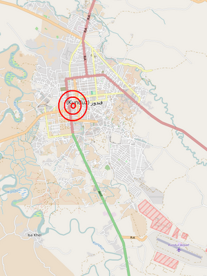
Kunduz
City in Kunduz Province, Afghanistan
Distance: Approx. 987 meters
Latitude and longitude: 36.72861111,68.86805556
Kunduz (; Pashto: قندوز; Persian: قندوز) is a city in northern Afghanistan and the capital of Kunduz Province. The city has an estimated population of about 268,893 as of 2015, making it about the seventh largest city of Afghanistan, and the largest city in northeastern Afghanistan. Kunduz is in the historical Tokharistan region of Bactria, near the confluence of the Kunduz River with the Khanabad River.
Kunduz District
District in Kunduz Province, Afghanistan
Distance: Approx. 987 meters
Latitude and longitude: 36.72861111,68.86805556
Kunduz District (ولسوالی قندوز) is situated in the center of Kunduz Province in Northern Afghanistan, around the provincial capital - the city of Kunduz. It borders Chahar dara District to the west, Qalay-I-Zal and Imam Sahib districts to the north, Archi and Khan Abad districts to the east and Ali abad District to the south. The population is 254,100 (2006).

Siege of Kunduz
2001 military operation
Distance: Approx. 989 meters
Latitude and longitude: 36.7333,68.8667
The siege of Kunduz occurred during the 2001 United States invasion of Afghanistan. After the fall of Mazar-i-Sharif on 9 November, the focus of the Northern Alliance advance shifted towards the city of Kunduz, which was the last remaining Taliban stronghold in northern Afghanistan.
Qataghan Province
Defunct Afghan province
Distance: Approx. 14 meters
Latitude and longitude: 36.7289,68.8569
Qataghan Province (Persian: قطغن) was a province of Afghanistan which became defunct in 1963, when it was divided into the current Baghlan Province, Kunduz Province, and Takhar Province. From the 19th century to 1963 Qataghan and neighboring Badakhshan Province were united into a single province called Qataghan-Badakhshan Province. It was ruled by a single governor and was divided into two separate provinces in 1963.
Kunduz University
University in Afghanistan
Distance: Approx. 2009 meters
Latitude and longitude: 36.7117,68.8634
Kunduz University (Persian: پوهنتون کندز, Pashto: د کندز پوهنتون) is located in Kunduz province Afghanistan. It was established as a teacher training center in 1967, and became an institution of higher learning in 1994. Kunduz University which is one of top 11 universities of Afghanistan is a co-education institute.

Battle of Kunduz (2015)
Battle during the War in Afghanistan
Distance: Approx. 989 meters
Latitude and longitude: 36.7333,68.8667
The Battle of Kunduz took place from April to October 2015 for control of the city of Kunduz, located in northern Afghanistan, with Taliban fighters attempting to seize the city and displace Afghan security forces. On 28 September 2015, the Taliban forces suddenly overran the city, with government forces retreating outside the city. The capture marked the first time since 2001 that the Taliban had taken control of a major city in Afghanistan.

Kunduz hospital airstrike
2015 U.S. air strike on a hospital in Kunduz, Afghanistan
Distance: Approx. 1313 meters
Latitude and longitude: 36.718,68.8623
On 3 October 2015, a United States Air Force AC-130U gunship attacked the Kunduz Trauma Centre operated by Médecins Sans Frontières (MSF, or Doctors Without Borders) in the city of Kunduz, in the province of the same name in northern Afghanistan. 42 people were killed and over 30 were injured. Médecins Sans Frontières condemned the incident, calling it a deliberate breach of international humanitarian law and a war crime.
Kunduz Trauma Centre
Hospital in Kunduz, Afghanistan
Distance: Approx. 1313 meters
Latitude and longitude: 36.718,68.8623
The Kunduz Trauma Centre was a hospital operated by Médecins Sans Frontières (MSF) in Kunduz, Afghanistan from 29 August 2011 until 3 October 2015 when it was destroyed in an airstrike by a United States Air Force AC-130U gunship. Before the bombing, the MSF's hospital was the only active medical facility in the area. It has been the only trauma center in northeastern Afghanistan.
Nangarhar offensive (2016)
Military offensive in February 2016
Distance: Approx. 989 meters
Latitude and longitude: 36.7333,68.8667
The Nangarhar offensive was a 21-day military offensive in February and March 2016, carried out by the Afghan government against the Islamic State of Iraq and the Levant – Khorasan Province (ISIS–K), with the assistance of ISAF and U.S airstrikes. When the offensive ended, ISIS had reportedly lost all of its territory in Afghanistan and had been expelled from the country.
Battle of Kunduz (2016)
Afghan/Taliban battle
Distance: Approx. 989 meters
Latitude and longitude: 36.7333,68.8667
The Battle of Kunduz occurred on 3 October 2016 in the Afghan city of Kunduz between Afghan National Security Forces and Taliban insurgents. It occurred exactly a year after the 2015 battle when the Taliban briefly controlled the city.

Battle of Boz Qandahari
Battle of the War in Afghanistan, 3 November 2016
Distance: Approx. 989 meters
Latitude and longitude: 36.7333,68.8667
The Battle of Boz Qandahari occurred on 3 November 2016, in the village of Boz Qandahari, on the western outskirts of the Afghan city of Kunduz, between Afghan National Army Commandos alongside United States Army Special Forces against Taliban insurgents.
2021 Kunduz mosque bombing
Suicide bombing in Kunduz, Afghanistan
Distance: Approx. 1733 meters
Latitude and longitude: 36.72805556,68.87638889
On 8 October 2021, an ISIS-K suicide bombing occurred at the Shia Gozar-e-Sayed Abad Mosque in the Afghan city of Kunduz. Over 50 people were killed, and another 100 injured, but according to an estimate by the United Nations Assistance Mission in Afghanistan, more than 100 people were killed and wounded.
Weather in this IP's area
scattered clouds
6 Celsius
6 Celsius
6 Celsius
6 Celsius
1029 hPa
42 %
1029 hPa
974 hPa
10000 meters
0.73 m/s
0.85 m/s
193 degree
25 %