Country:
Region:
City:
Latitude and Longitude:
Time Zone:
Postal Code:
IP information under different IP Channel
ip-api
Country
Region
City
ASN
Time Zone
ISP
Blacklist
Proxy
Latitude
Longitude
Postal
Route
Luminati
Country
Region
ut
City
fairview
ASN
Time Zone
America/Denver
ISP
CENTRALUTAH
Latitude
Longitude
Postal
IPinfo
Country
Region
City
ASN
Time Zone
ISP
Blacklist
Proxy
Latitude
Longitude
Postal
Route
db-ip
Country
Region
City
ASN
Time Zone
ISP
Blacklist
Proxy
Latitude
Longitude
Postal
Route
ipdata
Country
Region
City
ASN
Time Zone
ISP
Blacklist
Proxy
Latitude
Longitude
Postal
Route
Popular places and events near this IP address

Utah County, Utah
County in Utah, United States
Distance: Approx. 2877 meters
Latitude and longitude: 40.12,-111.67
Utah County is the second-most populous county in the U.S. state of Utah. The county seat and largest city is Provo, which is the state's fourth-largest city, and the largest outside of Salt Lake County. As of the 2020 United States Census, the population was 665,665.

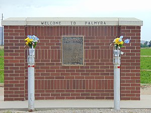
Palmyra, Utah
CDP in Utah, United States
Distance: Approx. 4351 meters
Latitude and longitude: 40.12666667,-111.68527778
Palmyra is a census-designated place (CDP) in Utah County, Utah, United States. It is part of the Provo–Orem Metropolitan Statistical Area. The population was 491 at the 2010 census.

Salem, Utah
City in Utah, United States
Distance: Approx. 6263 meters
Latitude and longitude: 40.05055556,-111.6725
Salem is a city in Utah County, Utah. It is part of the Provo–Orem metropolitan area. The population was 9,298 at the time of the 2020 U.S. census.

Spanish Fork, Utah
City in Utah, United States
Distance: Approx. 1617 meters
Latitude and longitude: 40.115,-111.655
Spanish Fork is a city in Utah County, Utah, United States. It is part of the Provo–Orem Metropolitan Statistical Area. The 2020 census reported a population of 42,602.

Sri Sri Radha Krishna Temple (Spanish Fork)
Radha Krishna temple in Utah, United States
Distance: Approx. 3344 meters
Latitude and longitude: 40.075703,-111.662122
The Sri Sri Radha Krishna Temple in Utah County, United States is a Hindu temple dedicated to Radha Krishna. It was built to meet the needs of the Hindu community in Utah County. The temple hosts many seasonal festivals, events and weekly services for prayer and meditation.
David H. Jones House
Historic house in Utah, United States
Distance: Approx. 664 meters
Latitude and longitude: 40.10805556,-111.64833333
The David H. Jones House is located at 143 South Main Street in Spanish Fork, Utah, United States and was added to the National Register of Historic Places in 1985.
Ira W. Gardner House
Historic house in Utah, United States
Distance: Approx. 5826 meters
Latitude and longitude: 40.05472222,-111.67222222
The Ira W. Gardner House is a historic house in Salem, Utah, United States was built in 1895. It was listed on the National Register of Historic Places (NRHP) in 1977. According to its NRHP nomination "the Gardner Home is considered the town's landmark residence." The NRHP lists the address as 10 North Main Street, but the actual address of the property is 15 East Center Street.

Spanish Fork High School Gymnasium
United States historic place
Distance: Approx. 873 meters
Latitude and longitude: 40.10555556,-111.65444444
The Spanish Fork High School Gymnasium at 320 South Main Street (SR-198) in Spanish Fork, Utah, United States is an Art Deco style building built in 1935 by the Public Works Administration. It was listed on the National Register of Historic Places in 1985. It is not part of the current Spanish Fork High School campus, which is a number of blocks to the northwest of the original gymnasium.

Spanish Fork Municipal Airport Woodhouse Field
Airport in Utah, US
Distance: Approx. 4642 meters
Latitude and longitude: 40.14194444,-111.66333333
Spanish Fork Municipal Airport Woodhouse Field (FAA LID:SPK), formerly known as the Spanish Fork-Springville Airport, is a general aviation airport located in north Spanish Fork, Utah, United States, that serves southern Utah County.
Leland, Utah
Ghost town in Utah, United States
Distance: Approx. 3887 meters
Latitude and longitude: 40.09888889,-111.69027778
Leland is an unincorporated community in southern Utah County, Utah, United States. Its elevation is 4,564 feet (1,391 m). Formerly a separate settlement, it has been largely absorbed into the city of Spanish Fork, with most of the rest being included in the boundaries of Benjamin (a census-designated place).

Dream Mine
Mine in Utah County, Utah, United States
Distance: Approx. 6225 meters
Latitude and longitude: 40.04833333,-111.62777778
The Dream Mine, or Relief Mine, is an unproductive underground mine in Salem, Utah, built by John Hyrum Koyle in the 1890s and incorporated in 1909. Koyle prophesied the mine would provide financial support for members of the Church of Jesus Christ of Latter-day Saints (LDS Church) just before the Second Coming of Jesus Christ. Koyle's prophecies were controversial among leaders of the LDS Church, who excommunicated him in 1948.
Maple Mountain High School (Utah)
School in Spanish Fork, Utah, Utah, United States
Distance: Approx. 2690 meters
Latitude and longitude: 40.10994,-111.61476083
Maple Mountain High School is a public high school in Spanish Fork, Utah, United States that serves the Spanish Fork and Mapleton areas.
Weather in this IP's area
clear sky
-2 Celsius
-4 Celsius
-3 Celsius
0 Celsius
1029 hPa
69 %
1029 hPa
864 hPa
10000 meters
1.54 m/s
90 degree
07:04:35
17:16:14

