23.48.109.93 - IP Lookup: Free IP Address Lookup, Postal Code Lookup, IP Location Lookup, IP ASN, Public IP
Country:
Region:
City:
Location:
Time Zone:
Postal Code:
IP information under different IP Channel
ip-api
Country
Region
City
ASN
Time Zone
ISP
Blacklist
Proxy
Latitude
Longitude
Postal
Route
Luminati
Country
Region
m
City
roshhaayin
ASN
Time Zone
Asia/Jerusalem
ISP
Partner Communications Ltd.
Latitude
Longitude
Postal
IPinfo
Country
Region
City
ASN
Time Zone
ISP
Blacklist
Proxy
Latitude
Longitude
Postal
Route
IP2Location
23.48.109.93Country
Region
hamerkaz
City
kafr qasim
Time Zone
Asia/Jerusalem
ISP
Language
User-Agent
Latitude
Longitude
Postal
db-ip
Country
Region
City
ASN
Time Zone
ISP
Blacklist
Proxy
Latitude
Longitude
Postal
Route
ipdata
Country
Region
City
ASN
Time Zone
ISP
Blacklist
Proxy
Latitude
Longitude
Postal
Route
Popular places and events near this IP address

Rosh HaAyin
City in Israel
Distance: Approx. 2636 meters
Latitude and longitude: 32.09555556,34.95666667
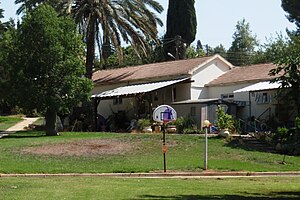
Rosh HaAyin (Hebrew: רֹאשׁ הָעַיִן, lit. 'fountainhead', [ˌʁoʃ (h)aˈ(ʔ)ajin]; Arabic: روش هاعين) is a city in the Central District of Israel. In 2022, it had a population of 73,678.

Highway 5 (Israel–Palestine)
Highway in Israel and Palestine
Distance: Approx. 1888 meters
Latitude and longitude: 32.10444444,34.99027778
Highway 5 or the Trans-Samaria Highway (Hebrew: כביש חוצה שומרון, Kvish Hotze Shomron), is one of Israel's main highways, connecting the Mediterranean coast immediately north of Tel Aviv with the central Sharon plain and eastwards to Ariel and other Israeli settlements in the northern West Bank. The name Highway 5 is commonly used to describe the section of the highway running from the road's western end at the Glilot Interchange until it reaches the main entrance of Ariel. In this capacity it intersects and creates a connection between four important arterial freeways in the northern Tel Aviv area: The Coastal Highway (Highway 2), the Ayalon Highway (Highway 20), Geha Highway (Highway 4) and the Cross-Israel Highway (Highway 6).

Hagor
Moshav in central Israel
Distance: Approx. 3638 meters
Latitude and longitude: 32.13888889,34.94861111
Hagor (Hebrew: חָגוֹר) is a moshav in the Central District of Israel. Located between Rosh HaAyin and Kfar saba it falls under the jurisdiction of Drom HaSharon Regional Council. In 2022 it had a population of 1,146.

Kafr Bara
Arab-Muslim locality and village in the Galilee region of northern Israel
Distance: Approx. 1830 meters
Latitude and longitude: 32.13055556,34.97194444
Kafr Bara or Kfar Bara (Arabic: كفر برا; Hebrew: כַּפְר בַּרָא) is an Arab locality in Israel in situated in its Central District. The small village, located near the Green Line, is often considered a part of the Arabs' Little Triangle along with the cities of Kafr Qasim and Jaljulia. In 2022 its population was 3,946.

Horshim
Kibbutz in central Israel
Distance: Approx. 2733 meters
Latitude and longitude: 32.13861111,34.97083333
Horshim (Hebrew: חוֹרְשִׁים, lit. 'Ploughmen') is a kibbutz in central Israel. Located in the south of the Sharon plain and covering 3,000 dunams, it falls under the jurisdiction of Drom HaSharon Regional Council. In 2022 it had a population of 350.
Nirit
Community settlement in central Israel
Distance: Approx. 3416 meters
Latitude and longitude: 32.14388889,34.98305556
Nirit (Hebrew: נִירִית) is a community settlement in central Israel. Located near Matan and the Horshim forest, it falls under the jurisdiction of Drom HaSharon Regional Council. In 2022 it had a population of 962.
Oranit
Israeli settlement in the West Bank
Distance: Approx. 2620 meters
Latitude and longitude: 32.12930556,34.99521111
Oranit (Hebrew: אֳרָנִית) is an Israeli settlement and local council located in the Seam Zone of the West Bank, abutting and crossing the Green Line. It is surrounded by Horshim forest to the west, Rosh HaAyin and Kfar Qasim to the southwest, Sha'arei Tikva to the east, and Khirbet Abu Salman to the northeast. In 2022 it had a population of 9,295.

Qesem cave
Archaeological site
Distance: Approx. 741 meters
Latitude and longitude: 32.11,34.98
Qesem cave is a Lower Paleolithic archaeological site near the town of Kafr Qasim in Israel. Early humans were occupying the site by 400,000 until c. 200,000 years ago.

Kafr Qasim
City in Israel
Distance: Approx. 151 meters
Latitude and longitude: 32.1151,34.9751
Kafr Qasim (Arabic: كفر قاسم, Hebrew: כַּפְר קָאסִם), also spelled as Kafr Qassem, Kufur Kassem, Kfar Kassem and Kafar Kassem, is an Arab city in Israel. It is located about 20 km (12 mi) east of Tel Aviv, on the Israeli side of the Green Line separating Israel and the West Bank, in the southern portion of the "Little Triangle" of Arab-Israeli towns and villages. In 2022 its population was 25,285.

Kafr Qasim massacre
1956 Israeli massacre of Arab civilians
Distance: Approx. 237 meters
Latitude and longitude: 32.11416667,34.97138889
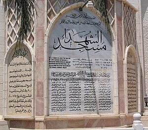
The Kafr Qasim massacre took place in the Israeli Arab village of Kafr Qasim on 29 October 1956, when the Israel Border Police killed 49 Palestinian civilians, including 19 men, 6 women and 23 children. Israeli forces had imposed a curfew on the village in the morning of the 29th on the eve of the Sinai War, and when a number of villagers who had been away and were unaware of the curfew returned, they were massacred. From 1949 to 1966, Arab citizens were regarded by Israel as a hostile population.

Kfar Qassem Football Stadium
Distance: Approx. 1565 meters
Latitude and longitude: 32.12641667,34.96569444
Kfar Qassem Municipal Stadium (כַּפְר קָסִם, כפר קאסם), is a football stadium currently being built in Kfar Qasim for F.C. Kafr Qasim, the football team of the town. Once completed in 2020, the new stadium will include 8,000 seats, along with all the Facilities that required by the regulations. Kfar Qassem Municipal Football Stadium - Hashalom Stadium - is located in the northern Part of Kfar Qassem, and designed by the architect Moti Bodek.

Rosh HaAyin Forest
Distance: Approx. 1627 meters
Latitude and longitude: 32.1,34.978
Rosh HaAyin Forest is a forest and green area located in the northeastern part of Rosh HaAyin, Israel, along the tributary of Nahal Rabba.
Weather in this IP's area
few clouds
15 Celsius
13 Celsius
14 Celsius
15 Celsius
1015 hPa
42 %
1015 hPa
1000 hPa
10000 meters
6.69 m/s
200 degree
20 %

