23.28.113.203 - IP Lookup: Free IP Address Lookup, Postal Code Lookup, IP Location Lookup, IP ASN, Public IP
Country:
Region:
City:
Location:
Time Zone:
Postal Code:
IP information under different IP Channel
ip-api
Country
Region
City
ASN
Time Zone
ISP
Blacklist
Proxy
Latitude
Longitude
Postal
Route
Luminati
Country
Region
mi
City
redford
ASN
Time Zone
America/Detroit
ISP
WOW-INTERNET
Latitude
Longitude
Postal
IPinfo
Country
Region
City
ASN
Time Zone
ISP
Blacklist
Proxy
Latitude
Longitude
Postal
Route
IP2Location
23.28.113.203Country
Region
michigan
City
livonia
Time Zone
America/Detroit
ISP
Language
User-Agent
Latitude
Longitude
Postal
db-ip
Country
Region
City
ASN
Time Zone
ISP
Blacklist
Proxy
Latitude
Longitude
Postal
Route
ipdata
Country
Region
City
ASN
Time Zone
ISP
Blacklist
Proxy
Latitude
Longitude
Postal
Route
Popular places and events near this IP address
Michigan's 13th congressional district
U.S. House district for Michigan
Distance: Approx. 3534 meters
Latitude and longitude: 42.38027778,-83.3125
Michigan's 13th congressional district is a United States congressional district in Wayne County, Michigan. It is currently represented by Democrat Shri Thanedar. The district includes portions of Detroit and some of its suburbs, and from 2013-2023, was the only congressional district in Michigan to be contained within a single county.
Livonia Engine
General Motors engine factory in Livonia, Michigan, United States (1971–2010)
Distance: Approx. 1936 meters
Latitude and longitude: 42.37444444,-83.33027778
Livonia Engine was a General Motors engine factory in Livonia, Michigan, United States. It is located at 12200 Middlebelt Rd and opened in 1971. The plant closed in June 2010.
Lutheran High School Westland
Parochial school in the United States
Distance: Approx. 3215 meters
Latitude and longitude: 42.34361111,-83.37222222
Lutheran High School Westland is a parochial high school located in Westland, Michigan, in Wayne County. It is governed by the Lutheran High School Association of Greater Detroit and is associated with the Lutheran Church – Missouri Synod. Its current enrollment is about 190 students.

Franklin High School (Livonia, Michigan)
Public high school in Livonia, Michigan
Distance: Approx. 1519 meters
Latitude and longitude: 42.356,-83.345
Benjamin Franklin High School, also referred to as Franklin High School, Livonia Franklin and FHS, is a public high school located in Livonia, Michigan, a suburb west of Detroit.
Wonderland Village
Shopping center in Michigan, United States
Distance: Approx. 1529 meters
Latitude and longitude: 42.36858333,-83.33380556
Wonderland Village is an outdoor shopping center in Livonia, Michigan, United States, a suburb of Detroit. The center is located at the southwest corner of Middlebelt Road and Plymouth Road, approximately one mile south of I-96. Opened in 1959 as the outdoor Wonderland Center, it originally featured Montgomery Ward and Federal's as its major anchor stores.
Detroit Race Course
Distance: Approx. 2752 meters
Latitude and longitude: 42.38,-83.32277778
The Detroit Race Course was a complex in Livonia, Michigan, a suburb northwest of Detroit and part of the metropolitan area. It consisted of a regulation racing track and associated stables for horses, and facilities for trainers, exercise workers, and jockeys. It was opened in 1950 primarily as a venue for racing thoroughbreds.
Bentley High School (Livonia, Michigan)
Public high school in Livonia, Michigan, United States
Distance: Approx. 2880 meters
Latitude and longitude: 42.39361111,-83.36083333
George N. Bentley Senior High School, also referred to as Bentley High School, was a public high school in the city of Livonia, Michigan, a western suburb of Detroit. The first public high school in the Livonia Public Schools district, it was open from September 1947 through June 1985. The school's first graduating class in June 1950 had 95 students.

Wilson Barn
United States historic place, Ira Wilson Dairy Barn
Distance: Approx. 1734 meters
Latitude and longitude: 42.36472222,-83.33194444
The Wilson Barn (also known as the Ira Wilson Dairy Barn) is a barn located at the northeast corner of Middlebelt and W. Chicago Roads in Livonia, Michigan right by Emerson Middle School. It was listed on the National Register of Historic Places and designated a Michigan State Historic Site in 1973. This was the beginning of the Ira Wilson & Sons Dairy Company, a now defunct company (which partnered for a time with Kroger and was ultimately acquired by Melody Farms in 1980).

Rosedale Gardens Historic District
Historic district in Michigan, United States
Distance: Approx. 607 meters
Latitude and longitude: 42.365,-83.35805556
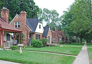
The Rosedale Gardens Historic District (locally known as Old Rosedale Gardens) is a historic district located on eight streets, from Arden Street to Hubbard Street, between Plymouth Road and West Chicago Street in Livonia, Michigan. The district was placed on the National Register of Historic Places in 2010.

Nankin Mills Nature Center
Historic site in Westland, Michigan
Distance: Approx. 2621 meters
Latitude and longitude: 42.34861111,-83.36944444
The Nankin Mills Nature Center is a historic and nature interpretive center located at 33175 Ann Arbor Trail in Westland, Michigan. It was originally built as a grist mill, and was one of Henry Ford's "village industries." The mill was designated a Michigan State Historic Site in 1967. Today, Nankin Mills serves as the headquarters of Wayne County Parks, and sits at the center of Hines Park.
Perrinsville School
Historic site in Westland, Michigan
Distance: Approx. 3200 meters
Latitude and longitude: 42.33983333,-83.35536111
Perrinsville School is a historical site in Wayne County in Westland, Michigan. Perrinsville is a one-room schoolhouse that is located on Warren Road and Cowan Road. What is now the city of Westland used to be called the Village of Perrinsville in the 1830s.
Universal Learning Academy
Charter school in Westland, Michigan, United States
Distance: Approx. 3202 meters
Latitude and longitude: 42.354669,-83.3182739
Universal Learning Academy is a charter school in Westland, Michigan, in the Detroit metropolitan area, serving grades Kindergarten through 12.
Weather in this IP's area
broken clouds
-1 Celsius
-5 Celsius
-2 Celsius
-1 Celsius
1015 hPa
77 %
1015 hPa
987 hPa
10000 meters
3.09 m/s
230 degree
75 %


