23.252.138.139 - IP Lookup: Free IP Address Lookup, Postal Code Lookup, IP Location Lookup, IP ASN, Public IP
Country:
Region:
City:
Location:
Time Zone:
Postal Code:
IP information under different IP Channel
ip-api
Country
Region
City
ASN
Time Zone
ISP
Blacklist
Proxy
Latitude
Longitude
Postal
Route
Luminati
Country
Region
ky
City
barbourville
ASN
Time Zone
America/New_York
ISP
B-U-C
Latitude
Longitude
Postal
IPinfo
Country
Region
City
ASN
Time Zone
ISP
Blacklist
Proxy
Latitude
Longitude
Postal
Route
IP2Location
23.252.138.139Country
Region
kentucky
City
barbourville
Time Zone
America/New_York
ISP
Language
User-Agent
Latitude
Longitude
Postal
db-ip
Country
Region
City
ASN
Time Zone
ISP
Blacklist
Proxy
Latitude
Longitude
Postal
Route
ipdata
Country
Region
City
ASN
Time Zone
ISP
Blacklist
Proxy
Latitude
Longitude
Postal
Route
Popular places and events near this IP address

Barbourville, Kentucky
City in Kentucky, United States
Distance: Approx. 513 meters
Latitude and longitude: 36.86666667,-83.88472222
Barbourville is a home rule-class city in Knox County, Kentucky, in the United States. The population was 3,165 at the 2010 census, down from 3,589 at the 2000 census. It is the county seat of Knox County.

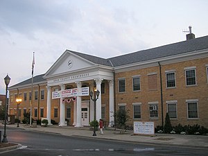
Union Commonwealth University
Private university in Barbourville, Kentucky, U.S.
Distance: Approx. 307 meters
Latitude and longitude: 36.87028,-83.88808
Union Commonwealth University is a private university in Barbourville, Kentucky. The university was founded in 1879 and is affiliated with the United Methodist Church. Union's approximately 825 undergraduate students represent 27 states and nine countries.

Battle of Barbourville
Battle of the American Civil War
Distance: Approx. 1234 meters
Latitude and longitude: 36.86111111,-83.87944444
The Battle of Barbourville was one of the early engagements of the American Civil War. It took place on September 19, 1861, in Knox County, Kentucky during the campaign known as the Kentucky Confederate Offensive. The battle is considered the first Confederate victory in the commonwealth, and threw a scare into Federal commanders, who rushed troops to central Kentucky to try to repel the invasion, which was finally stopped at the Battle of Camp Wildcat in October.
Appalachian Children's Home
Distance: Approx. 3795 meters
Latitude and longitude: 36.8691,-83.8476
The Appalachian Children's Home is a home for at-risk children, located on a 158-acre (0.64 km2) campus on the outskirts of Barbourville, Kentucky. It is operated as a Christian ministry with support from several Independent Pentecostal churches in Kentucky and more than 130 other regional churches. Its stated mission is to "Strive to provide the best possible care available for the children placed in our custody".
WKKQ
Radio station in Barbourville, Kentucky
Distance: Approx. 812 meters
Latitude and longitude: 36.86527778,-83.89861111
WKKQ (96.1 FM) is a radio station broadcasting a hot adult contemporary format, licensed to Barbourville, Kentucky, United States.
Slick Lizard Coal Camp, Kentucky
Unincorporated community in Kentucky, United States
Distance: Approx. 3871 meters
Latitude and longitude: 36.89611111,-83.86444444
Slick Lizard Coal Camp was an unincorporated community and coal town in Knox County, Kentucky, United States.
Heidrick, Kentucky
Unincorporated community in Kentucky, United States
Distance: Approx. 1906 meters
Latitude and longitude: 36.8825,-83.87861111
Heidrick is an unincorporated community located in Knox County, Kentucky, United States.

Barbourville Commercial District
Historic district in Kentucky, United States
Distance: Approx. 289 meters
Latitude and longitude: 36.86583333,-83.88861111
The Barbourville Commercial District is a 6 acres (2.4 ha) historic district which was listed on the National Register of Historic Places in 1984. It included 32 contributing buildings in the core of the historic downtown of Barbourville, Kentucky. The district is roughly bounded by Daniel Boone Dr., Liberty, High, and Jail Streets.

Mitchell Building-First State Bank Building
United States historic place
Distance: Approx. 340 meters
Latitude and longitude: 36.86694444,-83.88666667
The Mitchell Building-First State Bank Building, at 222 Knox Street in Barbourville, Kentucky, is a Romanesque Revival-style building built in 1910. It was listed on the National Register of Historic Places in 1984. It is a three-story masonry wall and wood-frame building, with a Romanesque brick arch entry as its most salient feature.

Old Classroom Building, Union College
United States historic place
Distance: Approx. 1591 meters
Latitude and longitude: 36.85388889,-83.88833333
The Old Classroom Building, Union College, located on College Street in Barbourville, Kentucky, is a historic building of Union College which was built in 1907. It was listed on the National Register of Historic Places in 1975.

Soldiers and Sailors Memorial Gymnasium
United States historic place
Distance: Approx. 388 meters
Latitude and longitude: 36.87083333,-83.8875
The Soldiers and Sailors Memorial Gymnasium, on the campus of Union College in Barbourville, Kentucky, was listed on the National Register of Historic Places in 1984. It is a Colonial Revival-style building built in 1919. It was deemed "significant as an outstanding example of Colonial Revival architecture in Southeast Kentucky and in the history of higher education in southeast, Kentucky.

Speed Hall
United States historic place
Distance: Approx. 326 meters
Latitude and longitude: 36.87083333,-83.88888889
Speed Hall, on the campus of Union College in Barbourville, Kentucky, was built during 1903–05. It was listed on the National Register of Historic Places in 1982. It is Union College's oldest building.
Weather in this IP's area
overcast clouds
5 Celsius
5 Celsius
4 Celsius
7 Celsius
1025 hPa
82 %
1025 hPa
989 hPa
10000 meters
1.17 m/s
1.14 m/s
158 degree
100 %