23.25.113.130 - IP Lookup: Free IP Address Lookup, Postal Code Lookup, IP Location Lookup, IP ASN, Public IP
Country:
Region:
City:
Location:
Time Zone:
Postal Code:
IP information under different IP Channel
ip-api
Country
Region
City
ASN
Time Zone
ISP
Blacklist
Proxy
Latitude
Longitude
Postal
Route
Luminati
Country
Region
va
City
fredericksburg
ASN
Time Zone
America/New_York
ISP
COMCAST-7922
Latitude
Longitude
Postal
IPinfo
Country
Region
City
ASN
Time Zone
ISP
Blacklist
Proxy
Latitude
Longitude
Postal
Route
IP2Location
23.25.113.130Country
Region
virginia
City
fredericksburg
Time Zone
America/New_York
ISP
Language
User-Agent
Latitude
Longitude
Postal
db-ip
Country
Region
City
ASN
Time Zone
ISP
Blacklist
Proxy
Latitude
Longitude
Postal
Route
ipdata
Country
Region
City
ASN
Time Zone
ISP
Blacklist
Proxy
Latitude
Longitude
Postal
Route
Popular places and events near this IP address

Battle of Fredericksburg
Major battle (1862) of the American Civil War
Distance: Approx. 1970 meters
Latitude and longitude: 38.2995,-77.4705
The Battle of Fredericksburg was fought December 11–15, 1862, in and around Fredericksburg, Virginia, in the Eastern Theater of the American Civil War. The combat between the Union Army of the Potomac commanded by Maj. Gen.

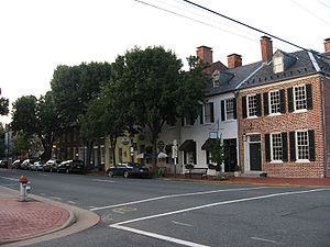
Fredericksburg, Virginia
Independent city in Virginia, United States
Distance: Approx. 2068 meters
Latitude and longitude: 38.301829,-77.470778
Fredericksburg is an independent city in Virginia, United States. As of the 2020 census, the population was 27,982. It is 48 miles (77 km) south of Washington, D.C., and 53 miles (85 km) north of Richmond.

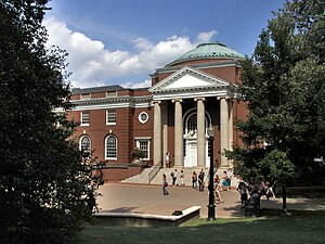
University of Mary Washington
Public college in Fredericksburg, Virginia, US
Distance: Approx. 1769 meters
Latitude and longitude: 38.30194444,-77.475
University of Mary Washington (UMW) is a public liberal arts university in Fredericksburg, Virginia. Established in 1908 as the Fredericksburg Teachers College, the institution was named Mary Washington College in 1938 after Mary Ball Washington, mother of the first president of the United States, George Washington. The General Assembly of Virginia changed the college's name to University of Mary Washington in 2004 to reflect the addition of graduate and professional programs to the central undergraduate curriculum, as well as the establishment of more than one campus.
Second Battle of Fredericksburg
Battle in the American Civil War
Distance: Approx. 2017 meters
Latitude and longitude: 38.29575,-77.46844
The Second Battle of Fredericksburg, also known as the Second Battle of Marye's Heights, took place on May 3, 1863, in Fredericksburg, Virginia, as part of the Chancellorsville Campaign of the American Civil War.

Fredericksburg and Spotsylvania National Military Park
American Civil War battlefields in Virginia
Distance: Approx. 1918 meters
Latitude and longitude: 38.29305556,-77.46916667
Fredericksburg and Spotsylvania National Military Park is a unit of the National Park Service in Fredericksburg, Virginia, and elsewhere in Spotsylvania County, commemorating four major battles in the American Civil War: Fredericksburg, Chancellorsville, The Wilderness, and Spotsylvania.

Central Park (shopping complex)
Shopping mall in Virginia, United States
Distance: Approx. 2146 meters
Latitude and longitude: 38.30519444,-77.50936111
Central Park is a shopping complex in Fredericksburg, Virginia, with 166 businesses. The complex is located near the intersection of Interstate 95 and State Route 3. Many national big-box stores, restaurants, and smaller local businesses occupy the Central Park complex.
St. Mary of the Immaculate Conception Roman Catholic Church (Fredericksburg, Virginia)
Distance: Approx. 1363 meters
Latitude and longitude: 38.29683,-77.47661
St. Mary of the Immaculate Conception Roman Catholic Church is located in Fredericksburg, Virginia and is part of the Roman Catholic Diocese of Arlington. Its grade school is Holy Cross Academy.

Hugh Mercer Apothecary
United States historic place
Distance: Approx. 2011 meters
Latitude and longitude: 38.3,-77.47027778
Hugh Mercer Apothecary was an apothecary founded by Hugh Mercer in the mid-18th century. Mercer was a doctor who fled Scotland after the Battle of Culloden. He travelled to Pennsylvania, where he met Colonel George Washington during the French and Indian War and later moved to Fredericksburg, Virginia, on Washington's advice to practice medicine and operate an apothecary.

Spotsylvania Towne Centre
Shopping mall in Virginia, United States
Distance: Approx. 1897 meters
Latitude and longitude: 38.29177778,-77.51280556
The Spotsylvania Towne Centre (formerly Spotsylvania Mall) is a mall located in Spotsylvania County, Virginia, on Virginia State Route 3, less than a mile west of Interstate 95, and directly across from the Central Park shopping and dining complex. The mall is owned and developed by Cafaro Company. The property was renamed as "Spotsylvania Towne Centre" at the beginning of a $12 million renovation project.
Braehead (Fredericksburg, Virginia)
Historic house in Virginia, United States
Distance: Approx. 2029 meters
Latitude and longitude: 38.28083333,-77.47305556
Braehead is a historic house located in Fredericksburg, Virginia. The 6,000-square-foot house was built in 1858-1859 by George Mullen for John Howison, who was born in Fredericksburg, Virginia, in 1809. John Howison's sister was the renowned Civil War diarist, Jane Briggs (née Howison) Beale.

Brompton (Fredericksburg, Virginia)
Historic house in Virginia, United States
Distance: Approx. 1855 meters
Latitude and longitude: 38.29555556,-77.47027778
Brompton, originally known as Marye House, is an historic house located on heights overlooking the town of Fredericksburg, Virginia. The house was built in 1838 by John Lawrence Marye. The house was added to the National Register of Historic Places in July 1979.
Idlewild (Fredericksburg, Virginia)
Historic house in Virginia, United States
Distance: Approx. 1278 meters
Latitude and longitude: 38.29055556,-77.50555556
Idlewild, also known as the Downman House, was a historic home located at Fredericksburg, Virginia. It was built in 1859; a fire in April 2003 destroyed most of the interior and collapsed the roof. It was a 2+1⁄2-story, Gothic Revival-style brick dwelling with an English basement and an irregular "T" shape with a center passage plan.
Weather in this IP's area
clear sky
1 Celsius
-4 Celsius
0 Celsius
2 Celsius
1011 hPa
57 %
1011 hPa
1003 hPa
10000 meters
4.12 m/s
7.72 m/s
320 degree
