23.247.253.115 - IP Lookup: Free IP Address Lookup, Postal Code Lookup, IP Location Lookup, IP ASN, Public IP
Country:
Region:
City:
Location:
Time Zone:
Postal Code:
ISP:
ASN:
language:
User-Agent:
Proxy IP:
Blacklist:
IP information under different IP Channel
ip-api
Country
Region
City
ASN
Time Zone
ISP
Blacklist
Proxy
Latitude
Longitude
Postal
Route
db-ip
Country
Region
City
ASN
Time Zone
ISP
Blacklist
Proxy
Latitude
Longitude
Postal
Route
IPinfo
Country
Region
City
ASN
Time Zone
ISP
Blacklist
Proxy
Latitude
Longitude
Postal
Route
IP2Location
23.247.253.115Country
Region
quebec
City
montreal
Time Zone
America/Montreal
ISP
Language
User-Agent
Latitude
Longitude
Postal
ipdata
Country
Region
City
ASN
Time Zone
ISP
Blacklist
Proxy
Latitude
Longitude
Postal
Route
Popular places and events near this IP address

Jarry Park
Urban park in Montreal, Canada
Distance: Approx. 1488 meters
Latitude and longitude: 45.535,-73.6283
Jarry Park is an urban park in the Villeray–Saint-Michel–Parc-Extension borough of Montreal, Quebec, Canada. Jarry Park has total area of 36 hectares. It is considered by the City of Montreal as one of its large parks.

Crémazie station
Montreal Metro station
Distance: Approx. 1306 meters
Latitude and longitude: 45.54611111,-73.63833333
Crémazie station (French pronunciation: [kʁemazi]) is a Montreal Metro station in Montreal, Quebec, Canada. It is operated by the Société de transport de Montréal (STM) and serves the Orange Line. It is located on the border between the boroughs of Ahuntsic-Cartierville and Villeray–Saint-Michel–Parc-Extension The station opened October 14, 1966, as part of the original Metro network.

Rockland Centre
Shopping mall in Quebec, Canada
Distance: Approx. 899 meters
Latitude and longitude: 45.52813889,-73.64805556
Rockland Centre (French: Centre Rockland) is an upscale shopping mall located in the town of Mount Royal, Quebec, Canada. The mall is situated at the intersections of the Metropolitan Boulevard, Chemin Rockland and Acadie Boulevard, adjacent to the Park Extension neighbourhood of Montreal.
Hochelaga Archipelago
Group of islands at the confluence of the Saint Lawrence and Ottawa Rivers
Distance: Approx. 1496 meters
Latitude and longitude: 45.54944444,-73.65055556
The Hochelaga Archipelago (French: Archipel d'Hochelaga), also known as the Montreal Islands, is a group of 234 islands at the confluence of the Saint Lawrence and Ottawa rivers in the southwestern part of the province of Quebec, Canada.

Maurice-Richard
Provincial electoral district in Quebec, Canada
Distance: Approx. 1478 meters
Latitude and longitude: 45.548,-73.656
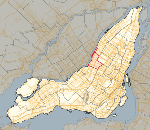
Maurice-Richard is a provincial electoral district in the Montreal region of Quebec, Canada that elects members to the National Assembly of Quebec. It comprises parts of the Ahuntsic-Cartierville and Montréal-Nord boroughs of the city of Montreal. The riding was known from 1972 to 2018 as Crémazie.
Garment District, Montreal
Neighbourhood in Montreal, Quebec, Canada
Distance: Approx. 658 meters
Latitude and longitude: 45.539857,-73.653935
The Garment District (French: Cité de la Mode) is a neighbourhood in the city of Montreal, Quebec, Canada. It is located primarily along Chabanel Street in the Ahuntsic neighbourhood of the Ahuntsic-Cartierville borough. The Chabanel Station (train) is located close by.
Chabanel station
Railway station in Montreal, Quebec, Canada
Distance: Approx. 821 meters
Latitude and longitude: 45.53694444,-73.65777778
Chabanel station is a commuter rail station operated by Exo in Montreal, Quebec, Canada. It serves the Saint-Jérôme line. Its name comes from Chabanel street, the street that the station is located on.

Ahuntsic station (Exo)
Railway station in Montreal, Quebec, Canada
Distance: Approx. 1190 meters
Latitude and longitude: 45.53527778,-73.6625
Ahunstic station is a commuter rail station operated by Exo in the borough of Ahuntsic-Cartierville, in Montreal, Quebec, Canada. It is served by the Mascouche line.

Lufa Farms
Distance: Approx. 823 meters
Latitude and longitude: 45.53162,-73.65559
Lufa Farms is an urban agricultural company located in the Ville Saint-Laurent neighborhood of Montreal, Quebec. The company states its mission is to grow food where people live and grow it more sustainably. The company, founded in 2009, has installed commercial greenhouses on the rooftops of several large industrial buildings in the greater Montreal area.

Centre justice et foi
Distance: Approx. 1216 meters
Latitude and longitude: 45.538636,-73.632097
Centre justice et foi (English: Centre for Justice and Faith), abbreviated to CJF, is a centre for social analysis in Montreal. It was founded by the Society of Jesus in 1983 and publishes the magazine Relation (French: Revue Relations). It is situated on the corner of Saint Laurent Boulevard and Jarry Street opposite Jarry Park.
CILO-FM
Multilingual radio station in Montreal
Distance: Approx. 1195 meters
Latitude and longitude: 45.5298,-73.6596
CILO-FM is a low-power commercial multilingual radio station in Montreal, Quebec, Canada, focusing on the city's South-Asian diaspora community, with most of its programs in Tamil. Operating at 102.9 MHz (FM), the station is owned and operated by AGNI Communications Inc., which received approval from the CRTC on May 16, 2014. The station broadcasts with an average ERP of 31 watts (maximum ERP of 50 watts with a directional antenna and an effective height of antenna above average terrain of 44.4 metres or 146 feet) from facilities near the intersection of Chabanel and Jean Pratt streets (near the intersection of A-15 and A-40) in the Ahuntsic-Cartierville borough of Montreal.
École secondaire Marie-Anne
Public school in Montreal, Quebec, Canada
Distance: Approx. 1545 meters
Latitude and longitude: 45.5476,-73.6586
École secondaire Marie-Anne is a francophone public secondary mixed school located in the Ahuntsic-Cartierville borough in Montreal. Part of the Centre de services scolaire de Montréal (CSSDM), it was originally in the Commission des écoles catholiques de Montréal (CECM) before the 1998 reorganization of school boards from religious communities into linguistic communities in Quebec. In 2019, the school had 756 students.
Weather in this IP's area
clear sky
-13 Celsius
-20 Celsius
-15 Celsius
-12 Celsius
1018 hPa
85 %
1018 hPa
1014 hPa
10000 meters
4.12 m/s
290 degree

