23.247.207.222 - IP Lookup: Free IP Address Lookup, Postal Code Lookup, IP Location Lookup, IP ASN, Public IP
Country:
Region:
City:
Location:
Time Zone:
Postal Code:
IP information under different IP Channel
ip-api
Country
Region
City
ASN
Time Zone
ISP
Blacklist
Proxy
Latitude
Longitude
Postal
Route
Luminati
Country
Region
ia
City
estherville
ASN
Time Zone
America/Chicago
ISP
FIBERNET-NETWORK-OPERATIONS-CENTER
Latitude
Longitude
Postal
IPinfo
Country
Region
City
ASN
Time Zone
ISP
Blacklist
Proxy
Latitude
Longitude
Postal
Route
IP2Location
23.247.207.222Country
Region
iowa
City
estherville
Time Zone
America/Chicago
ISP
Language
User-Agent
Latitude
Longitude
Postal
db-ip
Country
Region
City
ASN
Time Zone
ISP
Blacklist
Proxy
Latitude
Longitude
Postal
Route
ipdata
Country
Region
City
ASN
Time Zone
ISP
Blacklist
Proxy
Latitude
Longitude
Postal
Route
Popular places and events near this IP address

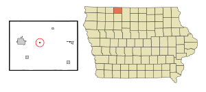
Estherville, Iowa
City in Iowa, United States
Distance: Approx. 841 meters
Latitude and longitude: 43.40444444,-94.83361111
Estherville is a city in Emmet County, Iowa, United States. The population was 5,904 in the 2020 census, a decline from 6,656 at the 2000 census. It is the county seat of Emmet County.

Gruver, Iowa
City in Iowa, United States
Distance: Approx. 9788 meters
Latitude and longitude: 43.39305556,-94.70472222
Gruver is a city in Emmet County, Iowa, United States. The population was 63 at the time of the 2020 census.
KILR (AM)
Radio station in Estherville, Iowa
Distance: Approx. 2413 meters
Latitude and longitude: 43.42916667,-94.82305556
KILR (1070 kHz) is a commercial AM radio station serving the Estherville, Iowa area as well as the Iowa Great Lakes region. The station primarily broadcasts a talk radio format. KILR is licensed to Beaver Broadcasting, Inc., which also owns sister station KILR-FM. The AM-FM studios, transmitter and towers are located northeast of Estherville along Iowa Highway 4.
KILR-FM
Radio station in Estherville, Iowa
Distance: Approx. 2413 meters
Latitude and longitude: 43.42916667,-94.82305556
KILR-FM (95.9 MHz) is a commercial radio station serving the Estherville, Iowa area, as well as the Iowa Great Lakes region. The station broadcasts a country format. KILR-FM is licensed to Beaver Broadcasting, Inc., which is owned by Matt and Jessica Beaver.

Center Township, Emmet County, Iowa
Township in Iowa, United States
Distance: Approx. 8417 meters
Latitude and longitude: 43.38861111,-94.72333333
Center Township is one of twelve townships in Emmet County, Iowa, United States. As of the 2000 census, its population was 459.

Emmet Township, Emmet County, Iowa
Township in Iowa, United States
Distance: Approx. 6599 meters
Latitude and longitude: 43.46194444,-94.85638889
Emmet Township is one of twelve townships in Emmet County, Iowa, USA. As of the 2000 census, its population was 178.

Estherville Township, Emmet County, Iowa
Township in Iowa, United States
Distance: Approx. 3281 meters
Latitude and longitude: 43.38416667,-94.84888889
Estherville Township is one of twelve townships in Emmet County, Iowa, United States. As of the 2000 census, its population was 7,077.
Fort Defiance State Park
State park in Emmet County, Iowa
Distance: Approx. 3400 meters
Latitude and longitude: 43.39194444,-94.86027778
Fort Defiance State Park is a state park in Emmet County, Iowa, United States. The park is 191 acres (77 ha) and sits at an elevation of 1,453 feet (443 m). The park, which was built by the Civilian Conservation Corps during the Great Depression, was opened to the public in 1930.
Huntington, Iowa
Unincorporated community in Iowa, United States
Distance: Approx. 9723 meters
Latitude and longitude: 43.49166667,-94.79194444
Huntington is an unincorporated community in Emmet County, Iowa, United States. Huntington got its start in 1899, following the construction of the Minneapolis & St. Louis railroad through that territory.
Raleigh, Iowa
Unincorporated community in Iowa, United States
Distance: Approx. 8398 meters
Latitude and longitude: 43.33944444,-94.86888889
Raleigh is an unincorporated community in Emmet County, Iowa, United States.

Iowa Lakes Community College
Public college in Estherville, Iowa, US
Distance: Approx. 1278 meters
Latitude and longitude: 43.397,-94.8177
Iowa Lakes Community College is a public community college based in Estherville, Iowa, with campuses also located in Algona, Emmetsburg, Spencer and Spirit Lake. It serves Iowa Community College District III, which encompasses an area roughly contiguous with Clay, Dickinson, Emmet, Kossuth and Palo Alto counties. The predominantly rural district encompasses and area of approximately 2,900 square miles (7,500 square kilometers) and a population of just over 73,000.
Estherville–Lincoln Central Community School District
Public school district in Estherville, Iowa, United States
Distance: Approx. 1490 meters
Latitude and longitude: 43.394874,-94.817975
Estherville–Lincoln Central Community School District (ELC) is a rural public school district headquartered in Estherville, Iowa. The district covers most of central and western Emmet County, along with a small part of eastern Dickinson County. In addition to Estherville it serves the communities of Dolliver, Gruver, Wallingford, and most of Superior.
Weather in this IP's area
mist
4 Celsius
0 Celsius
3 Celsius
4 Celsius
1015 hPa
89 %
1015 hPa
965 hPa
9656 meters
4.63 m/s
160 degree
100 %