23.24.220.97 - IP Lookup: Free IP Address Lookup, Postal Code Lookup, IP Location Lookup, IP ASN, Public IP
Country:
Region:
City:
Location:
Time Zone:
Postal Code:
IP information under different IP Channel
ip-api
Country
Region
City
ASN
Time Zone
ISP
Blacklist
Proxy
Latitude
Longitude
Postal
Route
Luminati
Country
Region
ca
City
hayward
ASN
Time Zone
America/Los_Angeles
ISP
COMCAST-7922
Latitude
Longitude
Postal
IPinfo
Country
Region
City
ASN
Time Zone
ISP
Blacklist
Proxy
Latitude
Longitude
Postal
Route
IP2Location
23.24.220.97Country
Region
california
City
berkeley
Time Zone
America/Los_Angeles
ISP
Language
User-Agent
Latitude
Longitude
Postal
db-ip
Country
Region
City
ASN
Time Zone
ISP
Blacklist
Proxy
Latitude
Longitude
Postal
Route
ipdata
Country
Region
City
ASN
Time Zone
ISP
Blacklist
Proxy
Latitude
Longitude
Postal
Route
Popular places and events near this IP address

Berkeley, California
City in California, United States
Distance: Approx. 8 meters
Latitude and longitude: 37.87166667,-122.27277778
Berkeley ( BURK-lee) is a city on the eastern shore of San Francisco Bay in northern Alameda County, California, United States. It is named after the 18th-century Anglo-Irish bishop and philosopher George Berkeley. It borders the cities of Oakland and Emeryville to the south and the city of Albany and the unincorporated community of Kensington to the north.

Berkeley Repertory Theatre
Theatre company in Berkeley, California, USA
Distance: Approx. 312 meters
Latitude and longitude: 37.87112778,-122.26929722
Berkeley Repertory Theatre is a regional theater company located in Berkeley, California. It runs seven productions each season from its two stages in Downtown Berkeley.

International Computer Science Institute
Distance: Approx. 220 meters
Latitude and longitude: 37.870052,-122.271235
The International Computer Science Institute (ICSI) is an independent, non-profit research organization located in Berkeley, California, United States. Since its founding in 1988, ICSI has maintained an affiliation agreement with the University of California, Berkeley, where several of its members hold faculty appointments.

Berkeley City College
Public community college in Berkeley, California, US
Distance: Approx. 337 meters
Latitude and longitude: 37.869826,-122.269698
Berkeley City College (BCC, formerly Vista Community College) is a public community college in Berkeley, California. It is part of the California Community Colleges System and the Peralta Community College District. Berkeley City College is accredited by the Accrediting Commission for Community and Junior Colleges.

UC Theatre
Music venue and former movie theater in Berkeley, California, United States
Distance: Approx. 271 meters
Latitude and longitude: 37.87138889,-122.26972222
The UC Theatre is a music venue on University Avenue near Shattuck Avenue in Downtown Berkeley, Berkeley, California, United States. From 1976 until 2001, it was a movie theater known for a revival house presentation of films. In 2013, The Berkeley Music Group was formed as a 501(c)(3) nonprofit organization with the mission to renovate and operate the UC Theater as live music venue.

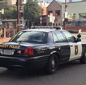
Berkeley Police Department
Police department serving Berkeley, California
Distance: Approx. 187 meters
Latitude and longitude: 37.869925,-122.272975
The Berkeley Police Department (BPD) is the municipal police department for the city of Berkeley, California, United States.

California Jazz Conservatory
American private music school
Distance: Approx. 346 meters
Latitude and longitude: 37.8712,-122.2689
The California Jazz Conservatory is a private conservatory in Berkeley, California. It is the only independent music conservatory in the United States devoted solely to jazz and related styles of music. Located in the Downtown Berkeley Arts District, the CJC offers Associate, Bachelor's, and Master's degrees in Jazz Studies.

UC Berkeley Extension
Extension school of the University of California, Berkeley
Distance: Approx. 143 meters
Latitude and longitude: 37.8721,-122.2713
The University of California, Berkeley, Extension (UC Berkeley Extension) is the continuing education division of the University of California, Berkeley (UC Berkeley) campus. Founded in 1891, UC Berkeley Extension provides continuing education through self-supporting academic programs. The extension is headquartered outside the main UC Berkeley campus in Berkeley, California, with classrooms in downtown San Francisco and other Bay Area locations.
Berkeley Fire Department
Fire department in Berkeley, California
Distance: Approx. 304 meters
Latitude and longitude: 37.87,-122.27
The Berkeley Fire Department (BFD) provides fire protection and emergency medical services to the city of Berkeley, California, United States as well as the University of California, Berkeley.
Berkeley Historic Civic Center District
Historic district in California, US
Distance: Approx. 327 meters
Latitude and longitude: 37.86944444,-122.27027778
The Berkeley Historic Civic Center District is a 9.9-acre (4.0 ha) historic district in Berkeley, California, U.S. It comprises portions of a five-block area surrounding Martin Luther King Jr. Civic Center Park, primarily made up of civic-related buildings. It has been listed as one of the National Register of Historic Places since December 3, 1998; and listed as a Berkeley Landmark by the City of Berkeley since December 7, 1998.

Old Berkeley City Hall
Historic building in Berkeley, California
Distance: Approx. 282 meters
Latitude and longitude: 37.8691,-122.2733
Old Berkeley City Hall, also known as the Maudelle Shirek Building, is a historic building in the Civic Center neighborhood of Berkeley, California, U.S.. It was originally located at 2134 Grove Street (now 2134 Martin Luther King Jr. Way).
Rose Pizzeria
Restaurant in Berkeley, California, U.S.
Distance: Approx. 115 meters
Latitude and longitude: 37.871585,-122.271497
Rose Pizzeria is a restaurant in Berkeley, California.
Weather in this IP's area
heavy intensity rain
12 Celsius
12 Celsius
11 Celsius
13 Celsius
1020 hPa
92 %
1020 hPa
1014 hPa
10000 meters
4.02 m/s
6.26 m/s
259 degree
87 %
