23.239.187.200 - IP Lookup: Free IP Address Lookup, Postal Code Lookup, IP Location Lookup, IP ASN, Public IP
Country:
Region:
City:
Location:
Time Zone:
Postal Code:
ISP:
ASN:
language:
User-Agent:
Proxy IP:
Blacklist:
IP information under different IP Channel
ip-api
Country
Region
City
ASN
Time Zone
ISP
Blacklist
Proxy
Latitude
Longitude
Postal
Route
db-ip
Country
Region
City
ASN
Time Zone
ISP
Blacklist
Proxy
Latitude
Longitude
Postal
Route
IPinfo
Country
Region
City
ASN
Time Zone
ISP
Blacklist
Proxy
Latitude
Longitude
Postal
Route
IP2Location
23.239.187.200Country
Region
washington
City
kenmore
Time Zone
America/Los_Angeles
ISP
Language
User-Agent
Latitude
Longitude
Postal
ipdata
Country
Region
City
ASN
Time Zone
ISP
Blacklist
Proxy
Latitude
Longitude
Postal
Route
Popular places and events near this IP address

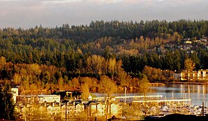
Kenmore, Washington
City in Washington, United States
Distance: Approx. 623 meters
Latitude and longitude: 47.75277778,-122.24722222
Kenmore is a city in King County, Washington, United States, along the northernmost shore of Lake Washington. It is a suburban commuter town at the mouth of the Sammamish River, 12 miles (19 km) northeast of downtown Seattle and 2 miles (3.2 km) west of Bothell. The population was 23,914 at the 2020 census.

Bastyr University
Alternative medicine university
Distance: Approx. 2383 meters
Latitude and longitude: 47.7304,-122.2528
Bastyr University is a private alternative medicine university with campuses in Kenmore, Washington, and San Diego, California. Programs include naturopathy, acupuncture, Traditional Asian medicine, nutrition, herbal medicine, ayurvedic medicine, psychology, and midwifery. Some of Bastyr's programs teach and research topics that are considered pseudoscience, quackery, and fake by the scientific and medical communities.

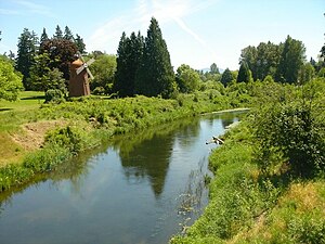
Sammamish River
River in Washington, United States of America
Distance: Approx. 1421 meters
Latitude and longitude: 47.75333333,-122.25833333
The Sammamish River (also known as Sammamish Slough) flows through north King County, Washington for about 14 miles (23 km), draining Lake Sammamish into Lake Washington. Along its course, the Sammamish River flows through Redmond, Woodinville, Bothell, and Kenmore. The river is named after the native people who once lived along its entire length.

Inglemoor High School
Public secondary school in Kenmore, Washington, United States
Distance: Approx. 1748 meters
Latitude and longitude: 47.74,-122.222
Inglemoor High School is a public high school located in Kenmore, Washington, United States. In 2024, the student population was approximately 1,463 students in grades 9–12. Starting from the 2017 school year, the school accommodates 9th grade as well.

Sammamish River Trail
Distance: Approx. 2291 meters
Latitude and longitude: 47.75270278,-122.20965
The Sammamish River Trail is a 10.1-mile (16.3 km) recreational pedestrian and bike path rail trail in King County, Washington that runs along the Sammamish River from Blyth Park in Bothell to Marymoor Park in Redmond as part of the “Locks to Lakes Corridor.” It connects to the Burke-Gilman Trail at its northwestern end, and to the Redmond Central Connector at its southeastern end.

Saint Edward Seminary
United States historic place
Distance: Approx. 2280 meters
Latitude and longitude: 47.7331,-122.2572
Saint Edward Seminary (sometimes Saint Edward's Seminary) was an institution for developing Catholic priests in the US state of Washington. Dedicated to Saint Edward the Confessor and located in Kenmore, it operated for 46 years before closing in 1976. The seminary and most of its grounds now constitute Saint Edward State Park.

Saint Edward State Park
State park in the U.S. state of Washington
Distance: Approx. 2505 meters
Latitude and longitude: 47.73027778,-122.25611111
Saint Edward State Park is a 326-acre (132 ha)-park in Kenmore, Washington and Kirkland, Washington. It is part of the Washington State Park System. Before becoming a Catholic seminary and later a state park, the area was logged in the 19th century and again in the 1920s.

Bothell High School
High school in Washington, USA
Distance: Approx. 1811 meters
Latitude and longitude: 47.75981,-122.2207
Bothell High School is located in Bothell, Washington, United States, and is one of six high schools in the Northshore School District. Approximately 1,500 students in grades 9 through 12 attend the school, which is a member of the KingCo 4A athletic conference. The high school has alternated between in-person and online classes and has also had to close temporarily due to the COVID-19 pandemic.
GTE Northwest Classic
Golf tournament
Distance: Approx. 1123 meters
Latitude and longitude: 47.75,-122.255
The GTE Northwest Classic was a professional golf tournament in the Seattle area on the Senior PGA Tour. Played for ten seasons, from 1986 through 1995, its inaugural event was at Sahalee Country Club (now in Sammamish) and the last nine were at Inglewood Golf Club in Kenmore. The title sponsor was GTE Northwest, a local telephone operating company headquartered in Everett.

Swamp Creek (Washington)
River in Washington, United States
Distance: Approx. 451 meters
Latitude and longitude: 47.75388889,-122.24166667
Swamp Creek is a tributary of the Sammamish River in Snohomish and King counties, in the U.S. state of Washington. It is also known as dxʷɬ(ə)q̓ab in Lushootseed, meaning "a wide place". Swamp Creek starts at Lake Stickney near Everett.

Pop Keeney Stadium
Stadium in Bothell, Washington
Distance: Approx. 2602 meters
Latitude and longitude: 47.7631,-122.2112
Pop Keeney Stadium is an outdoor stadium in Bothell, Washington, a suburb northeast of Seattle. It hosts high school football games and graduation ceremonies for the four traditional high schools of the Northshore School District: Bothell, Inglemoor, North Creek, and Woodinville. Pop Keeney has also hosted both men's lacrosse games as well as state soccer playoffs for both boys and girls.
Inglewood Golf Club
Distance: Approx. 1123 meters
Latitude and longitude: 47.75,-122.255
Inglewood Golf Club is a private golf club in the northwest United States in Kenmore, Washington. Founded 106 years ago in 1919 and opened for play in July 1921, it is located at the north end of Lake Washington, northeast of Seattle. Inglewood was designed by A. Vernon "Mac" Macan, a leading golf course architect of the time.
Weather in this IP's area
clear sky
-2 Celsius
-2 Celsius
-3 Celsius
1 Celsius
1028 hPa
87 %
1028 hPa
1018 hPa
10000 meters
0.45 m/s
1.34 m/s
352 degree