23.235.20.73 - IP Lookup: Free IP Address Lookup, Postal Code Lookup, IP Location Lookup, IP ASN, Public IP
Country:
 USA
USARegion:
City:
Location:
Time Zone:
Postal Code:
ISP:
ASN:
language:
User-Agent:
Proxy IP:
Blacklist:
IP information under different IP Channel
ip-api
Country
Region
City
ASN
Time Zone
ISP
Blacklist
Proxy
Latitude
Longitude
Postal
Route
db-ip
Country
Region
City
ASN
Time Zone
ISP
Blacklist
Proxy
Latitude
Longitude
Postal
Route
IPinfo
Country
Region
City
ASN
Time Zone
ISP
Blacklist
Proxy
Latitude
Longitude
Postal
Route
IP2Location
23.235.20.73Country
usRegion
pennsylvania
City
new milford
Time Zone
America/New_York
ISP
Language
User-Agent
Latitude
Longitude
Postal
ipdata
Country
Region
City
ASN
Time Zone
ISP
Blacklist
Proxy
Latitude
Longitude
Postal
Route
Popular places and events near this IP address

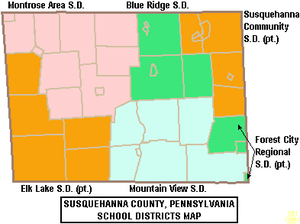
Susquehanna County, Pennsylvania
County in Pennsylvania, United States
Distance: Approx. 8690 meters
Latitude and longitude: 41.82133,-75.80068
Susquehanna County is a county in the Commonwealth of Pennsylvania. As of the 2020 census, the population was 38,434 Its county seat is Montrose. The county was created on February 21, 1810, from part of Luzerne County and later organized in 1812.

Franklin Township, Susquehanna County, Pennsylvania
Township in Pennsylvania, United States
Distance: Approx. 8842 meters
Latitude and longitude: 41.87472222,-75.83305556
Franklin Township is a township in Susquehanna County, Pennsylvania, United States. The population was 833 at the 2020 census. Salt Springs State Park, a Pennsylvania state park, is in Franklin Township.

Great Bend Township, Susquehanna County, Pennsylvania
Township in Pennsylvania, United States
Distance: Approx. 8212 meters
Latitude and longitude: 41.95,-75.73305556
Great Bend Township is a township in Susquehanna County, Pennsylvania, United States. The population was 1,711 at the 2020 census. Children living in the township are served by the public schools in the Blue Ridge School District, including Blue Ridge High School.

Jackson Township, Susquehanna County, Pennsylvania
Township in Pennsylvania, United States
Distance: Approx. 7813 meters
Latitude and longitude: 41.86666667,-75.63305556
Jackson Township is a township in Susquehanna County, Pennsylvania, United States. The population was 857 at the 2020 census. Children living in the township are served by the schools in the Blue Ridge School District, including Blue Ridge High School.

New Milford, Pennsylvania
Borough in Pennsylvania, United States
Distance: Approx. 2 meters
Latitude and longitude: 41.87638889,-75.72638889
New Milford is a borough in Susquehanna County, Pennsylvania, United States. The population was 817 at the 2020 census. Children living in New Milford are served by the schools in the Blue Ridge School District, including Blue Ridge High School.

New Milford Township, Pennsylvania
Township in Pennsylvania, United States
Distance: Approx. 3651 meters
Latitude and longitude: 41.85,-75.70027778
New Milford Township is a township in Susquehanna County, Pennsylvania, United States. The population was 1,797 at the 2020 census. Children living in New Milford Township are served by the schools in the Blue Ridge School District, including Blue Ridge High School.

Salt Lick Creek (Susquehanna River tributary)
Distance: Approx. 9684 meters
Latitude and longitude: 41.96286,-75.73935
Salt Lick Creek is an 11.1-mile-long (17.9 km) tributary of the Susquehanna River in Susquehanna County, Pennsylvania in the United States. Salt Lick Creek rises at the outlet of Page Lake at the village of Lakeside in New Milford Township and flows northwest to the borough of New Milford, then turns north and joins the Susquehanna at the borough of Hallstead. Interstate 81 and U.S. Route 11 follow the creek from New Milford to the Susquehanna River.
Page Lake (Pennsylvania)
Lake located in Pennsylvania, USA
Distance: Approx. 6163 meters
Latitude and longitude: 41.85777778,-75.65638889
Page Lake (also known as Page's Pond, Corse's Pond and Lake Page) is a lake that is located in New Milford Township, Pennsylvania, United States. It is approximately 1 mile (1.6 km) long with an average center depth of 25 ft (7.62 m).
Pratt Memorial Library
Public library located in New Milford, Pennsylvania, U.S.
Distance: Approx. 68 meters
Latitude and longitude: 41.87602,-75.72705
The Pratt Memorial Library is a historic public library located in New Milford, Pennsylvania.
Blue Ridge High School (Pennsylvania)
School in Pennsylvania, US
Distance: Approx. 2595 meters
Latitude and longitude: 41.89846,-75.73652
Blue Ridge High School is a small, rural public high school located in New Milford, Susquehanna County, Pennsylvania. It is the sole high school operated by Blue Ridge School District. In 2015, enrollment was reported as 315 pupils in 9th through 12th grades.
Little Butler Creek
River
Distance: Approx. 9369 meters
Latitude and longitude: 41.82769,-75.63425
Little Butler Creek is a tributary of Butler Creek in Susquehanna County, Pennsylvania, in the United States. It is approximately 3.1 miles (5.0 km) long and flows through Jackson Township. The watershed of the creek has an area of 1.63 square miles (4.2 km2).
Pennsylvania State Game Lands Number 35
Distance: Approx. 6573 meters
Latitude and longitude: 41.93138889,-75.6975
The Pennsylvania State Game Lands Number 35 are Pennsylvania State Game Lands in Susquehanna County in Pennsylvania in the United States providing hunting, bird watching, and other activities.
Weather in this IP's area
broken clouds
-5 Celsius
-11 Celsius
-6 Celsius
-5 Celsius
1025 hPa
63 %
1025 hPa
968 hPa
10000 meters
4.33 m/s
11.54 m/s
303 degree
69 %