Country:
Region:
City:
Latitude and Longitude:
Time Zone:
Postal Code:
IP information under different IP Channel
ip-api
Country
Region
City
ASN
Time Zone
ISP
Blacklist
Proxy
Latitude
Longitude
Postal
Route
Luminati
Country
ASN
Time Zone
America/Chicago
ISP
WECOM-INC
Latitude
Longitude
Postal
IPinfo
Country
Region
City
ASN
Time Zone
ISP
Blacklist
Proxy
Latitude
Longitude
Postal
Route
db-ip
Country
Region
City
ASN
Time Zone
ISP
Blacklist
Proxy
Latitude
Longitude
Postal
Route
ipdata
Country
Region
City
ASN
Time Zone
ISP
Blacklist
Proxy
Latitude
Longitude
Postal
Route
Popular places and events near this IP address

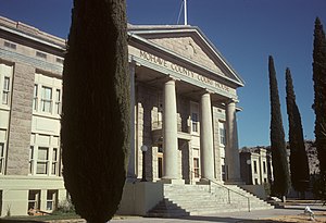
Kingman, Arizona
City in Arizona, United States
Distance: Approx. 500 meters
Latitude and longitude: 35.20833333,-114.02583333
Kingman is a city in and the county seat of Mohave County, Arizona, United States. It is named after Lewis Kingman, an engineer for the Atlantic and Pacific Railroad. It is located 105 miles (169 km) southeast of Las Vegas, Nevada, and 180 miles (290 km) northwest of Arizona's state capital, Phoenix.

Ross H. Blakely House
Historic house in Arizona, United States
Distance: Approx. 2670 meters
Latitude and longitude: 35.19138889,-114.04888889
The Ross H. Blakely House is a Queen Anne style house located in Kingman, Arizona. The house is listed on the National Register of Historic Places.

R. L. Anderson House
United States historic place in Kingman, Arizona
Distance: Approx. 2649 meters
Latitude and longitude: 35.18888889,-114.04638889
The R. L. Anderson House is a Bungalow/Craftsman style house located in Kingman, Arizona. The house is listed on the National Register of Historic Places. It was evaluated for National Register listing as part of a 1985 study of 63 historic resources in Kingman that led to this and many others being listed.
J. M. Gates House
United States historic place in Kingman, Arizona
Distance: Approx. 2609 meters
Latitude and longitude: 35.18916667,-114.04611111
The J. M. Gates House is a Bungalow/Craftsman-style house located in Kingman, Arizona. It was evaluated for National Register listing as part of a 1985 study of 63 historic resources in Kingman that led to this and many others being listed.

Raymond Carr House
United States historic place in Kingman, Arizona
Distance: Approx. 2669 meters
Latitude and longitude: 35.18944444,-114.04722222
The Raymond Carr House is a Colonial Revival style house located in Kingman, Arizona. The house is listed on the National Register of Historic Places. It was evaluated for National Register listing as part of a 1985 study of 63 historic resources in Kingman that led to this and many others being listed.

S. T. Elliott House
Historic house in Arizona, United States
Distance: Approx. 2627 meters
Latitude and longitude: 35.19138889,-114.04833333
The S. T. Elliott House is a Bungalow/Craftsman style house located in Kingman, Arizona. It was evaluated for National Register listing as part of a 1985 study of 63 historic resources in Kingman that led to this and many others being listed.

House at 527 Pine
Historic place in Arizona, United States
Distance: Approx. 2616 meters
Latitude and longitude: 35.19194444,-114.04861111
The house at 527 Pine Street, Kingman, Arizona, is listed on the National Register of Historic Places. The house was built in 1917. The home is of the style of the Bungalow/Craftsman.

Lovin & Withers Investment House
Historic house in Arizona, United States
Distance: Approx. 2652 meters
Latitude and longitude: 35.18805556,-114.04555556
Lovin & Withers Investment House, located at 722 Beale Street in Kingman, Arizona, was built c. 1914 in the Bungalow/Craftsman style. Lovin & Withers built the house as contractors, using native stone.

George R. Kayser House
Historic house in Arizona, United States
Distance: Approx. 2711 meters
Latitude and longitude: 35.18972222,-114.04805556
The George R. Kayser House is in Kingman, Arizona. The house was built in 1911 in the Colonial Revival style. The house is on an important corner located in the residential area development of 1910 to 20.

Kingman Air Force Station
Former USAF General Surveillance Radar station
Distance: Approx. 1744 meters
Latitude and longitude: 35.1975,-114.04138889
Kingman Air Force Station (ADC ID: M-128) is a closed United States Air Force General Surveillance Radar station. It is located 1 mile (1.6 km) southwest of Kingman, Arizona. It was closed in 1958.
Kingman Academy of Learning
Public charter school in Mohave County, Arizona
Distance: Approx. 2128 meters
Latitude and longitude: 35.222849,-114.028583
Kingman Academy of Learning (often shortened to Kingman Academy or KAOL) is a public charter school in Kingman, Arizona for preschool grades through high school. It consists of four campuses with a total enrollment of approximately 1,500 students. It is a member of the Arizona Interscholastic Association.
Kingman explosion
1973 propane tanker explosion in Arizona
Distance: Approx. 1343 meters
Latitude and longitude: 35.21502778,-114.03026389
The Kingman explosion, also known as the Doxol disaster or Kingman BLEVE, was a catastrophic boiling liquid expanding vapor explosion (BLEVE) that occurred on July 5, 1973, in Kingman, Arizona, United States.
Weather in this IP's area
few clouds
9 Celsius
9 Celsius
7 Celsius
9 Celsius
1012 hPa
61 %
1012 hPa
891 hPa
10000 meters
0.89 m/s
1.79 m/s
85 degree
11 %
07:12:41
17:29:34