Country:
Region:
City:
Latitude and Longitude:
Time Zone:
Postal Code:
IP information under different IP Channel
ip-api
Country
Region
City
ASN
Time Zone
ISP
Blacklist
Proxy
Latitude
Longitude
Postal
Route
Luminati
Country
ASN
Time Zone
America/Chicago
ISP
MICHAEL
Latitude
Longitude
Postal
IPinfo
Country
Region
City
ASN
Time Zone
ISP
Blacklist
Proxy
Latitude
Longitude
Postal
Route
db-ip
Country
Region
City
ASN
Time Zone
ISP
Blacklist
Proxy
Latitude
Longitude
Postal
Route
ipdata
Country
Region
City
ASN
Time Zone
ISP
Blacklist
Proxy
Latitude
Longitude
Postal
Route
Popular places and events near this IP address

Battle of Tippecanoe
1811 battle of Tecumseh's War
Distance: Approx. 246 meters
Latitude and longitude: 40.50694444,-86.84388889
The Battle of Tippecanoe ( TIP-ə-kə-NOO) was fought on November 7, 1811, in Battle Ground, Indiana, between American forces led by then Governor William Henry Harrison of the Indiana Territory and tribal forces associated with Shawnee leader Tecumseh and his brother Tenskwatawa (commonly known as "The Prophet"), leaders of a confederacy of various tribes who opposed European-American settlement of the American frontier. As tensions and violence increased, Governor Harrison marched with an army of about 1,000 men to attack the confederacy's headquarters at Prophetstown, near the confluence of the Tippecanoe River and the Wabash River. Tecumseh was not yet ready to oppose the United States by force and was away recruiting allies when Harrison's army arrived.

Battle Ground, Indiana
Town in Indiana, US
Distance: Approx. 1430 meters
Latitude and longitude: 40.50444444,-86.85777778
Battle Ground is a town in Tippecanoe Township, Tippecanoe County in the U.S. state of Indiana. The population was 1,334 at the 2010 census. It is near the site of the Battle of Tippecanoe.

Tippecanoe River
River in Indiana, USA
Distance: Approx. 4808 meters
Latitude and longitude: 40.515,-86.78555556
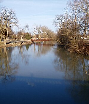
The Tippecanoe River ( TIP-ə-kə-NOO) is a gentle, 182-mile-long (293 km) river in the Central Corn Belt Plains ecoregion in northern Indiana. It flows from Crooked Lake in Noble County to the Wabash River near what is now Battle Ground, about 12 miles (19 km) northeast of Lafayette. The name "Tippecanoe" was derived from a Miami-Illinois word for buffalo fish, reconstructed as */kiteepihkwana/ or as kiteepihkwana siipiiwi.

Prophetstown State Park
State park in Indiana, United States
Distance: Approx. 1173 meters
Latitude and longitude: 40.5,-86.83333333
Prophetstown State Park commemorates a Native American village founded in 1808 by Shawnee leaders Tecumseh and his brother Tenskwatawa north of present-day Lafayette, Indiana, which grew into a large, multi-tribal community. The park features an open-air museum at Prophetstown, with living history exhibits including a Shawnee village and a 1920s-era farmstead. Battle Ground, Indiana, is a village about a mile east of the site of the Battle of Tippecanoe in 1811, a crucial battle in Tecumseh's War which ultimately led to the demise of Prophetstown.
Wabash Heritage Trail
Distance: Approx. 5418 meters
Latitude and longitude: 40.47025,-86.88144444
The Wabash Heritage Trail is a hiking trail running from Fort Ouiatenon to the Tippecanoe Battlefield Park in Battle Ground, Indiana. It is approximately 13 miles (21 km) long and passes along the cities of West Lafayette and Lafayette, Indiana. The path consists of approximately 5+1⁄2 miles of paved path and 7.5 miles of unpaved footpath.

Wildcat Creek (Indiana)
Distance: Approx. 4427 meters
Latitude and longitude: 40.47055556,-86.85777778
Wildcat Creek is a tributary of the Wabash River in north-central Indiana. The stream is 84 miles (135 km) long and drains an area of 804.2 square miles (2,083 km2). Wildcat Creek consists of three main forks-North, South, and Middle.

Tippecanoe Battlefield Park
United States historic place
Distance: Approx. 362 meters
Latitude and longitude: 40.50605556,-86.84466667
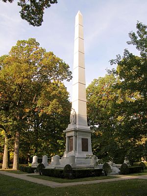
The Tippecanoe Battlefield Park preserves the location of the Battle of Tippecanoe fought on November 7, 1811. The 16-acre (6.5 ha) site of the battle was deeded to the State of Indiana by John Tipton, a veteran of the fight, on November 7, 1836, the twenty-fifth anniversary of the battle. The site was used for a number of major political rallies during its earlier years, those most significant being on May 29, 1840 in favor of William Henry Harrison's bid for the White House attended by 30,000 people.
WBPE (FM)
Radio station in Brookston, Indiana
Distance: Approx. 4354 meters
Latitude and longitude: 40.547,-86.85
WBPE (95.3 MHz, "95.3 BOB FM") is an FM radio station in Lafayette, Indiana, United States, owned by William Fielder, III's Coastal Television, through licensee CTI License LLC, as part of a cluster with Fox/NBC affiliate WPBI-LD, ABC affiliate WPBY-LD, and sister radio stations WSHY, WYCM and WAZY-FM. The station's studios are located at 3824 South 18th Street in Lafayette.

Harrisonville, Indiana
Ghost town in Indiana, United States
Distance: Approx. 1475 meters
Latitude and longitude: 40.51388889,-86.82583333
Harrisonville was a small town, now extinct, in Tippecanoe Township, Tippecanoe County, in the U.S. state of Indiana. The community is now part of the town of Battle Ground.

Tippecanoe Township, Tippecanoe County, Indiana
Township in Indiana, United States
Distance: Approx. 2027 meters
Latitude and longitude: 40.52583333,-86.84861111
Tippecanoe Township is one of thirteen townships in Tippecanoe County, Indiana, United States. As of the 2010 census, its population was 7,702 and it contained 3,085 housing units.

Wolf Park
Nonprofit organization in Indiana, United States
Distance: Approx. 3297 meters
Latitude and longitude: 40.5363584,-86.828842
Wolf Park is a nonprofit education and research facility in Battle Ground, Indiana, United States, established in 1972 by Dr. Erich Klinghammer. Along with research and seminars on wolf behavior, particularly reproductive and inter-pack social behavior, Wolf Park provides interpretive programs to school groups and the public throughout the year.

Battle Ground Historic District
Historic district in Indiana, United States
Distance: Approx. 260 meters
Latitude and longitude: 40.50972222,-86.83916667
Battle Ground Historic District is a national historic district located at Battle Ground, Tippecanoe County, Indiana. The district encompasses 129 contributing buildings in the central business district of Battle Ground, including the site of the Battle of Tippecanoe. It developed between about 1811 and 1930 and includes representative examples of Queen Anne, Colonial Revival, and Bungalow / American Craftsman style architecture.
Weather in this IP's area
overcast clouds
9 Celsius
9 Celsius
8 Celsius
10 Celsius
1022 hPa
78 %
1022 hPa
1002 hPa
10000 meters
1.54 m/s
150 degree
100 %
07:35:36
17:29:10