Country:
 USA
USARegion:
City:
Latitude and Longitude:
Time Zone:
Postal Code:
IP information under different IP Channel
ip-api
Country
Region
City
ASN
Time Zone
ISP
Blacklist
Proxy
Latitude
Longitude
Postal
Route
IPinfo
Country
Region
City
ASN
Time Zone
ISP
Blacklist
Proxy
Latitude
Longitude
Postal
Route
MaxMind
Country
Region
City
ASN
Time Zone
ISP
Blacklist
Proxy
Latitude
Longitude
Postal
Route
Luminati
Country
USASN
Time Zone
America/Chicago
ISP
AS-GLOBALTELEHOST
Latitude
Longitude
Postal
db-ip
Country
Region
City
ASN
Time Zone
ISP
Blacklist
Proxy
Latitude
Longitude
Postal
Route
ipdata
Country
Region
City
ASN
Time Zone
ISP
Blacklist
Proxy
Latitude
Longitude
Postal
Route
Popular places and events near this IP address

Sheridan, Wyoming
City in Wyoming, United States
Distance: Approx. 1981 meters
Latitude and longitude: 44.79666667,-106.95888889
Sheridan is a city in the U.S. state of Wyoming and the county seat of Sheridan County. The city is located halfway between Yellowstone Park and Mount Rushmore by U.S. Route 14 and 16. It is the principal town of the Sheridan, Wyoming, Micropolitan Statistical Area which encompasses all of Sheridan County.
Sheridan College (Wyoming)
Community college in Sheridan, Wyoming, US
Distance: Approx. 2171 meters
Latitude and longitude: 44.76472222,-106.9425
Sheridan College is a public community college in Sheridan, Wyoming, United States. It is part of the Northern Wyoming Community College District. It offers certificate programs; program tracks that prepare students to transfer to a four-year college or university; and associate degrees in the arts, science, and applied science.
Little Goose Creek
Distance: Approx. 2494 meters
Latitude and longitude: 44.80305556,-106.95805556
Little Goose Creek is a creek originating on the east slope of the Big Horn Mountains in north-central Wyoming.

Sheridan Flouring Mills, Inc.
United States historic place
Distance: Approx. 1086 meters
Latitude and longitude: 44.77444444,-106.94111111
The Sheridan Flouring Mills, also known as the Mill Inn, are an industrial complex in Sheridan, Wyoming. The mills were a major component of the economy of north central Wyoming, providing collection, storage and milling of locally produced wheat and other grains into flour and other milled products. The original mill was established by Captain Scott W. Snively in the early 1890s.

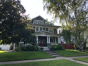
Mount View (Sheridan, Wyoming)
Historic house in Wyoming, United States
Distance: Approx. 1793 meters
Latitude and longitude: 44.79166667,-106.96111111
Mount View is a historic house located at 610 S. Jefferson St. in Sheridan, Wyoming. The Prairie School home was built from 1911 to 1912 and designed by Glenn Charles McAllister.

Sheridan County Courthouse (Wyoming)
United States historic place
Distance: Approx. 1679 meters
Latitude and longitude: 44.795,-106.95583333
The Sheridan County Courthouse, located at the intersection of Burkett and Main Streets in Sheridan, is the seat of government of Sheridan County, Wyoming. Built from 1904 to 1905, the courthouse was the first built in the county. The firm of Link & McAllister designed the courthouse; their design features elements of the Classical Revival and Beaux-Arts styles.
KHNA-LP
Radio station in Sheridan, Wyoming
Distance: Approx. 1740 meters
Latitude and longitude: 44.79763889,-106.95225
KHNA-LP (94.3 FM) is a low-power FM radio station broadcasting a Catholic Radio format. Licensed to Sheridan, Wyoming, US, the station is currently owned by Aperio Radio, Inc. The transmitter for the station is located in downtown Sheridan atop an office building.

St. Peter's Episcopal Church (Sheridan, Wyoming)
United States historic place
Distance: Approx. 1968 meters
Latitude and longitude: 44.79708333,-106.95805556
St Peter's Episcopal Church is a brick Gothic Revival style church built in 1912 in Sheridan, Wyoming. It was listed on the National Register of Historic Places in 2013. It was designed by architect Edward E. Hendrickson of Frank Miles Day firm in Philadelphia.

Sheridan Railroad Historic District
Historic district in Wyoming, United States
Distance: Approx. 2532 meters
Latitude and longitude: 44.80527778,-106.95305556
The Sheridan Railroad Historic District, in Sheridan, Wyoming, is a 37 acres (15 ha) historic district which was listed on the National Register of Historic Places in 2004. The district includes railroad-related resources and a well-preserved working-class neighborhood. The district includes 110 contributing buildings and two contributing structures in an area including 201-841 Broadway and 508-955 N. Gould.

Sheridan Main Street Historic District
Historic district in Wyoming, United States
Distance: Approx. 1961 meters
Latitude and longitude: 44.79861111,-106.95527778
The Sheridan Main Street Historic District, in Sheridan, Wyoming, is a 16.4 acres (6.6 ha) historic district which was listed on the National Register of Historic Places in 1982. It includes both sides of several blocks of Main Street, from Burkitt Street to Mandel Street, an area including the oldest portion of the historic core of Sheridan, dating back to 1882. It included 57 contributing buildings.
Robinson-Smith House
United States historic place
Distance: Approx. 1580 meters
Latitude and longitude: 44.79222222,-106.9575
The Robinson-Smith House was built in 1909. It was listed on the National Register of Historic Places in 2016. It is American Foursquare in style.

Holy Name Catholic School
United States historic place
Distance: Approx. 1507 meters
Latitude and longitude: 44.79555556,-106.95138889
The Holy Name Catholic School is a school and a historic school building located at 121 S. Connor Street in Sheridan, Wyoming. The school is one of the oldest Catholic schools in Wyoming, and its 1914 building is the oldest Catholic school building in the state. The original brick school building and a secondary annex building constructed in 1952 were listed on the National Register of Historic Places in 2013.
Weather in this IP's area
clear sky
14 Celsius
12 Celsius
14 Celsius
15 Celsius
1014 hPa
30 %
1014 hPa
885 hPa
10000 meters
2.31 m/s
2.01 m/s
226 degree
07:14:51
18:35:08