23.173.128.33 - IP Lookup: Free IP Address Lookup, Postal Code Lookup, IP Location Lookup, IP ASN, Public IP
Country:
Region:
City:
Location:
Time Zone:
Postal Code:
IP information under different IP Channel
ip-api
Country
Region
City
ASN
Time Zone
ISP
Blacklist
Proxy
Latitude
Longitude
Postal
Route
Luminati
Country
Region
oh
City
marietta
ASN
Time Zone
America/New_York
ISP
WASHINGTONELECTRIC-AS-1
Latitude
Longitude
Postal
IPinfo
Country
Region
City
ASN
Time Zone
ISP
Blacklist
Proxy
Latitude
Longitude
Postal
Route
IP2Location
23.173.128.33Country
Region
ohio
City
devola
Time Zone
ISP
Language
User-Agent
Latitude
Longitude
Postal
db-ip
Country
Region
City
ASN
Time Zone
ISP
Blacklist
Proxy
Latitude
Longitude
Postal
Route
ipdata
Country
Region
City
ASN
Time Zone
ISP
Blacklist
Proxy
Latitude
Longitude
Postal
Route
Popular places and events near this IP address

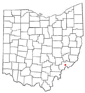
Washington County, Ohio
County in Ohio, United States
Distance: Approx. 1794 meters
Latitude and longitude: 39.46,-81.49
Washington County is a county located in the southeastern part of the U.S. state of Ohio. As of the 2020 census, the population was 59,711. Its county seat is Marietta.

Devola, Ohio
CDP in Ohio, United States
Distance: Approx. 535 meters
Latitude and longitude: 39.47638889,-81.48416667
Devola is a census-designated place (CDP) in Washington County, Ohio, United States, along the Muskingum River. It is part of the Parkersburg-Marietta-Vienna, WV-OH Metropolitan Statistical Area. The population was 2,639 at the 2020 census.
Marietta High School (Ohio)
Public school in Marietta, Ohio, United States
Distance: Approx. 4382 meters
Latitude and longitude: 39.43944444,-81.45388889
Marietta High School (MHS) is a six-year, public, secondary school in Marietta, Ohio, United States. The school serves students in the Marietta City School District in grades seven through twelve. As of 2023–2024, the enrollment is 1,028 students.
Muskingum Township, Washington County, Ohio
Township in Ohio, United States
Distance: Approx. 440 meters
Latitude and longitude: 39.475,-81.47416667
Muskingum Township is one of the twenty-two townships of Washington County, Ohio, United States. The 2020 census found 4,424 people in the township.
Colonel Joseph Barker House
Historic house in Ohio, United States
Distance: Approx. 1636 meters
Latitude and longitude: 39.48638889,-81.48861111
The Colonel Joseph Barker House is a historic residence in Washington County, Ohio, United States. Located north of Marietta, in the Muskingum Township community of Devola, it has changed little since its construction in the early nineteenth century, and it has been designated a historic site.
Unionville, Washington County, Ohio
Unincorporated community in Ohio, U.S.
Distance: Approx. 3007 meters
Latitude and longitude: 39.45222222,-81.45777778
Unionville is an unincorporated community in Washington County, in the U.S. state of Ohio.
Stanleyville, Ohio
Unincorporated community in Ohio, U.S.
Distance: Approx. 5837 meters
Latitude and longitude: 39.47194444,-81.41111111
Stanleyville is an unincorporated community in Washington County, in the U.S. state of Ohio.
Oak Grove, Ohio
Unincorporated community in Ohio, U.S.
Distance: Approx. 2996 meters
Latitude and longitude: 39.44861111,-81.46638889
Oak Grove is an unincorporated community in Washington County, in the U.S. state of Ohio. The Oak Grove Volunteer Fire Department has served the community since the 1950s.
Rainbow, Ohio
Unincorporated community in Ohio, U.S.
Distance: Approx. 2593 meters
Latitude and longitude: 39.49444444,-81.46527778
Rainbow is an unincorporated community in Washington County, in the U.S. state of Ohio.
Rainbow Creek (Ohio)
Stream in Ohio, United States
Distance: Approx. 2447 meters
Latitude and longitude: 39.49305556,-81.4925
Rainbow Creek is a stream entirely within Washington County, Ohio. Rainbow Creek, noted for its rainbow shape, lent its name to the community of Rainbow, Ohio.
New Years Creek
River in Ohio, United States
Distance: Approx. 5775 meters
Latitude and longitude: 39.50277778,-81.42333333
New Years Creek is a stream in the U.S. state of Ohio. It is a tributary to Duck Creek. Variant names are "New Year's Run" and "New Years Run".
Indian Run (Muskingum River tributary)
Stream in Ohio, U.S.
Distance: Approx. 4473 meters
Latitude and longitude: 39.43388889,-81.47194444
Indian Run is a stream in the U.S. state of Ohio. It is a tributary to the Muskingum River. According to tradition, Indian Run was named from an incident when an American Indian went missing from his party after having boasted of the killing of a white pioneer settler.
Weather in this IP's area
light snow
-4 Celsius
-8 Celsius
-4 Celsius
-3 Celsius
1023 hPa
71 %
1023 hPa
992 hPa
10000 meters
2.57 m/s
7.2 m/s
280 degree
100 %
