23.167.224.209 - IP Lookup: Free IP Address Lookup, Postal Code Lookup, IP Location Lookup, IP ASN, Public IP
Country:
Region:
City:
Location:
Time Zone:
Postal Code:
IP information under different IP Channel
ip-api
Country
Region
City
ASN
Time Zone
ISP
Blacklist
Proxy
Latitude
Longitude
Postal
Route
Luminati
Country
ASN
Time Zone
America/Toronto
ISP
IMPER-AS-1
Latitude
Longitude
Postal
IPinfo
Country
Region
City
ASN
Time Zone
ISP
Blacklist
Proxy
Latitude
Longitude
Postal
Route
IP2Location
23.167.224.209Country
Region
alberta
City
calgary
Time Zone
America/Edmonton
ISP
Language
User-Agent
Latitude
Longitude
Postal
db-ip
Country
Region
City
ASN
Time Zone
ISP
Blacklist
Proxy
Latitude
Longitude
Postal
Route
ipdata
Country
Region
City
ASN
Time Zone
ISP
Blacklist
Proxy
Latitude
Longitude
Postal
Route
Popular places and events near this IP address

Fort Calgary
Fort, historical site and museum in Calgary, Alberta, Canada
Distance: Approx. 808 meters
Latitude and longitude: 51.04527778,-114.04555556
Fort Calgary was a North-West Mounted Police outpost at the confluence of the Bow and Elbow rivers in present-day Calgary, Alberta, Canada. Originally named Fort Brisebois, after the outpost's first commander, the outpost was renamed Fort Calgary in June 1876. The outpost was built in 1875 as a part of the North-West Mounted Police (NWMP) larger effort to curtail American rum and whisky runners in the region, and to establish relationships with the Indigenous peoples of the territory.

Elbow River
River in Alberta, Canada
Distance: Approx. 563 meters
Latitude and longitude: 51.04519,-114.04126
The Elbow River is a river in southern Alberta, Canada. It flows from the Canadian Rockies to the city of Calgary, where it merges into the Bow River.

Zoo station (Calgary)
Light rail station in Calgary, Alberta, Canada
Distance: Approx. 991 meters
Latitude and longitude: 51.0475,-114.025
Zoo station is a CTrain light rail station in Calgary, Alberta, Canada. It is on the Blue Line between Bridgeland/Memorial and Barlow/Max Bell stations. It opened on April 22, 1985 as part of the original Blue Line.

Bridgeland/Memorial station
Light rail station in Calgary, Alberta, Canada
Distance: Approx. 902 meters
Latitude and longitude: 51.04908333,-114.04055556
Bridgeland/Memorial station is a CTrain light rail station in Calgary, Alberta. It serves the Northeast Line (Route 202). It opened on April 27, 1985, as part of the original Northeast line.
Inglewood, Calgary
Neighbourhood in Calgary, Alberta, Canada
Distance: Approx. 299 meters
Latitude and longitude: 51.04277778,-114.03944444
Inglewood is an urban neighbourhood in central Calgary, Alberta, Canada, centred on 9th Avenue SE for several blocks east of the Elbow River and downtown. It also contains the Business Revitalization Zone of Inglewood. It is represented in the Calgary City Council by the Ward 9 councillor, Gian-Carlo Carra.
Ramsay, Calgary
Neighbourhood in Calgary, Alberta, Canada
Distance: Approx. 820 meters
Latitude and longitude: 51.03638889,-114.04388889
Ramsay is a residential neighbourhood in the southeast quadrant of Calgary, Alberta. It is an inner city community, located east of the Elbow River, Macleod Trail, Stampede Grounds and the Scotiabank Saddledome arena and south of Inglewood. To the southeast, it borders the Alyth-Bonny Brook industrial area.
Scotia Place
Under construction arena in Alberta, Canada
Distance: Approx. 1182 meters
Latitude and longitude: 51.03972222,-114.05222222
Scotia Place is a multi-purpose arena under construction in Calgary, Alberta, Canada. It is intended to replace the Scotiabank Saddledome, home of the Calgary Flames of the National Hockey League. Construction began following the groundbreaking on July 22, 2024; the new arena is planned to open prior to the start of the 2027–28 NHL season.

St. Patrick's Island Park
Distance: Approx. 710 meters
Latitude and longitude: 51.047,-114.041
St. Patrick's Island Park (also simply known as St. Patrick's Island) is a 31-acre public park on an island at the confluence of the Bow and Elbow rivers just northeast of Downtown Calgary.

George C. King Bridge
Bridge in Calgary
Distance: Approx. 1090 meters
Latitude and longitude: 51.0484,-114.0468
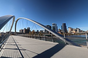
The George C. King Bridge (formerly known as the St. Patrick's Island Bridge and colloquially known as the Skipping Stone Bridge) is a pedestrian bridge that spans the Bow River just northeast of Downtown Calgary, Alberta, Canada. The bridge connects the neighbourhoods of East Village to the south and Bridgeland to the north, with access from the bridge to St.
St. Anne Academic Centre (Calgary)
High school in Calgary, Alberta, Canada
Distance: Approx. 802 meters
Latitude and longitude: 51.034692,-114.03887
St. Anne Academic Centre is a Roman Catholic school located in the community of Ramsay in the city of Calgary, Alberta. The school is operated the jurisdiction of the Calgary Catholic School District.
4 Street SE station
Future light rail station in Calgary, Alberta
Distance: Approx. 1160 meters
Latitude and longitude: 51.042052,-114.052158
4 Street SE station is a planned and approved CTrain light rail station in Calgary, Alberta, part of the Green Line. Construction will begin in 2024 and complete in 2030 as part of construction stage one, segment 2A. The station is located in Beltline, immediately southeast of downtown Calgary near the confluence of the Bow River and Elbow River. The station will be an integral part of the redevelopment of Calgary's Rivers District, a high-density urban entertainment centre.
Ramsay/Inglewood station
Future light rail station in Calgary, Alberta
Distance: Approx. 339 meters
Latitude and longitude: 51.038604,-114.036451
Ramsay/Inglewood station is a planned and approved CTrain light rail station in Calgary, Alberta, part of the Green Line. Construction will begin in 2022 and complete in 2027 as part of construction stage one, segment one. The station serves some of Calgary's oldest, most historic areas located in the urban inner-city communities of Ramsay and Inglewood.
Weather in this IP's area
overcast clouds
0 Celsius
-3 Celsius
0 Celsius
1 Celsius
1026 hPa
67 %
1026 hPa
895 hPa
10000 meters
3.09 m/s
330 degree
100 %
