23.163.40.194 - IP Lookup: Free IP Address Lookup, Postal Code Lookup, IP Location Lookup, IP ASN, Public IP
Country:
Region:
City:
Location:
Time Zone:
Postal Code:
IP information under different IP Channel
ip-api
Country
Region
City
ASN
Time Zone
ISP
Blacklist
Proxy
Latitude
Longitude
Postal
Route
Luminati
Country
Region
fl
City
navarre
ASN
Time Zone
America/Chicago
ISP
RIPPLE-BROADBAND
Latitude
Longitude
Postal
IPinfo
Country
Region
City
ASN
Time Zone
ISP
Blacklist
Proxy
Latitude
Longitude
Postal
Route
IP2Location
23.163.40.194Country
Region
florida
City
navarre
Time Zone
America/Chicago
ISP
Language
User-Agent
Latitude
Longitude
Postal
db-ip
Country
Region
City
ASN
Time Zone
ISP
Blacklist
Proxy
Latitude
Longitude
Postal
Route
ipdata
Country
Region
City
ASN
Time Zone
ISP
Blacklist
Proxy
Latitude
Longitude
Postal
Route
Popular places and events near this IP address

East Bay River
River in Florida, United States
Distance: Approx. 7507 meters
Latitude and longitude: 30.44,-86.863
The East Bay River (also called the East River and historically known as The River Jordan or the Chester River) in Florida is a 15-mile-long (24 km) river located in Santa Rosa and Okaloosa counties. It flows from east to west, forming near Hurlburt Field, and empties into the eastern portion of East Bay (Florida) near the towns Holley and Navarre. The river forms part of the southern boundary of Eglin Air Force Base.

Naval Outlying Landing Field Choctaw
Distance: Approx. 5939 meters
Latitude and longitude: 30.50916667,-86.95777778
Naval Outlying Landing Field Choctaw (IATA: NFJ, ICAO: KNFJ, FAA LID: NFJ) is the United States Navy's designation for an auxiliary airfield that was originally constructed during World War II as Eglin Field (now Eglin Air Force Base) Auxiliary Field # 10. It is located 16.6 miles northeast of Pensacola, Florida.
Naval Outlying Landing Field Holley
Airport in Navarre, Florida
Distance: Approx. 7806 meters
Latitude and longitude: 30.43083333,-86.89972222
Naval Outlying Landing Field (NOLF) Holley was a naval outlying landing field of the larger Naval Air Station Whiting Field located within the community of Navarre, Florida. The two runways were each 3,600 feet (1,100 meters) long. The runways were restricted to limited military use only; however, in 2017, the Gulf Power company was authorized to build a solar power plant on the facility grounds.
Holley, Florida
Census-designated place in Florida, United States
Distance: Approx. 6088 meters
Latitude and longitude: 30.44694444,-86.90694444
Holley is an unincorporated community and census-designated place in Santa Rosa County, Florida, United States. Its population was 2,484 as of the 2020 census, up from 1,630 at the 2010 census. It is part of the Pensacola—Ferry Pass—Brent, Florida Metropolitan Statistical Area.

Gable Lake
Small lake in Navarre, Florida
Distance: Approx. 7527 meters
Latitude and longitude: 30.4359,-86.9182
Gable Lake is a small lake located in Navarre, Florida. The lake is primarily fed by a number of small unnamed creeks on the south shore. Subsequently, the lake outflows into the East Bay River and the East Bay via a small unnamed stream.

Axelson Point
Distance: Approx. 6225 meters
Latitude and longitude: 30.452323,-86.928735
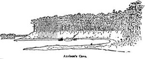
Axelson Point is a small cape along the shore of the East Bay in Navarre, Florida. The point is sometimes mistakenly called Diana's Point by local residents, though the origin of this is unclear. The point is named after the Axelson Family, one of the first families permanently residing in Navarre.
Buck Pond (Navarre, Florida)
Reservoir in Navarre, Florida
Distance: Approx. 5727 meters
Latitude and longitude: 30.55138889,-86.90805556
Buck Pond is a small reservoir on Eglin Air Force Base, southeast of Milton, Florida and north of Navarre, Florida. The pond is reportedly fishable and accessible for members of the general public with prior permits and permission from Eglin Air Force Base.
Dean Creek (Florida)
Creek in Holley-Navarre, Florida, United States
Distance: Approx. 6376 meters
Latitude and longitude: 30.44416667,-86.8875
Dean Creek is a creek primarily on Eglin Air Force Base, near Holley and Navarre, Florida.
Poplar Creek (Florida)
River
Distance: Approx. 5417 meters
Latitude and longitude: 30.45975,-86.92673
Poplar Creek is a creek tributary of the narrowed river-like side of East Bay, in the Holley neighborhood of Navarre, Florida.
Tom King Bayou
Bayou in Navarre, Florida
Distance: Approx. 6753 meters
Latitude and longitude: 30.45222222,-86.93861111
Tom King Bayou is a small, but locally important, bayou and creek in Navarre, Florida. The mouth of the bayou opens onto East Bay near Axelson Point and Robledal. The bayou acts as a major runoff for stormwaters and is critical to the local environment and for local homes for this purpose.
Tom King Bayou Bridge
Bridge in Navarre, Florida
Distance: Approx. 7196 meters
Latitude and longitude: 30.446,-86.9362
Tom King Bayou Bridge is the locally used name for the East Bay Boulevard bridge crossing at Tom King Bayou. The bayou is crossed by East Bay Boulevard near the entrance of the bayou.
Emerald Coast Wildlife Refuge
Zoo in Navarre, Florida
Distance: Approx. 6415 meters
Latitude and longitude: 30.4444835,-86.8829648
The Emerald Coast Wildlife Refuge is a wildlife sanctuary and rehabilitation center in Navarre, Florida.
Weather in this IP's area
clear sky
13 Celsius
12 Celsius
11 Celsius
14 Celsius
1023 hPa
64 %
1023 hPa
1021 hPa
10000 meters
1.79 m/s
4.47 m/s
323 degree