Country:
Region:
City:
Latitude and Longitude:
Time Zone:
Postal Code:
IP information under different IP Channel
ip-api
Country
Region
City
ASN
Time Zone
ISP
Blacklist
Proxy
Latitude
Longitude
Postal
Route
Luminati
Country
ASN
Time Zone
America/Chicago
ISP
AS-CYBER-DATA
Latitude
Longitude
Postal
IPinfo
Country
Region
City
ASN
Time Zone
ISP
Blacklist
Proxy
Latitude
Longitude
Postal
Route
db-ip
Country
Region
City
ASN
Time Zone
ISP
Blacklist
Proxy
Latitude
Longitude
Postal
Route
ipdata
Country
Region
City
ASN
Time Zone
ISP
Blacklist
Proxy
Latitude
Longitude
Postal
Route
Popular places and events near this IP address
California Virtual Academies
Virtual charter school in Simi Valley, California, United States
Distance: Approx. 1134 meters
Latitude and longitude: 34.277461,-118.788694
California Virtual Academies (CAVA) are nine virtual charter schools with business agreements with the curriculum-provider K12 Inc. The nine virtual charter schools are CAVA@Fresno, CAVA@Kings, CAVA@Los Angeles, CAVA@Maricopa, CAVA@San Diego, CAVA@San Joaquin, CAVA@San Mateo, CAVA@Sonoma, and CAVA@Sutter. Although all public charter schools are nonprofit organizations, they are affiliated with a for-profit company, K12 Inc.
Simi Valley Community Church
Distance: Approx. 2226 meters
Latitude and longitude: 34.26138889,-118.75888889
Simi Community Church (SCC) is located in Simi Valley, California. Its main worship service is held on Sundays at 10:00 a.m.
Simi Valley Town Center
Shopping center in Simi Valley, California, United States
Distance: Approx. 1977 meters
Latitude and longitude: 34.28479,-118.77006
Simi Valley Town Center is a lifestyle center located in Simi Valley, California. It was owned and operated by Forest City Enterprises. The mall was sold to Alberta Development Partners and Walton Street Capital in 2010.
Royal High School (California)
Public school in Simi Valley, California, United States
Distance: Approx. 1076 meters
Latitude and longitude: 34.26356,-118.77178
Royal High School (RHS) is a public high school in Simi Valley, California. Royal is part of the Simi Valley Unified School District and is located on Simi Valley's west side.

Simi Adobe–Strathearn House
Historic house in California, United States
Distance: Approx. 1921 meters
Latitude and longitude: 34.27445278,-118.80100278
The historic Simi Adobe–Strathearn House served as the headquarters of Rancho Simi, also known as Rancho San José de Nuestra Senora de Altagracia y Simi, one of the land grants in Alta California by the Spanish government. The name derives from Shimiji, the name of the Chumash village here before the Spanish. Rancho Simi was the earliest Spanish colonial land grant within Ventura and Santa Barbara Counties.

Challenger Park
Distance: Approx. 3099 meters
Latitude and longitude: 34.24166667,-118.78055556
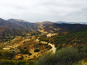
Challenger Park is a 141.55-acre open-space park (57.28 ha) located in southern portion of Simi Valley, California in the Simi Hills. The park is owned and maintained by the Rancho Simi Recreation and Park District. Challenger Park is used for mountain hiking, mountain biking, jogging, and horseback riding but with a focus on the preservation of wildlife habitat.

Tierra Rejada Park
Distance: Approx. 2424 meters
Latitude and longitude: 34.27611111,-118.80611111
Tierra Rejada Park is a 150-acre park located in the northern Simi Hills foothills, in southwestern Simi Valley city near Moorpark, in Ventura County, California. There are several trails leaving from the park to: Moorpark; Mount McCoy, Oak Canyon, Coyote Hills Park, Long Canyon, Wood Ranch Open Space, and other open-space nature areas in southwestern Simi Valley. Trails up into the Simi Hills, offer panoramic views of the Simi Valley, the Santa Rosa Valley, eastern Moorpark, and the western Santa Susana Mountains.
Bridle Path, Simi Valley, California
Distance: Approx. 2884 meters
Latitude and longitude: 34.24492,-118.79092
Bridle Path is a community in the southwestern area of the City of Simi Valley, in Ventura County, Southern California. The residential development is located in the north−central Simi Hills, east of the southern end of First Street as it turns into Long Canyon Road, and east of the Wood Ranch community. The area was developed in the mid-1970s, during one of Simi Valley's housing development booms.

Mount McCoy (Simi Valley)
Mountain in California, United States
Distance: Approx. 2287 meters
Latitude and longitude: 34.26253123,-118.80438913
Mount McCoy (previously known as Verde Hill) is a 1,325-foot-high peak in Simi Valley, California known for its characteristic 12 foot white cross on the top. There are numerous trails leading to Mount McCoy, which sits in a 200 acres (81 ha) nature area operated by the Rancho Simi Recreation and Park District (RSRPD), while the cross and its immediate surroundings are owned by the Simi Valley Historical Society. By 1813, the cross on Mt.
Sinaloa Lake
Man-made reservoir in California, United States
Distance: Approx. 1865 meters
Latitude and longitude: 34.256,-118.793
Sinaloa Lake is a 12-acre (4.9 ha) reservoir in southwestern Simi Valley. The lake is adjacent to the Sinaloa Golf Course and neighborhood. It has a 35-foot (11 m) deep earth dam which was constructed between 1925 and 1929.

Easy Fire
2019 wildfire in Southern California
Distance: Approx. 2497 meters
Latitude and longitude: 34.282179,-118.803389
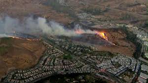
The Easy Fire was a wildfire that burned in Simi Valley, Ventura County, California. The fire burned 1,806 acres (731 ha) in October 2019.
Grace Brethren High School
Private, coeducational school in Simi Valley, California, United States
Distance: Approx. 2877 meters
Latitude and longitude: 34.26361111,-118.75055556
Grace Brethren Jr./Sr. High School (GBHS) is a co-educational, college-preparatory Christian school in Simi Valley, California serving grades 7–12. The school is one of three campuses in Simi Valley comprising the Grace Brethren Schools, the others being an elementary school (grades K—6) and a preschool.
Weather in this IP's area
clear sky
18 Celsius
16 Celsius
15 Celsius
20 Celsius
1012 hPa
31 %
1012 hPa
984 hPa
10000 meters
2.24 m/s
3.58 m/s
299 degree
06:29:50
16:50:29