23.142.89.233 - IP Lookup: Free IP Address Lookup, Postal Code Lookup, IP Location Lookup, IP ASN, Public IP
Country:
Region:
City:
Location:
Time Zone:
Postal Code:
ISP:
ASN:
language:
User-Agent:
Proxy IP:
Blacklist:
IP information under different IP Channel
ip-api
Country
Region
City
ASN
Time Zone
ISP
Blacklist
Proxy
Latitude
Longitude
Postal
Route
db-ip
Country
Region
City
ASN
Time Zone
ISP
Blacklist
Proxy
Latitude
Longitude
Postal
Route
IPinfo
Country
Region
City
ASN
Time Zone
ISP
Blacklist
Proxy
Latitude
Longitude
Postal
Route
IP2Location
23.142.89.233Country
Region
california
City
fulton
Time Zone
America/Los_Angeles
ISP
Language
User-Agent
Latitude
Longitude
Postal
ipdata
Country
Region
City
ASN
Time Zone
ISP
Blacklist
Proxy
Latitude
Longitude
Postal
Route
Popular places and events near this IP address

Larkfield-Wikiup, California
Census-designated place in California, United States
Distance: Approx. 2666 meters
Latitude and longitude: 38.50861111,-122.75305556
Larkfield-Wikiup is a census-designated place, unincorporated area in Sonoma County, California, United States. The population was 8,884 at the 2010 census, up from 7,479 at the 2000 census. It comprises the Mark West area between Santa Rosa (to the south), Windsor (north), Calistoga (east), and Fulton (west).
Redwood Empire Food Bank
Distance: Approx. 2800 meters
Latitude and longitude: 38.5139,-122.7926
Redwood Empire Food Bank (REFB) is a food bank on the North Coast of California which belongs to the Feeding America network. Its mission is to end hunger in its community. Founded in 1987, REFB is Sonoma County's largest hunger-relief organization, serving 133 charitable organizations, including emergency food pantries/closets, shelters and dining rooms, childcare centers/youth programs, group homes, and disaster relief agencies.
Mark West, California
Unincorporated community in California, United States
Distance: Approx. 1969 meters
Latitude and longitude: 38.50943889,-122.78221944
Mark West is an unincorporated community immediately north of Santa Rosa, California in Sonoma County, California, United States. Mark West is located along Mark West Springs Road adjacent to U.S. Highway 101. The community of Mark West is named for Scottish American pioneer William Marcus West.
Northern Sonoma AVA
American Viticultural Area in Sonoma County, California
Distance: Approx. 2276 meters
Latitude and longitude: 38.5,-122.8
The Northern Sonoma AVA is an American Viticultural Area in Sonoma County, California, United States. The appellation covers most of the county with the notable exceptions of the Los Carneros AVA and Sonoma Valley AVA wine regions, which are located in the southern portion of the county. The creation of this AVA was largely based on the petitioning of the E & J Gallo Winery as part of their expansion of their Gallo of Sonoma brand.

Luther Burbank Center for the Arts
Performing arts venue in Santa Rosa, California
Distance: Approx. 2310 meters
Latitude and longitude: 38.4932,-122.7492
The Luther Burbank Center for the Arts (sometimes called the LBC), and previously known as the Wells Fargo Center for the Arts from March 2005 to March 2016) is a performance venue located just north of Santa Rosa, California, near U.S. 101. The facility is owned and operated by the Luther Burbank Memorial Foundation, a non-profit arts organization established in 1979.
Rancho San Miguel (West)
Distance: Approx. 467 meters
Latitude and longitude: 38.49,-122.78
Rancho San Miguel was a 6,663-acre (26.96 km2) Mexican land grant in present-day Sonoma County, California given in 1840 by Governor Juan B. Alvarado to William Marcus West. The grant was located north of present-day Santa Rosa, between Mark West Creek and Santa Rosa Creek, and encompassed present-day Mark West and Mark West Springs.

Fulton, California
Census-designated place in California, United States
Distance: Approx. 659 meters
Latitude and longitude: 38.49638889,-122.77
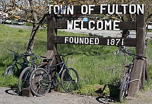
Fulton is a census-designated place (CDP) in Sonoma County, California, United States. Fulton is just to the north of the city limits of Santa Rosa, and 7 miles (11 km) north-northeast of Sebastopol. Fulton has a post office, established in 1871 and assigned ZIP code 95439.
Sonoma Water
Distance: Approx. 2242 meters
Latitude and longitude: 38.51166667,-122.78361111
Sonoma Water, formerly known as the Sonoma County Water Agency, maintains a water transmission system that provides naturally filtered Russian River water to more than 600,000 residents in portions of Sonoma County, California and Marin County, California. The Water Agency is a water wholesaler that sells potable water to nine cities and special districts that in turn sell drinking water to their residents. These cities and special districts are: the City of Santa Rosa, Rohnert Park, Cotati, Petaluma, Sonoma, the Town of Windsor, Valley of the Moon Water District, Marin Municipal Water District, and North Marin Water District.

Pacific Coast Air Museum
Museum in Santa Rosa, California, U.S.
Distance: Approx. 2750 meters
Latitude and longitude: 38.5064,-122.8018
The Pacific Coast Air Museum is an aviation museum located at Charles M. Schulz–Sonoma County Airport in Santa Rosa, California. The museum displays a varied collection of over 30 American military, propeller, and jet aircraft.
Sonoma County Airport station
Train station in Santa Rosa, California, U.S.
Distance: Approx. 2084 meters
Latitude and longitude: 38.51,-122.7842
Sonoma County Airport station is a Sonoma–Marin Area Rail Transit train station in Santa Rosa, 1.1 miles (1.8 km) east of Charles M. Schulz–Sonoma County Airport. It opened to preview service on July 1, 2017; full commuter service commenced on August 25, 2017. Until Phase 2 is completed, this will be the northern terminus of rail service on the line.
Martinelli Winery
Distance: Approx. 2836 meters
Latitude and longitude: 38.4883,-122.8078
Martinelli Winery is located in California’s Russian River Valley and is a family business that has been growing grapes since the 1880s. It is one of the oldest surviving vineyards in Sonoma County.
James H. and Frances E. Laughlin House
United States historic place
Distance: Approx. 2367 meters
Latitude and longitude: 38.51277778,-122.78388889
The James H. and Frances E. Laughlin House, in Sonoma County, California, near Windsor, was built around 1876. It has also been known as Shady Farm. The listing includes four contributing buildings and a contributing structure.
Weather in this IP's area
clear sky
2 Celsius
1 Celsius
1 Celsius
6 Celsius
1023 hPa
73 %
1023 hPa
1006 hPa
10000 meters
1.54 m/s
290 degree

