23.142.33.111 - IP Lookup: Free IP Address Lookup, Postal Code Lookup, IP Location Lookup, IP ASN, Public IP
Country:
Region:
City:
Location:
Time Zone:
Postal Code:
ISP:
ASN:
language:
User-Agent:
Proxy IP:
Blacklist:
IP information under different IP Channel
ip-api
Country
Region
City
ASN
Time Zone
ISP
Blacklist
Proxy
Latitude
Longitude
Postal
Route
db-ip
Country
Region
City
ASN
Time Zone
ISP
Blacklist
Proxy
Latitude
Longitude
Postal
Route
IPinfo
Country
Region
City
ASN
Time Zone
ISP
Blacklist
Proxy
Latitude
Longitude
Postal
Route
IP2Location
23.142.33.111Country
Region
michigan
City
bay city
Time Zone
America/Detroit
ISP
Language
User-Agent
Latitude
Longitude
Postal
ipdata
Country
Region
City
ASN
Time Zone
ISP
Blacklist
Proxy
Latitude
Longitude
Postal
Route
Popular places and events near this IP address

Bay City, Michigan
City in Michigan, United States
Distance: Approx. 2208 meters
Latitude and longitude: 43.595,-83.88861111
Bay City is a city in and the county seat of Bay County, Michigan, United States. The population was 32,661 as of the 2020 census. The city is located just upriver from the Saginaw Bay on the Saginaw River.
Bay City Central High School
Secondary school in Bay City, Michigan, United States
Distance: Approx. 901 meters
Latitude and longitude: 43.5887,-83.8739
Bay City Central High School (BCC) is a high school located at 1624 Columbus Avenue, Bay City, Michigan, United States, and a part of Bay City Public Schools. Its mascot is the wolf, and its colors are purple and gold.
All Saints Central High School
Private, coeducational school in Bay City, Michigan, United States
Distance: Approx. 1493 meters
Latitude and longitude: 43.58861111,-83.88416667
All Saints Central High School is a private Roman Catholic high school located in Bay City, Michigan, United States. It is located in the Diocese of Saginaw. It is part of a grouping of schools: All Saints Central Elementary, All Saints Central Middle/High School and Little Saints Childcare Center.

Bay County Library System
Distance: Approx. 2221 meters
Latitude and longitude: 43.597215,-83.885615
The Bay County Library System (BCLS), is a public library system serving Bay County, Michigan. It contains four libraries and one bookmobile. The headquarters library, the Alice & Jack Wirt Public Library is located in Bay City, Michigan.
WCHW-FM
Radio station in Bay City, Michigan
Distance: Approx. 934 meters
Latitude and longitude: 43.589,-83.874
WCHW-FM (91.3 FM) is a high school radio station. Licensed to Bay City, Michigan, it first began broadcasting in 1973. The station broadcasts in mono.
City Hall (Bay City, Michigan)
United States historic place
Distance: Approx. 2123 meters
Latitude and longitude: 43.59333333,-83.88916667
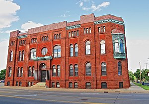
The Bay City Hall is a government building located at 301 Washington Street in Bay City, Michigan. It was listed on the National Register of Historic Places in 1975.
Mercy Hospital and Elizabeth McDowell Bialy Memorial House
United States historic place
Distance: Approx. 2042 meters
Latitude and longitude: 43.58638889,-83.89277778
Mercy Hospital and the Elizabeth McDowell Bialy Memorial House are two associated buildings located at 15th and Water Streets in Bay City, Michigan. They were listed on the National Register of Historic Places in 1980. As of 2018, the structures are operated as the Bradley House, a low income apartment complex.

Bay County Building
United States historic place
Distance: Approx. 2289 meters
Latitude and longitude: 43.59833333,-83.885
The Bay County Building is a government building located at 515 Center Avenue in Bay City, Michigan. It was listed on the National Register of Historic Places in 1982.

Bay City station
United States historic place
Distance: Approx. 2442 meters
Latitude and longitude: 43.6,-83.885
The Bay City Station of the Pere Marquette Railway, also known as The Depot Building, is a former railroad depot located at 919 Boutell Place in Bay City, Michigan. It was listed on the National Register of Historic Places in 1982.
Center Avenue Neighborhood Residential District
United States historic place
Distance: Approx. 1676 meters
Latitude and longitude: 43.59666667,-83.87055556
The Center Avenue Neighborhood Residential District is a residential historic district located in Bay City, Michigan, running primarily along Center, Fifth, and Sixth Avenues between Monroe and Green Avenues, with additional portions of the district along Fourth between Madison and Johnson, down to Tenth Avenue between Madison and Lincoln, along Green to Ridge, and around Carroll Park. The original section, along Center and portions of Fifth and Sixth, was listed on the National Register of Historic Places in 1982. A boundary increase including the other sections of the neighborhood was listed in 2012.
Elm Lawn Cemetery
Historic cemetery in Bay County, Michigan
Distance: Approx. 1129 meters
Latitude and longitude: 43.58861111,-83.85805556
Elm Lawn Cemetery is a cemetery located at 300 Ridge Road in Bay City, Michigan. It was listed on the National Register of Historic Places in 2006.

Bay City Masonic Temple
United States historic place
Distance: Approx. 2139 meters
Latitude and longitude: 43.59694444,-83.88444444
The Bay City Masonic Temple is a historic building located at 700 North Madison Avenue in Bay City, Michigan. It was listed on the National Register of Historic Places in 1982.
Weather in this IP's area
broken clouds
-17 Celsius
-24 Celsius
-17 Celsius
-17 Celsius
1026 hPa
79 %
1026 hPa
1002 hPa
10000 meters
4.12 m/s
260 degree
75 %


