223.196.174.237 - IP Lookup: Free IP Address Lookup, Postal Code Lookup, IP Location Lookup, IP ASN, Public IP
Country:
Region:
City:
Location:
Time Zone:
Postal Code:
IP information under different IP Channel
ip-api
Country
Region
City
ASN
Time Zone
ISP
Blacklist
Proxy
Latitude
Longitude
Postal
Route
Luminati
Country
Region
ap
City
mangalagiri
ASN
Time Zone
Asia/Kolkata
ISP
Andhra Pradesh State FiberNet Limited
Latitude
Longitude
Postal
IPinfo
Country
Region
City
ASN
Time Zone
ISP
Blacklist
Proxy
Latitude
Longitude
Postal
Route
IP2Location
223.196.174.237Country
Region
andhra pradesh
City
vizianagaram
Time Zone
Asia/Kolkata
ISP
Language
User-Agent
Latitude
Longitude
Postal
db-ip
Country
Region
City
ASN
Time Zone
ISP
Blacklist
Proxy
Latitude
Longitude
Postal
Route
ipdata
Country
Region
City
ASN
Time Zone
ISP
Blacklist
Proxy
Latitude
Longitude
Postal
Route
Popular places and events near this IP address

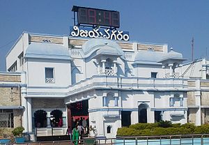
Vizianagaram
City in Andhra Pradesh, India
Distance: Approx. 1136 meters
Latitude and longitude: 18.1159,83.406
Vizianagaram, also known as Vijayanagaram, is a city and the headquarters of the Vizianagaram district in the Indian state of Andhra Pradesh. It is located in the Eastern Ghats, about 24 km (15 mi) west of the Bay of Bengal and 40 km (25 mi) north-northeast of Visakhapatnam. The city has a population of 228,025 and was established as the capital of the Vizianagaram estate by Raja Vijayaram Raj from the Pusapati dynasty.
Gajularega
Village in Andhra Pradesh, India
Distance: Approx. 0 meters
Latitude and longitude: 18.1167,83.4167
Gajularega is a census town in Vizianagaram district in the state of Andhra Pradesh, India.
Kanapaka
Census Town in Andhra Pradesh, India
Distance: Approx. 2434 meters
Latitude and longitude: 18.10694444,83.39611111
Kanapaka is a census town in Vizianagaram district in the Indian state of Andhra Pradesh.
Vizianagaram Lok Sabha constituency
Lok Sabha Constituency in Andhra Pradesh
Distance: Approx. 2565 meters
Latitude and longitude: 18.1,83.4
Vizianagaram Lok Sabha constituency is one of the twenty-five lok sabha constituencies of Andhra Pradesh in India. As per the Delimitation of Parliamentary and Assembly Constituencies Order (2008), it was formed with seven assembly segments belongs to Vizianagaram and Srikakulam districts .
Vizianagaram Estate
Distance: Approx. 5 meters
Latitude and longitude: 18.11666667,83.41666667
The name is derived from its founder Raja Vijayaram Raj who established a sovereign kingdom by claiming independence from the Kingdom of Jeypore in 1711. It formed alliances with the French and British East India Company to conquer the neighbouring principalities of Bobbili, Kurupam, Paralakhemundi and the Kingdom of Jeypore. However, they fell out with the British and as a result were attacked and defeated in the Battle of Padmanabham.
Vizianagaram mandal
Mandal in Andhra Pradesh, India
Distance: Approx. 507 meters
Latitude and longitude: 18.12,83.42
Vizianagaram mandal is one of the 34 mandals in Vizianagaram district of Andhra Pradesh, India. Vizianagaram city is the headquarters of the mandal. The mandal is bounded by Gantyada, Bondapalle, Nellimarla, Denkada, Jami mandals and Visakhapatnam district.

Vizianagaram Junction railway station
Railway station in Andhra Pradesh, India
Distance: Approx. 2252 meters
Latitude and longitude: 18.112,83.396
Vizianagaram railway station (station code:VZM) is an Indian railway station located in the Indian state of Andhra Pradesh; it serves Vizianagaram city in Vizianagaram district. It is one of the important railway stations on Howrah–Chennai main line, serving as the point where links from Raipur and Jharsuguda via Titlagarh connect to the main line. It is administered under South Coast Railway zone.

Vizianagaram Assembly constituency
Constituency of the Andhra Pradesh Legislative Assembly, India
Distance: Approx. 2922 meters
Latitude and longitude: 18.11,83.39
Vizianagaram Assembly constituency is a constituency in Vizianagaram district of Andhra Pradesh that elects representatives to the Andhra Pradesh Legislative Assembly in India. It is one of the seven assembly segments of Vizianagaram Lok Sabha constituency. Pusapati Aditi Vijayalakshmi is the current MLA of the constituency, having won the 2024 Andhra Pradesh Legislative Assembly election from Telugu Desam Party.
Pedanadipalli
Village in Andhra Pradesh, India
Distance: Approx. 5368 meters
Latitude and longitude: 18.15,83.38
Pedanadipalli is a village in Vizianagaram district of the Indian state of Andhra Pradesh. It is located in Cheepurupalli mandal. It is 13 km from the mandal headquarters and 43km from the district headquarters.

Vizianagaram Fort
18th-century fort in Vizianagaram, Andhra Pradesh, South India.
Distance: Approx. 921 meters
Latitude and longitude: 18.11083333,83.41055556
Vizianagaram fort is an early 18th-century fort in the city of Vizianagaram in northeastern Andhra Pradesh, South India. It was built by Vijaya Rama Raju, the Maharaja of Vizianagaram in 1713. The formal ceremony, while laying the foundation for the fort, was very auspicious as it represented five signs of victory.
Pedatadivada
Distance: Approx. 4110 meters
Latitude and longitude: 18.08333333,83.43333333
Pedatadivada is a village located in Denkada tehsil of Vizianagaram District,Uttarandhra, Andhra Pradesh, India. It is located 3 km from Vizianagaram.
Central Tribal University of Andhra Pradesh
Central university in Andhra Pradesh, India
Distance: Approx. 3504 meters
Latitude and longitude: 18.142,83.397
Central Tribal University of Andhra Pradesh (CTUAP) is an Indian Central University yet to be located in Marrivalasa, Vizianagaram district of Andhra Pradesh, India. As of 2021, it is operating from a transit campus, and its final location is yet to be finalised.
Weather in this IP's area
overcast clouds
21 Celsius
21 Celsius
21 Celsius
21 Celsius
1011 hPa
94 %
1011 hPa
1004 hPa
10000 meters
2.37 m/s
5.64 m/s
13 degree
100 %
