223.123.44.200 - IP Lookup: Free IP Address Lookup, Postal Code Lookup, IP Location Lookup, IP ASN, Public IP
Country:
Region:
City:
Location:
Time Zone:
Postal Code:
IP information under different IP Channel
ip-api
Country
Region
City
ASN
Time Zone
ISP
Blacklist
Proxy
Latitude
Longitude
Postal
Route
Luminati
Country
Region
pb
ASN
Time Zone
Asia/Karachi
ISP
CMPak Limited
Latitude
Longitude
Postal
IPinfo
Country
Region
City
ASN
Time Zone
ISP
Blacklist
Proxy
Latitude
Longitude
Postal
Route
IP2Location
223.123.44.200Country
Region
punjab
City
bhera
Time Zone
Asia/Karachi
ISP
Language
User-Agent
Latitude
Longitude
Postal
db-ip
Country
Region
City
ASN
Time Zone
ISP
Blacklist
Proxy
Latitude
Longitude
Postal
Route
ipdata
Country
Region
City
ASN
Time Zone
ISP
Blacklist
Proxy
Latitude
Longitude
Postal
Route
Popular places and events near this IP address

Bhera
Pakistani town
Distance: Approx. 348 meters
Latitude and longitude: 32.48111111,72.90694444
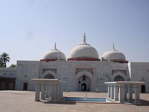
Bhera (Punjabi: بھیرا; Urdu: بھیرہ) is a city and a tehsil of Sargodha District, Punjab province of Pakistan. The city is known for wood-carved items, textiles (such as quilts and khussas), and certain desserts (such as pheonian and pateesa). The city is made up of the walled Old Town and the surrounding newer development.
Khan Muhammad Wala
Place in Punjab, Pakistan
Distance: Approx. 7435 meters
Latitude and longitude: 32.41666667,72.91666667
Khan Muhammad Wala is a union council in the Punjab province of Pakistan. Khan Muhammad Wala village is situated on the road joining Bhera with Bhalwal. It is 8 km away from Bhera and 15 km from Bhalwal.
Kasupur Dulhar
Place in Punjab, Pakistan
Distance: Approx. 8681 meters
Latitude and longitude: 32.43658333,72.83561111
Kasu Pur Dulhar (کیسوپور ڈلہر) is a village in Sargodha District in the Punjab Province of Pakistan. It is at 32°26'11.7"N 72°50'08.2"E with an altitude of 190 metres (620 ft). Its neighboring villages are Kohlian to the west, Turtipur to the south, and Sheikh Da lok to the east.
Pither Nadi
Pakistani village
Distance: Approx. 9584 meters
Latitude and longitude: 32.54777778,72.97722222
Pither Nadi Is a village, Union Council, and administrative subdivision of Jhelum District (Urdu جہلم) in the Punjab Province of Pakistan. It is part of Pind Dadan Khan Tehsil.
Weather in this IP's area
clear sky
21 Celsius
19 Celsius
21 Celsius
21 Celsius
1019 hPa
21 %
1019 hPa
995 hPa
10000 meters
5.25 m/s
4.54 m/s
343 degree