223.123.117.27 - IP Lookup: Free IP Address Lookup, Postal Code Lookup, IP Location Lookup, IP ASN, Public IP
Country:
Region:
City:
Location:
Time Zone:
Postal Code:
ISP:
ASN:
language:
User-Agent:
Proxy IP:
Blacklist:
IP information under different IP Channel
ip-api
Country
Region
City
ASN
Time Zone
ISP
Blacklist
Proxy
Latitude
Longitude
Postal
Route
db-ip
Country
Region
City
ASN
Time Zone
ISP
Blacklist
Proxy
Latitude
Longitude
Postal
Route
IPinfo
Country
Region
City
ASN
Time Zone
ISP
Blacklist
Proxy
Latitude
Longitude
Postal
Route
IP2Location
223.123.117.27Country
Region
sindh
City
larkana
Time Zone
Asia/Karachi
ISP
Language
User-Agent
Latitude
Longitude
Postal
ipdata
Country
Region
City
ASN
Time Zone
ISP
Blacklist
Proxy
Latitude
Longitude
Postal
Route
Popular places and events near this IP address

Larkana
City in Sindh, Pakistan
Distance: Approx. 465 meters
Latitude and longitude: 27.55833333,68.21111111
Larkana (Urdu: لاڑکانہ, romanized: lāṛkāna) is a city located in the Sindh province of Pakistan. It is the 15th largest city of Pakistan by population. It is home to the Indus Valley civilization site Mohenjo-daro.

Larkana District
District of Sindh, Pakistan
Distance: Approx. 1330 meters
Latitude and longitude: 27.56,68.22638889
Larkana District (Sindhi: لاڙڪاڻو ضلعو; Urdu: ضلع لاڑکانہ) is a district of the Sindh province of Pakistan. Its largest city is Larkana, which sits on the banks of the Indus River. It is the home district of the influential Bhutto family.

Larkana Division
Administrative division of Sindh
Distance: Approx. 945 meters
Latitude and longitude: 27.5606,68.2068
Larkana Division (Sindhi: لاڙڪاڻو ڊويزن) is an administrative division of the Sindh Province of Pakistan. It was created in 1980 by bifurcation of Sukkur Division. In 2000 abolished by General Pervaiz Musharraf rule but Sindh government restored it again on 11 July 2011.
Naich, Jhelum
Village in Jhelum District, Pakistan
Distance: Approx. 6892 meters
Latitude and longitude: 27.53055556,68.15
Naich (Urdu: نا ئچ) Ch Zain Gujjar. 03470569610 is a village of in Tehsil Pind Dadan Khan, District Jhelum, Punjab.
Larkana Tehsil
Taluka in Sindh, Pakistan
Distance: Approx. 1503 meters
Latitude and longitude: 27.55,68.2
Larkana Tehsil is an administrative subdivision (tehsil) of Larkana District in the Sindh province of Pakistan. The city of Larkana is the capital.
Chandka Medical College
Medical college in Pakistan
Distance: Approx. 1595 meters
Latitude and longitude: 27.5521,68.1983
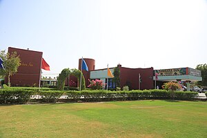
Chandka Medical College Sindhi: چانڈکا طبی ڪاليج, or CMC), established on 20 April 1973, is a public sector medical college located in Larkana, Sindh, Pakistan. It also provides post graduate training to doctors. It provides tertiary medical care facilities to upper Sindh and half of the Balochistan, and medical education for the students of Larkana Division.
Larkana Junction railway station
Railway station in Pakistan
Distance: Approx. 849 meters
Latitude and longitude: 27.5486,68.2096
Larkana Junction Railway Station (Urdu: لاڑکانہ جوڑ اسٹیشن, Sindhi: لاڙڪاڻو جنڪشن ريلوي اسٽيشن) is a railway station located in Larkana, Sindh, Pakistan. It was built in 1891. The station is staffed and has a booking office.
Mashori Sharif railway station
Railway station in Pakistan
Distance: Approx. 8967 meters
Latitude and longitude: 27.4882,68.1635
Mashori Sharif Railway Station (Urdu: مشوری شریف ریلوے اسٹیشن, Sindhi: مشوري شریف ریلوي اسٽیشن) is located in Pakistan.

Bhutta Kalhora
Village in Sindh, Pakistan
Distance: Approx. 9268 meters
Latitude and longitude: 27.47611111,68.18444444
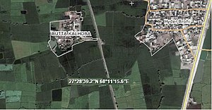
Bhutta Kalhora (Sindhi:ٻٽا ڪلھوڙا) is a village situated in Bakrani Taluka, city Larkana, province Sindh. The village was created 300 years ago, during Kalhora Dynasty. Due to diseases spread in the village during 1920, inhabitants abandoned it and only few families left behind.
Bero Chandio
Pakistani village
Distance: Approx. 465 meters
Latitude and longitude: 27.55833333,68.21111111
Bero Chandio (Sindhi: ٻيڙو چانڍيو), (Urdu: بیڑو چانڈیو), Pakistan is one of the oldest villages of Sindh and dates back to Samma Dynasty. Its total area is 15 km2 (5.8 sq mi). The village got much attention when the British Empire built a railway station, Bero Chandio railway station.
Weather in this IP's area
clear sky
25 Celsius
24 Celsius
25 Celsius
25 Celsius
1013 hPa
18 %
1013 hPa
1006 hPa
10000 meters
1.4 m/s
1.17 m/s
109 degree