223.123.116.52 - IP Lookup: Free IP Address Lookup, Postal Code Lookup, IP Location Lookup, IP ASN, Public IP
Country:
Region:
City:
Location:
Time Zone:
Postal Code:
ISP:
ASN:
language:
User-Agent:
Proxy IP:
Blacklist:
IP information under different IP Channel
ip-api
Country
Region
City
ASN
Time Zone
ISP
Blacklist
Proxy
Latitude
Longitude
Postal
Route
db-ip
Country
Region
City
ASN
Time Zone
ISP
Blacklist
Proxy
Latitude
Longitude
Postal
Route
IPinfo
Country
Region
City
ASN
Time Zone
ISP
Blacklist
Proxy
Latitude
Longitude
Postal
Route
IP2Location
223.123.116.52Country
Region
balochistan
City
quetta
Time Zone
Asia/Karachi
ISP
Language
User-Agent
Latitude
Longitude
Postal
ipdata
Country
Region
City
ASN
Time Zone
ISP
Blacklist
Proxy
Latitude
Longitude
Postal
Route
Popular places and events near this IP address

Quetta
Capital of Balochistan, Pakistan
Distance: Approx. 1978 meters
Latitude and longitude: 30.18333333,67
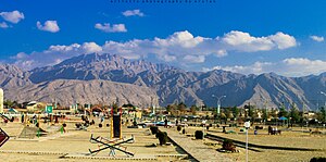
Quetta (; Urdu: کوئٹہ, ko'eṭa, [ˈkweːʈə] , Pashto: کوټه) is the capital and largest city of the Pakistani province of Balochistan. It is the ninth largest city in Pakistan, with an estimated population of over 1.5 million in 2024. It is situated in the south-west of the country, lying in a valley surrounded by mountains on all sides.
Ayub National Stadium
Distance: Approx. 1245 meters
Latitude and longitude: 30.20388889,66.99805556
Ayub National Stadium, formerly known as the Baluchistan Cricket Association Ground, is a multi-purpose stadium in Quetta, Pakistan. It is currently used mostly for hosting football matches. The stadium has a capacity of 20,000 people.

St. Francis' Grammar School
Private primary and secondary school in Pakistan
Distance: Approx. 234 meters
Latitude and longitude: 30.201083,67.009391
For the school of the same name in Hartlepool, England, see St Francis RC Grammar School. St. Francis' Grammar School is a private Catholic secondary school located in Baluchistan, Pakistan.

Quetta railway station
Railway station in Pakistan
Distance: Approx. 1189 meters
Latitude and longitude: 30.1915,67.0009
Quetta Railway Station (Urdu: کوئٹہ اسٹیشن; Balochi: کوئٹہ اسٹیشن) is the main railway station of Quetta, Balochistan, Pakistan. It serves as a major station on the Rohri-Chaman Railway Line and as the eastern terminus of the Quetta-Taftan Railway Line.
St. Joseph's Convent School, Quetta
High school in Quetta, Balochistan, Pakistan
Distance: Approx. 300 meters
Latitude and longitude: 30.2015,67.00852778
St. Joseph's Convent School is a Pakistani Christian school for girls located in Quetta, Balochistan. It is located on Zarghoon Road, 200 meters away from the St.
St. Mary's High School, Quetta
High school in Quetta, Balochistan, Pakistan
Distance: Approx. 1366 meters
Latitude and longitude: 30.206711,67.020739
St. Mary's High School, Quetta, is a high school located in Quetta, the capital of the Balochistan province of Pakistan.
2014 Quetta Airbase attack
Terrorist attack on Quetta Airport
Distance: Approx. 1978 meters
Latitude and longitude: 30.18333333,67
The 2014 Quetta airbase attack occurred on 15 August 2014, when approximately 13 Tehrik-i-Taliban militants attempted to storm two airbases of the Pakistan Army and Pakistan Air Force; PAF Base Samungli and Khalid Airbase, both located in Quetta, Balochistan, Pakistan. The attack was largely unsuccessful as Pakistani security forces foiled the attempt following a major armed engagement between the two sides which resulted in the deaths of 12 militants, while 12 people were injured, including one attacker and 11 security personnel.

Bugti Stadium
Cricket stadium
Distance: Approx. 1159 meters
Latitude and longitude: 30.20166667,66.99805556
Bugti Stadium, formerly known as the Racecourse Ground, is a cricket ground in Quetta, Pakistan, owned by the Pakistan Cricket Board. It is located next to the Ayub National Stadium.
August 2017 Quetta suicide bombing
Terrorist attack in Quetta, Pakistan
Distance: Approx. 723 meters
Latitude and longitude: 30.20365833,67.00446944
On 12 August 2017, a suicide bombing took place near a Pakistan army truck in Quetta, Balochistan, Pakistan, leaving 15 people dead including 8 soldiers, while injuring 40 others. The Islamic State of Iraq and the Levant – Khorasan Province claimed responsibility for the attack.

Governor's House, Quetta
Official residence of the governor of Balochistan, Pakistan
Distance: Approx. 376 meters
Latitude and longitude: 30.1982,67.0059
Governor's House (Urdu/Balochi: گورنر ہاؤس; Pashto: ګورنر هاؤس), formerly known as the Quetta Residency, is a historical government building located on Zarghun Road in Quetta, Balochistan, Pakistan. It serves as the official residence of the governor of Balochistan. Originally built in 1888 to house the chief commissioners of Baluchistan during British rule, the building was damaged during the 1935 Quetta earthquake.
Qayyum Papa Stadium
Football stadium in Quetta, Pakistan
Distance: Approx. 2764 meters
Latitude and longitude: 30.1874,67.0351
The Qayyum Papa Stadium, also known as Qayyum Ali Changezi Stadium, is a football stadium in Mari Abad, Quetta, Pakistan. Named after the Pakistan national football team former captain Qayyum Ali Changezi, it has the capacity to accommodate up to 10,000 spectators. The stadium has also been used on occasion to celebrate the Hazara culture day.

2024 Quetta railway station bombing
Terrorist attack in Quetta, Pakistan
Distance: Approx. 1181 meters
Latitude and longitude: 30.19166667,67.00083333
On 9 November 2024, at least 32 people were killed and 62 others were injured in a suicide bombing at Quetta railway station in Quetta, Balochistan, Pakistan. The Balochistan Liberation Army (BLA), a separatist militant group, claimed responsibility for the attack. It was the first time that the BLA had attacked the centre of Quetta.
Weather in this IP's area
scattered clouds
5 Celsius
2 Celsius
5 Celsius
5 Celsius
1020 hPa
56 %
1020 hPa
811 hPa
10000 meters
3.57 m/s
4.95 m/s
321 degree
36 %