Country:
Region:
City:
Latitude and Longitude:
Time Zone:
Postal Code:
IP information under different IP Channel
ip-api
Country
Region
City
ASN
Time Zone
ISP
Blacklist
Proxy
Latitude
Longitude
Postal
Route
Luminati
Country
Region
tj
City
tianjin
ASN
Time Zone
Asia/Shanghai
ISP
Tianjij,300000
Latitude
Longitude
Postal
IPinfo
Country
Region
City
ASN
Time Zone
ISP
Blacklist
Proxy
Latitude
Longitude
Postal
Route
db-ip
Country
Region
City
ASN
Time Zone
ISP
Blacklist
Proxy
Latitude
Longitude
Postal
Route
ipdata
Country
Region
City
ASN
Time Zone
ISP
Blacklist
Proxy
Latitude
Longitude
Postal
Route
Popular places and events near this IP address
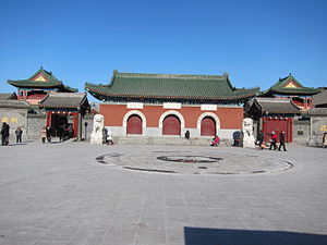
Temple of Great Compassion
Buddhist temple in Tianjin, China
Distance: Approx. 952 meters
Latitude and longitude: 39.15493,117.18389
The Temple of Great Compassion or Dabei Yuan (Chinese: 大悲院; pinyin: Dàbēi Yuàn) is a Chan Buddhist temple in Tianjin, China.

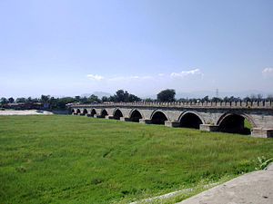
Yongding River
River in northern China
Distance: Approx. 1503 meters
Latitude and longitude: 39.1623,117.1762
The Yongding River (Chinese: 永定河; pinyin: Yǒngdìng Hé; Wade–Giles: Yungting Ho) is a river in northern China. It is one of the main tributaries in the Hai River system and is best known as the largest river to flow through Beijing. In recent years, the Beijing segment of the river has dried up due to environmental issues.

Hebei, Tianjin
District in Tianjin, People's Republic of China
Distance: Approx. 1771 meters
Latitude and longitude: 39.14777778,117.19666667
Hebei District (Chinese: 河北区; pinyin: Héběi Qū) is a district of the municipality of Tianjin, People's Republic of China. Its name literally means "District north of the River", as the district is located on the northern shore of the Hai River, part of the Grand Canal. Tianjin's famous Zhongshan Park lies within the district.

Tianjin Eye
Ferris wheel in Tianjin, China
Distance: Approx. 617 meters
Latitude and longitude: 39.1533636,117.1802616
Tianjin Eye, the official name The Tientsin Eye, is a 120-meter (394 ft)-tall giant ferris wheel built above the Yongle Bridge (formerly Chihai Bridge), over the Hai River in Tianjin, China. Construction started in 2007, with completion of the main body on 18 December 2007, and the wheel opened to the public on 7 April 2008. At the time of its completion, only the 135 m (443 ft) London Eye, 160 m (525 ft) Star of Nanchang, and 165 m (541 ft) Singapore Flyer were taller.

Guwenhua Jie
Pedestrian tourist area of Tianjin, China
Distance: Approx. 1626 meters
Latitude and longitude: 39.1422,117.193
Guwenhua Jie, Tianjin's Ancient Culture Street, is a pedestrian pathway complex dotted with temple gates and kiosks on the west bank of the Hai River in Tianjin, China. The Nankai District area is classified as a AAAAA scenic area by the China National Tourism Administration. Tianjin Ancient Culture Street was opened on New Year's Day in 1986.

Xi'nanjiao station
Tianjin Metro station
Distance: Approx. 1659 meters
Latitude and longitude: 39.13638889,117.16555556
Xi'nanjiao Station (Chinese: 西南角站), is a station of Line 1 and Line 2 of the Tianjin Metro. It started operations as a Line 1 station in 2006 and as part of Line 2's western section on 1 July 2012.
Dongnanjiao station
Metro station in Tianjin, China
Distance: Approx. 1610 meters
Latitude and longitude: 39.1357,117.1841
Dongnanjiao station (Chinese: 东南角站), is a station of Line 2 and Line 4 of the Tianjin Metro. It started operations on 1 July 2012.

Xibeijiao station
Metro station in Tianjin, China
Distance: Approx. 1042 meters
Latitude and longitude: 39.1462,117.1646
Xibeijiao Station (Chinese: 西北角站), is a station of Line 1 of the Tianjin Metro. It started operations on 12 June 2006.

Gulou Subdistrict, Tianjin
Subdistrict in Tianjin, China
Distance: Approx. 673 meters
Latitude and longitude: 39.14277778,117.17555556
Gulou Subdistrict (simplified Chinese: 鼓楼街道; traditional Chinese: 鼓樓街道; pinyin: Gǔlóu Jiēdào) is a subdistrict situated on the northeast corner of Nankai District, Tianjin, China. It borders Jieyuan and Dahongtong Subdistricts to its north, Guangfudao Subdistrict to its east, Nanshi and Xingnan Subdistricts to its south, as well as Lingdangge and Guangkai Subdistricts to its west. In 2010, its total population was 28,788.

Hongshunli Subdistrict
Subdistrict in Tianjin, China
Distance: Approx. 1442 meters
Latitude and longitude: 39.15722222,117.18888889
Hongshunli Subdistrict (simplified Chinese: 鸿顺里街道; traditional Chinese: 鴻順裏街道; pinyin: Hóngshùnlǐ Jiēdào) is a subdistrict located within Hebei District, Tianjin, China. It shares a border with Xinkaihe and Tiedong Road Subdistricts in the northwest, Ningyuan Subdistrict in the northeast, Wanghailou Subdistrict in the southeast, Santiaoshi and Dahutong Subdistircts in the southwest. In the year 2010, its population was 94,411.

Santiaoshi Subdistrict
Subdistrict in Tianjin, China
Distance: Approx. 1120 meters
Latitude and longitude: 39.15305556,117.16444444
Santiaoshi Subdistrict (simplified Chinese: 三条石街道; traditional Chinese: 三條石街道; pinyin: Sāntiáoshí Jiēdào) is a subdistrict in southeastern Hongqiao District, Tianjin, China. It shares border with Xigu and Xinkaihe Subdistricts in its north, Hongshunli Subdistrict in its east, Gulou and Jieyuan Subdistricts in its south, and Shaogongzhuang Subdistrict in its west. Its population was 19,255 in 2010.

Dahutong Subdistrict
Subdistrict in Tianjin, China
Distance: Approx. 850 meters
Latitude and longitude: 39.14944444,117.16638889
Dahutong Subdistrict (Chinese: 大胡同街道; pinyin: Dàhútòng Jiēdào) was a subdistrict situated on the southeastern corner of Hongqiao District, Tianjin, China. It borders Santiaoshi and Hongshunli Subdistricts in its north, Wanghailou Subdistrict in its east, Gulou Subdistrict in its south, and Jieyuan Subdistrict in its west. Its population was 8,239 as of 2010.
Weather in this IP's area
fog
8 Celsius
8 Celsius
8 Celsius
8 Celsius
1018 hPa
93 %
1018 hPa
1017 hPa
100 meters
1 m/s
140 degree
82 %
06:54:35
16:57:26

