Country:
Region:
City:
Latitude and Longitude:
Time Zone:
Postal Code:
IP information under different IP Channel
ip-api
Country
Region
City
ASN
Time Zone
ISP
Blacklist
Proxy
Latitude
Longitude
Postal
Route
Luminati
Country
ASN
Time Zone
Asia/Seoul
ISP
Jeonbuk National University
Latitude
Longitude
Postal
IPinfo
Country
Region
City
ASN
Time Zone
ISP
Blacklist
Proxy
Latitude
Longitude
Postal
Route
db-ip
Country
Region
City
ASN
Time Zone
ISP
Blacklist
Proxy
Latitude
Longitude
Postal
Route
ipdata
Country
Region
City
ASN
Time Zone
ISP
Blacklist
Proxy
Latitude
Longitude
Postal
Route
Popular places and events near this IP address

Roman Catholic Diocese of Jeonju
Roman Catholic diocese in South Korea
Distance: Approx. 3210 meters
Latitude and longitude: 35.8167,127.133
The Diocese of Jeonju (Latin: Dioecesis Ieoniuensis) is a Latin Church ecclesiastical territory or diocese of the Catholic Church in South Korea. It is in the ecclesiastical province of the metropolitan Archdiocese of Gwangju, yet depends on the missionary Dicastery for Evangelization. Its cathedra is in the Joongang Cathedral of the Sacred Heart of Jesus, in the episcopal see of Jeonju 전주시, Jeollabuk-do 전라북도.
Jeonbuk National University
South Korea University
Distance: Approx. 542 meters
Latitude and longitude: 35.84682,127.12935
Jeonbuk National University (JBNU; Korean: 전북대학교) is one of ten Flagship Korean National Universities founded in 1947, located in Jeonju, South Korea. Jeonbuk National University has been ranked 551–560th in the world by QS Top Universities Ranking in 2023.
Hyoja-dong
Place in South Korea
Distance: Approx. 2503 meters
Latitude and longitude: 35.83333333,127.1
Hyoja-dong is a dong (neighborhood) of Jongno District, Seoul, South Korea.
Jeonju Baseball Stadium
Baseball stadium in Jeonju, South Korea
Distance: Approx. 759 meters
Latitude and longitude: 35.837807,127.124679
Jeonju Baseball Stadium is a baseball stadium in the city of Jeonju, South Korea. It is former home of the Haitai Tigers and Ssangbangwool Raiders. The stadium holds 10,000 people.
Deokjin District
Non-autonomous District in Honam, South Korea
Distance: Approx. 1937 meters
Latitude and longitude: 35.829359,127.134363
Deokjin District (Korean: 덕진구; RR: Deokjin-gu) is a non-autonomous district of Jeonju, North Jeolla Province, South Korea.

Wansan District
Non-autonomous District in Honam, South Korea
Distance: Approx. 3631 meters
Latitude and longitude: 35.812166,127.119781
Wansan District (Korean: 완산구; RR: Wansan-gu) is a non-autonomous district of Jeonju, North Jeolla Province, South Korea.
Jeonju International Sori Festival
Distance: Approx. 2245 meters
Latitude and longitude: 35.8255,127.132
Founded in 2001, Jeonju International Sori Festival (전주세계소리축제) is South Korea's main event for traditional music and, since 2011, world music. In 2012, 2013, and 2014, Songlines listed Jeonju Sori Festival among the World's Best 25 International Festivals, the only Asian festival in the list.
Jeonju Mill
Distance: Approx. 2331 meters
Latitude and longitude: 35.8484,127.0986
Jeonju Mill is a pulp mill and paper mill situated in Jeonju, South Korea. Owned by Jeonju Paper, the mill produces 850,000 tonnes of newsprint and magazine paper annually. The mill sources fibers both from virgin wood, including sawmill residue, as well as from deinking.

Jeonju Station
Railway station in South Korea
Distance: Approx. 3460 meters
Latitude and longitude: 35.8498,127.1618
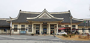
Jeonju Station (Korean: 전주역; Hanja: 全州驛) is a railway station of Jeolla Line, located in Deokjin-gu, Jeonju, South Korea. KTX, ITX-Saemaeul, Mugunghwa-ho, S-Train stops at this station. Jeonju Station's feature is station built as Hanok style.
Jeonju Indoor Ice Rink
Distance: Approx. 2516 meters
Latitude and longitude: 35.822,127.124
Jeonju Indoor Ice Rink (전주실내빙상경기장), sometimes called Hwasan Indoor Ice Rink, is an indoor ice rink in Wansan-gu, Jeonju-si, Jeollabuk-do, South Korea. It was completed in 1996, originally for the 1997 Winter Universiade. At the Winter Universiade, it was the venue for the figure skating and short track speed skating events.

Jeonju Gymnasium
Arena in Jeonju, South Korea
Distance: Approx. 469 meters
Latitude and longitude: 35.84416667,127.12916667
Jeonju Gymnasium is an arena in Jeonju, South Korea. It is the home arena of the Jeonju KCC Egis of the Korean Basketball League (KBL).
Samyang Dabang
Coffeehouse in Jeonju, South Korea
Distance: Approx. 3694 meters
Latitude and longitude: 35.8182,127.1488
Samyang Dabang (Korean: 삼양다방) is a historic dabang (coffeehouse) in Gyeongwon-dong, Wansan-gu, Jeonju, South Korea. It is the oldest active coffeehouse in the country, having been founded in 1952. The dabang was made a Jeonju Future Heritage in 2019 and set for preservation.
Weather in this IP's area
broken clouds
21 Celsius
20 Celsius
21 Celsius
21 Celsius
1016 hPa
55 %
1016 hPa
1012 hPa
10000 meters
2.92 m/s
3.34 m/s
292 degree
55 %
07:08:44
17:24:04
