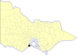
Country:
 Australia
Region:
City:
Latitude and Longitude:
Time Zone:
Postal Code:
IP information under different IP Channel
ip-api
Country
Region
City
ASN
Time Zone
ISP
Blacklist
Proxy
Latitude
Longitude
Postal
Route
IPinfo
Country
Region
City
ASN
Time Zone
ISP
Blacklist
Proxy
Latitude
Longitude
Postal
Route
MaxMind
Country
Region
City
ASN
Time Zone
ISP
Blacklist
Proxy
Latitude
Longitude
Postal
Route
Luminati
Country
AURegion
vic
City
geelong
ASN
Time Zone
Australia/Melbourne
ISP
Neighbourhood Cable
Latitude
Longitude
Postal
db-ip
Country
Region
City
ASN
Time Zone
ISP
Blacklist
Proxy
Latitude
Longitude
Postal
Route
ipdata
Country
Region
City
ASN
Time Zone
ISP
Blacklist
Proxy
Latitude
Longitude
Postal
Route
Popular places and events near this IP address

Grovedale, Victoria
Suburb of Geelong, Victoria, Australia
Distance: Approx. 2269 meters
Latitude and longitude: -38.2,144.35
Grovedale is a southern suburb of Geelong, Victoria, Australia. At the 2021 census, Grovedale had a population of 14,869.
St Albans Park, Victoria
Suburb of Geelong, Victoria, Australia
Distance: Approx. 2306 meters
Latitude and longitude: -38.167,144.363
St. Albans Park is a residential suburb of Geelong, Victoria, 6 km southeast from Geelong's city centre. It is bounded by Boundary Road (West), Coppards Road (East), Townsend Road (North) and the Barwon River (South).

Highton, Victoria
Suburb of Geelong in Victoria, Australia
Distance: Approx. 2417 meters
Latitude and longitude: -38.171,144.318
Highton is a residential suburb of Geelong, Victoria, Australia. With views across Geelong, Corio Bay and the surrounding region, Highton is located along the banks of the Barwon River and across the rolling Barrabool Hills. The Barwon River straddles Highton to the north and east, while it is bordered by the hilly Ceres and Wandana Heights to the west, the former (and now underground) Kardinia Creek separates the suburb from Belmont to the south-east, and the Princes Highway and Pigdons Road to the south separate the suburb from Waurn Ponds.

Belmont, Victoria
Suburb of Geelong, Victoria, Australia
Distance: Approx. 840 meters
Latitude and longitude: -38.173,144.341
Belmont is a southern suburb of Geelong, Victoria, Australia. The name means "beautiful hill". Belmont is geographically separated from the Geelong central business district by the Barwon River.

Marshall railway station
Railway station in Geelong, Victoria, Australia
Distance: Approx. 2314 meters
Latitude and longitude: -38.19888889,144.355
Marshall railway station is a regional railway station on the Warrnambool line, which is part of the Regional railway network. It serves the southern Geelong suburb of Marshall, in Victoria, Australia. Marshall station is a ground level premium station, featuring two side platforms, connected by an accessible footbridge and concourse.
Geelong Racecourse railway station
Former railway station in Geelong, Victoria, Australia
Distance: Approx. 2250 meters
Latitude and longitude: -38.1764,144.3681
Geelong Racecourse (also known as Breakwater) is a disused railway station on the Geelong-Warrnambool railway line, in the Geelong suburb of Breakwater, Victoria, Australia. The station was located on a loop siding off the main line and was only used for special events at the nearby Geelong Racecourse. In 1910, the Geelong Racing Club, the Geelong Agricultural Society and the Hibernian Society together paid the Victorian Railways £1000 to have the station built.
Belmont High School (Victoria)
Public high school in Belmont, Victoria, Australia
Distance: Approx. 1228 meters
Latitude and longitude: -38.1769413,144.3295705
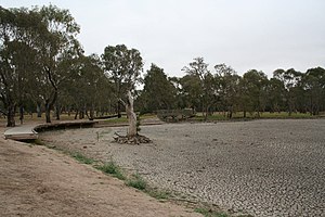
Balyang Sanctuary
Distance: Approx. 2074 meters
Latitude and longitude: -38.1642,144.3312
Balyang Sanctuary is a public park in the suburb of Newtown, Geelong. Situated at 38.1642°S 144.3312°E / -38.1642; 144.3312 on the banks of the Barwon River, it is 20 acres (8 ha) in size and consists of open park lands, lakes, and wetlands. It was opened in 1973.
City of South Barwon
Local government area in Victoria, Australia
Distance: Approx. 1743 meters
Latitude and longitude: -38.16666667,144.33333333
The City of South Barwon was a local government area in Victoria, Australia, which contained a number of Geelong suburbs south of the Barwon River, and extending to Torquay in the south and Barwon Heads to the east. The city covered an area of 165.4 square kilometres (63.9 sq mi), and existed from 1863 until 1994.

Landy Field
Athletics field in Australia
Distance: Approx. 2151 meters
Latitude and longitude: -38.16611111,144.35944444
John Landy Athletics Field is at the corner of Swanston Street and Barwon Terrace, South Geelong, and was formerly known as Riverside Reserve. It sits adjacent to the Barwon River to the south and the Godfrey Hirst Pty Ltd carpet factory to the east. it is considered the premier athletics venue in the Geelong region, and its track is of national standard.
Geelong Baseball Park
Stadium specifically built for baseball in Geelong, Australia
Distance: Approx. 2604 meters
Latitude and longitude: -38.19722222,144.32222222
The Geelong Baseball Centre or Geelong Baseball Park is home to Geelong Baseball Club in Geelong, Victoria during summer and the Guild Allstars Baseball Club and East Belmont Saints Baseball Club during the winter season. In total the Geelong Baseball Centre has four playing fields, with the main diamond being one of the few international standard baseball ballparks in Australia. Features include lighting up to international standard, electronic scoreboard and associated infrastructure in the form of elevated commentary box, outfield sightboards, bullpen tunnels, meeting and dining areas and an indoor training facility.

Electoral district of Geelong East
State electoral district of Victoria, Australia (1976–1985)
Distance: Approx. 2407 meters
Latitude and longitude: -38.1625,144.35833333
Geelong East was an electoral district of the Legislative Assembly in the Australian state of Victoria from 1859 to 1985. It was located south of the city of Geelong, defined in the Victorian Electoral Act, 1858 as: Commencing at the north-western angle of the town reserve of Geelong; thence by a line south to the River Barwon; thence westward and northwestward by the River Barwon to the western boundary of the reserve at the junction of the Moorabool and Barwon; thence east by the northern boundary of section 25, parish of Barrabool; thence south by the eastern boundaries of sections 25 and 11, and by part of the eastern boundary of section 7, all in the same parish; thence south-easterly by a curved line crossing the Waurn Chain of Ponds to the southern boundary of section 3, parish of Conewarre; thence east by the southern boundaries of sections 3 and 4 in the same parish; thence north-easterly by a curved line crossing the River Barwon to the south-eastern angle of section 11 in the parish of Moolap; thence by the eastern boundary of that section and a line north to the shores of Corio Bay; and thence by the shores of Corio Bay to the north-western angle of the town reserve, the commencing point aforesaid, including the remaining portion of the reserve at Point Henry. Geelong East (along with Electoral district of Geelong West) was created when the four-member Electoral district of Geelong was abolished in 1859.
Weather in this IP's area
light rain
12 Celsius
11 Celsius
12 Celsius
13 Celsius
1008 hPa
77 %
1008 hPa
1004 hPa
10000 meters
8.75 m/s
300 degree
91 %
06:15:20
18:16:58