219.100.236.5 - IP Lookup: Free IP Address Lookup, Postal Code Lookup, IP Location Lookup, IP ASN, Public IP
Country:
Region:
City:
Location:
Time Zone:
Postal Code:
IP information under different IP Channel
ip-api
Country
Region
City
ASN
Time Zone
ISP
Blacklist
Proxy
Latitude
Longitude
Postal
Route
Luminati
Country
Region
14
City
chigasaki
ASN
Time Zone
Asia/Tokyo
ISP
SHONAN CABLE NETWORK
Latitude
Longitude
Postal
IPinfo
Country
Region
City
ASN
Time Zone
ISP
Blacklist
Proxy
Latitude
Longitude
Postal
Route
IP2Location
219.100.236.5Country
Region
ibaraki
City
naka
Time Zone
Asia/Tokyo
ISP
Language
User-Agent
Latitude
Longitude
Postal
db-ip
Country
Region
City
ASN
Time Zone
ISP
Blacklist
Proxy
Latitude
Longitude
Postal
Route
ipdata
Country
Region
City
ASN
Time Zone
ISP
Blacklist
Proxy
Latitude
Longitude
Postal
Route
Popular places and events near this IP address

Naka, Ibaraki
City in Kantō, Japan
Distance: Approx. 888 meters
Latitude and longitude: 36.45738889,140.48675
Naka (那珂市, Naka-shi) is a city located in Ibaraki Prefecture, Japan. As of 1 July 2020, the city had an estimated population of 53,153 in 20,953 households and a population density of 543.4 persons per km2. The percentage of the population aged over 65 was 32.4%.
Kasamatsu Stadium
Sports venue in Naka, Ibaraki Prefecture, Japan
Distance: Approx. 5021 meters
Latitude and longitude: 36.457262,140.538343
Kasamatsu Stadium (笠松運動公園陸上競技場) is a multi-purpose stadium in Naka, Japan. It is currently used mostly for football matches and track and field events. It served as the main home ground of Mito HollyHock through 2011.

Ibaraki Botanical Garden
Distance: Approx. 4945 meters
Latitude and longitude: 36.474134,140.436623
The Ibaraki Botanical Garden (茨城県植物園, Ibaraki-ken Shokubutsuen) is a botanical garden and arboretum located at 4589 To, Naka, Ibaraki, Japan. It is open daily except Mondays; an admission fee is charged. The garden was established in 1981, and now contains a rose garden, aquatic plant garden, rock garden; collections of camellias, conifers, and tropical fruit trees; and a tropical greenhouse.
Ibaraki Women's Junior College
Private women's junior college in Naka, Ibaraki, Japan
Distance: Approx. 3076 meters
Latitude and longitude: 36.42341667,140.47361111
Ibaraki Women's Junior College (茨城女子短期大学, Ibaraki joshi tanki daigaku) is a private women's junior college in Naka, Ibaraki, Japan, established in 1967. The predecessor of the school was founded in 1907.

Hitachi-Tsuda Station
Railway station in Hitachinaka, Ibaraki Prefecture, Japan
Distance: Approx. 5110 meters
Latitude and longitude: 36.4041,140.4829
Hitachi-Tsuda Station (常陸津田駅, Hitachi-Tsuda-eki) is a railway station in the city of Hitachinaka, Ibaraki, Japan operated by East Japan Railway Company (JR East).

Godai Station
Railway station in Naka, Ibaraki Prefecture, Japan
Distance: Approx. 2999 meters
Latitude and longitude: 36.4236,140.4897
Godai Station (後台駅, Godai-eki) is a passenger railway station in the city of Naka, Ibaraki, Japan operated by East Japan Railway Company (JR East).

Shimo-Sugaya Station
Railway station in Naka, Ibaraki Prefecture, Japan
Distance: Approx. 1896 meters
Latitude and longitude: 36.4354,140.4939
Shimo-Sugaya Station (下菅谷駅, Shimo-Sugaya-eki) is a passenger railway station in the city of Naka, Ibaraki, Japan operated by East Japan Railway Company (JR East).

Naka-Sugaya Station
Railway station in Naka, Ibaraki Prefecture, Japan
Distance: Approx. 1013 meters
Latitude and longitude: 36.4456,140.4929
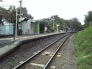
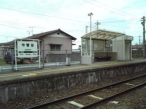
Naka-Sugaya Station (中菅谷駅, Naka-Sugaya-eki) is a passenger railway station in the city of Naka, Ibaraki, Japan operated by East Japan Railway Company (JR East).

Kami-Sugaya Station
Railway station in Naka, Ibaraki Prefecture, Japan
Distance: Approx. 1076 meters
Latitude and longitude: 36.4556,140.4928
Kami-Sugaya Station (上菅谷駅, Kami-Sugaya-eki) is a junction passenger railway station in the city of Naka, Ibaraki, Japan operated by East Japan Railway Company (JR East).
Hitachi-Kōnosu Station
Railway station in Naka, Ibaraki Prefecture, Japan
Distance: Approx. 2869 meters
Latitude and longitude: 36.4726,140.4676
Hitachi-Kōnosu Station (常陸鴻巣駅, Hitachi-Kōnosu-eki) is a passenger railway station in the city of Naka, Ibaraki, Japan operated by East Japan Railway Company (JR East).

Minami-Sakaide Station
Distance: Approx. 3355 meters
Latitude and longitude: 36.4774,140.4986
Minami-Sakaide Station (南酒出駅, Minami-Sakaide-eki) is a passenger railway station in the city of Naka, Ibaraki Prefecture, operated by East Japan Railway Company (JR East).
Nukada Station
Distance: Approx. 4385 meters
Latitude and longitude: 36.48583333,140.50333333
Nukada Station (額田駅, Nukada-eki) is a passenger railway station in the city of Naka, Ibaraki, Japan operated by East Japan Railway Company (JR East).
Weather in this IP's area
scattered clouds
14 Celsius
13 Celsius
14 Celsius
14 Celsius
1015 hPa
65 %
1015 hPa
1010 hPa
10000 meters
5.23 m/s
9.28 m/s
307 degree
26 %


