Country:
 Japan
JapanRegion:
City:
Latitude and Longitude:
Time Zone:
Postal Code:
IP information under different IP Channel
ip-api
Country
Region
City
ASN
Time Zone
ISP
Blacklist
Proxy
Latitude
Longitude
Postal
Route
IPinfo
Country
Region
City
ASN
Time Zone
ISP
Blacklist
Proxy
Latitude
Longitude
Postal
Route
MaxMind
Country
Region
City
ASN
Time Zone
ISP
Blacklist
Proxy
Latitude
Longitude
Postal
Route
Luminati
Country
JPASN
Time Zone
Asia/Tokyo
ISP
STNet, Incorporated
Latitude
Longitude
Postal
db-ip
Country
Region
City
ASN
Time Zone
ISP
Blacklist
Proxy
Latitude
Longitude
Postal
Route
ipdata
Country
Region
City
ASN
Time Zone
ISP
Blacklist
Proxy
Latitude
Longitude
Postal
Route
Popular places and events near this IP address
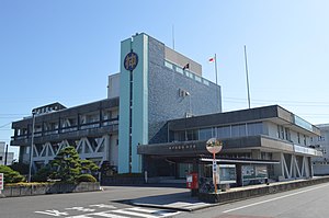
Gōdo, Gifu
Town in Chūbu, Japan
Distance: Approx. 5488 meters
Latitude and longitude: 35.41736111,136.62519444
Gōdo (神戸町, Gōdo-chō) is a town located in Gifu, Japan. As of 1 December 2018, the town had an estimated population of 19,361 and a population density of 1000 persons per km2, in 6998 households. The total area of the town was 18.78 square kilometres (7.25 sq mi).
Ibigawa
Town in Chūbu, Japan
Distance: Approx. 5023 meters
Latitude and longitude: 35.48727778,136.56858333
Ibigawa (揖斐川町, Ibigawa-chō) is a town located in Ibi District, Gifu Prefecture, Japan. As of 1 December 2018, the town had an estimated population of 21,319 in 8,015 households and a population density of 27 persons per km2. The total area of the town was 803.44 square kilometres (310.21 sq mi).

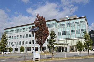
Ikeda, Gifu
Town in Chūbu, Japan
Distance: Approx. 6 meters
Latitude and longitude: 35.44225,136.57297222
Ikeda (池田町, Ikeda-chō) is a town located in Ibi District, Gifu Prefecture, Japan. As of 1 December 2018, the town had an estimated population of 24,034 in 8291 households and a population density of 620 persons per km2. The total area of the town was 38.80 square kilometres (14.98 sq mi).

Seinō
Distance: Approx. 3866 meters
Latitude and longitude: 35.4076,136.5712
Seinō (Japanese: 西濃) is the southwestern portion of Gifu Prefecture in the Chūbu region of Japan. Before Gifu became a prefecture, the area was part of Mino Province. The Seinō region received its name as a combination of the kanji for "west" (西) and "Mino" (美濃), and is sometimes referred to by the unabbreviated name of Nishi Mino.

Hiro-Gōdo Station
Railway station in Gōdo, Gifu Prefecture, Japan
Distance: Approx. 3648 meters
Latitude and longitude: 35.4196,136.602
Hiro-Gōdo Station (広神戸駅, Hiro-Gōdo-eki) is a railway station in the town of Gōdo, Anpachi District, Gifu Prefecture Japan, operated by the private railway operator Yōrō Railway.
Kita-Gōdo Station
Railway station in Gōdo, Gifu Prefecture, Japan
Distance: Approx. 2361 meters
Latitude and longitude: 35.43,136.5942
Kita-Gōdo Station (北神戸駅, Kita-Gōdo-eki) is a railway station in the town of Gōdo, Anpachi District, Gifu Prefecture, Japan, operated by the private railway operator Yōrō Railway.
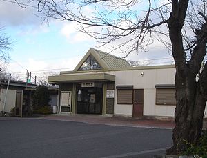
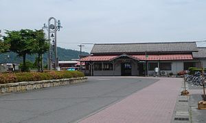
Ikeno Station
Railway station in Ikeda, Gifu Prefecture, Japan
Distance: Approx. 825 meters
Latitude and longitude: 35.4364,136.5785
Ikeno Station (池野駅, Ikeno-eki) is a railway station in the town of Ikeda, Ibi District, Gifu Prefecture, Japan, operated by the private railway operator Yōrō Railway.

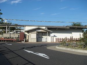
Kita-Ikeno Station
Railway station in Ikeda, Gifu Prefecture, Japan
Distance: Approx. 124 meters
Latitude and longitude: 35.4433,136.5736
Kita-Ikeno Station (北池野駅, Kita-Ikeno-eki) is a railway station in the town of Ikeda, Ibi District, Gifu Prefecture, Japan, operated by the private railway operator Yōrō Railway.

Mino-Hongō Station
Railway station in Ikeda, Gifu Prefecture, Japan
Distance: Approx. 830 meters
Latitude and longitude: 35.4497,136.5719
Mino-Hongō Station (美濃本郷駅, Mino-Hongō-eki) is a railway station in the town of Ikeda, Ibi District, Gifu Prefecture, Japan, operated by the private railway operator Yōrō Railway.
Ibi Station
Railway station in Ibigawa, Gifu Prefecture, Japan
Distance: Approx. 3106 meters
Latitude and longitude: 35.4702,136.5731
Ibi Station (揖斐駅, Ibi-eki) is a railway station in the town of Ibigawa, Ibi District, Gifu Prefecture, Japan, operated by the private railway operator Yōrō Railway.

Mount Ikeda
Mountain in Gifu Prefecture, Japan
Distance: Approx. 5086 meters
Latitude and longitude: 35.44111111,136.51694444
Mount Ikeda (池田山, Ikeda-san, Ikeda-yama) is a mountain located in the towns of Ikeda and Ibigawa, in Ibi District, Gifu Prefecture, Japan.

Kamagatani
Distance: Approx. 2450 meters
Latitude and longitude: 35.43194444,136.54916667
Kamagatani (霞間ヶ渓) is a valley in the town of Ikeda, Gifu Prefecture, Japan noted for a scenic valley. It is a noted spot for viewing cherry blossoms in spring and was designated both a nationally designated Place of Scenic Beauty and Natural Monument,in 1928 It is located within the borders of the Ibi-Sekigahara-Yōrō Quasi-National Park.
Weather in this IP's area
few clouds
27 Celsius
32 Celsius
27 Celsius
29 Celsius
1016 hPa
87 %
1016 hPa
1013 hPa
10000 meters
1.36 m/s
1.6 m/s
309 degree
20 %
05:40:05
17:54:22