Country:
Region:
City:
Latitude and Longitude:
Time Zone:
Postal Code:
IP information under different IP Channel
ip-api
Country
Region
City
ASN
Time Zone
ISP
Blacklist
Proxy
Latitude
Longitude
Postal
Route
Luminati
Country
Region
05
City
akita
ASN
Time Zone
Asia/Tokyo
ISP
Cable Networks Akita Co.,ltd.
Latitude
Longitude
Postal
IPinfo
Country
Region
City
ASN
Time Zone
ISP
Blacklist
Proxy
Latitude
Longitude
Postal
Route
db-ip
Country
Region
City
ASN
Time Zone
ISP
Blacklist
Proxy
Latitude
Longitude
Postal
Route
ipdata
Country
Region
City
ASN
Time Zone
ISP
Blacklist
Proxy
Latitude
Longitude
Postal
Route
Popular places and events near this IP address

Misono Gakuen Junior College
Distance: Approx. 2016 meters
Latitude and longitude: 39.72333333,140.11388889
Misono Gakuen Junior College (聖園学園短期大学, Misono gakuen tanki daigaku) is a private junior college, located in the city of Akita, Japan.

Belle Demeure Landmark AKITA
Skyscraper in Akita City, Akita, Japan
Distance: Approx. 2437 meters
Latitude and longitude: 39.71791667,140.11891667
The Belle Demeure Landmark AKITA (ベルドゥムール ランドマーク秋田, Beru Dumāru Randomāku Akita) is a skyscraper located in Akita City, Akita, Japan. Construction of the 95-metre, 30-storey skyscraper was finished in 2003. There was a Kyodosha department store in this place.

Akita Museum of Art
Building in Akita Prefecture, Japan
Distance: Approx. 2453 meters
Latitude and longitude: 39.71742778,140.1215
Akita Museum of Art (秋田県立美術館 平野政吉コレクション, Akita Kenritsu Bijutsukan Hirano Masakichi Collection) is an art museum in the city of Akita. The original Akita Prefectural Museum of Art was opened on May 5, 1967. The new museum was opened on September 28, 2013.

Kubota Castle
Distance: Approx. 1767 meters
Latitude and longitude: 39.72348056,140.12324167
Kubota Castle (久保田城, Kubota-jō) is a Japanese castle in the city Akita, Akita Prefecture, Japan. Throughout the Edo period, Kubota Castle was home to the Satake clan, daimyō of Kubota Domain, rulers of northern Dewa Province. The castle was also known as "Yadome-jō" (矢留城) or "Kuzune-jō" (葛根城).

Akita Senshū Museum of Art
Building in Akita Prefecture, Japan
Distance: Approx. 2460 meters
Latitude and longitude: 39.717202,140.124588
Akita Senshū Museum of Art (秋田市立千秋美術館, Akita Shiritsu Senshū Bijutsukan) opened in Akita, Japan in 1989. It is located within the Atorion Building (アトリオン), more formally the Akita Integrated Life Cultural Hall・Museum (秋田総合生活文化会館・美術館). The Museum is the successor of the Akita City Museum of Art (秋田市美術館), which opened in 1958.

Akita Prefectural Hall
Building in Akita, Japan
Distance: Approx. 2199 meters
Latitude and longitude: 39.71969444,140.12186111
The Akita Prefectural Hall (秋田県民会館, Akita Kenminkaikan) was a multi-purpose public cultural facility in Akita, Japan, which operated from 30 April 1961 to 31 May 2018. The main concert hall had a seating capacity of 1,839. Notable past performers include Rainbow.

Akita High School
Prefectural senior co-educational school in Akita, Akita Prefecture, Japan
Distance: Approx. 823 meters
Latitude and longitude: 39.736584,140.133947
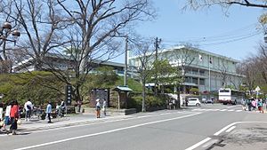
Akita High School (秋田県立秋田高等学校, Akita Kenritsu Akita Kōtō Gakkō) is a high school in the city of Akita, Akita Prefecture, Japan. Akita High is the oldest and first high school in the prefecture and one of the earliest pre-World War II middle schools in Japan.

Satake Historical Museum
Building in Akita Prefecture, Japan
Distance: Approx. 2146 meters
Latitude and longitude: 39.720019,140.124823
Satake Historical Museum (秋田市立佐竹史料館, Akita Shiritsu Satake Shiryōkan) opened in Akita, Akita Prefecture, Japan in 1990. Located in the grounds of Kubota Castle in Senshū Park (千秋公園), the collection relates to the Satake clan, daimyō of the Akita Domain.

Hiroomote
Neighborhood of Akita City in Akita Prefecture, Japan
Distance: Approx. 2057 meters
Latitude and longitude: 39.728806,140.144778
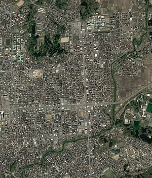
Hiroomote (広面, Hiroomote) is a neighbourhood located in Akita City, Akita Prefecture, Japan. Annexed by the city in 1941, it borders the neighborhoods of Shimokitate on the east, Yanagida on the north, Tegata on the west and Sakura and Yokomori on the south that is bounded by Taihei River. Developed primarily in the post-World War II era, it is residential with commercial uses fronting prefectural roads #41, #28 and #62.

Akita Bank Red Arrows
Basketball team
Distance: Approx. 2167 meters
Latitude and longitude: 39.72358333,140.11005556
Akita Bank Red Arrows is a Japanese women's basketball club based in Akita, Akita, playing in the Japan Industrial and Commercial Basketball Federation. They play their home games at the Akita Prefectural Gymnasium, located on the Yabase Sports Park.

Joshitei
Landscape garden in Akita, Japan
Distance: Approx. 674 meters
Latitude and longitude: 39.73416667,140.12916667
The Joshitei (如斯亭), also known as the Former Akita Domain Satake Clan Villa Gardens (旧秋田藩主佐竹氏別邸, kyū-Akita-han-shu Satake-shi bettei teien) is a Japanese landscape garden and nationally designated Place of Scenic Beauty in the city of Akita, Akita Prefecture, Japan.

Izumi-Sotoasahikawa Station
Distance: Approx. 1102 meters
Latitude and longitude: 39.73835,140.11218056
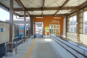
Izumi-Sotoasahikawa Station (泉外旭川駅, Izumi-Sotoasahikawa-eki) is a railway station in the city of Akita in Akita Prefecture, Japan, operated by East Japan Railway Company (JR East). The station was opened on 13 March 2021.
Weather in this IP's area
overcast clouds
14 Celsius
13 Celsius
14 Celsius
14 Celsius
1022 hPa
58 %
1022 hPa
1020 hPa
10000 meters
2.47 m/s
2.73 m/s
105 degree
100 %
06:18:16
16:28:39