Country:
 Switzerland
Region:
City:
Latitude and Longitude:
Time Zone:
Postal Code:
IP information under different IP Channel
ip-api
Country
Region
City
ASN
Time Zone
ISP
Blacklist
Proxy
Latitude
Longitude
Postal
Route
IPinfo
Country
Region
City
ASN
Time Zone
ISP
Blacklist
Proxy
Latitude
Longitude
Postal
Route
MaxMind
Country
Region
City
ASN
Time Zone
ISP
Blacklist
Proxy
Latitude
Longitude
Postal
Route
Luminati
Country
CHRegion
vs
City
leytron
ASN
Time Zone
Europe/Zurich
ISP
netplus.ch SA
Latitude
Longitude
Postal
db-ip
Country
Region
City
ASN
Time Zone
ISP
Blacklist
Proxy
Latitude
Longitude
Postal
Route
ipdata
Country
Region
City
ASN
Time Zone
ISP
Blacklist
Proxy
Latitude
Longitude
Postal
Route
Popular places and events near this IP address

International Seminary of Saint Pius X
Distance: Approx. 3524 meters
Latitude and longitude: 46.1562435,7.2042985
The International Seminary of Saint Pius X in Écône, Valais, Switzerland, is the premier seminary of the Roman Catholic traditionalist Society of Saint Pius X (SSPX). The seminary is one of the six houses for formation for the future priests of the Society of Saint Pius X. The Seminary was founded in 1970 by Archbishop Marcel Lefebvre, and his tomb can be found there.

Chamoson
Municipality in Valais, Switzerland
Distance: Approx. 1632 meters
Latitude and longitude: 46.2,7.21666667
Chamoson (French pronunciation: [ʃamozɔ̃]) is a municipality in the district of Conthey in the canton of Valais in Switzerland.
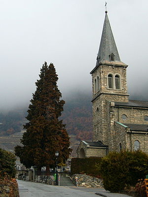
Leytron
Municipality in Valais, Switzerland
Distance: Approx. 624 meters
Latitude and longitude: 46.18333333,7.2
Leytron is a municipality in the district of Martigny in the canton of Valais in Switzerland.

Riddes
Municipality in Valais, Switzerland
Distance: Approx. 2537 meters
Latitude and longitude: 46.16666667,7.21666667
Riddes is a municipality in the district of Martigny in the canton of Valais in Switzerland.

Saillon
Municipality in Valais, Switzerland
Distance: Approx. 2881 meters
Latitude and longitude: 46.16666667,7.18333333
Saillon (French pronunciation: [sajɔ̃]) is a municipality in the district of Martigny in the canton of Valais in Switzerland.
Bieudron Hydroelectric Power Station
Distance: Approx. 3469 meters
Latitude and longitude: 46.18529722,7.24956111
The Bieudron Hydroelectric Power Station is a hydroelectric power plant located in the Swiss Alps in the Canton of Valais in Switzerland. The power plant is fed with water from the Grande Dixence Dam's reservoir, Lac des Dix and is part of the Cleuson-Dixence Complex. The 1269 MW power plant is operated by Grande Dixence SA. Production began in 1998, with two world records set upon its completion: the world's most powerful Pelton turbine as well as the highest head used to produce hydro-electric energy.

Ovronnaz
Village in the canton of Valais, Switzerland
Distance: Approx. 3172 meters
Latitude and longitude: 46.20194444,7.16888889
Ovronnaz is a French speaking village located in the canton of Valais, Switzerland. It lies in the municipality of Leytron, close to Martigny. The village is located on the south side of the Bernese Alps, on a terrace above the Rhone river, at an altitude of 1,330 metres.
Saint-Pierre-de-Clages
Village in Valais, Switzerland
Distance: Approx. 2265 meters
Latitude and longitude: 46.18333333,7.23333333
Saint-Pierre-de-Clages is a village in Switzerland. It is located in the French-speaking part of the Canton of Valais in the municipality of Chamoson. The village of Saint-Pierre-de-Clages was joined with the municipality of Chamoson in 1376.
L'Ardève
Mountain in Switzerland
Distance: Approx. 1151 meters
Latitude and longitude: 46.1975,7.19916667
L'Ardève (1,501 m) is a mountain of the western Bernese Alps, overlooking the Rhone valley at Leytron, in the canton of Valais. It is elevated less than 200 metres above the nearby mountain resort of Ovronnaz, with high cliffs on its south side.

Chamoson-St-Pierre-de-Clages railway station
Railway station in Chamoson, Switzerland
Distance: Approx. 2807 meters
Latitude and longitude: 46.18883611,7.24109889
Chamoson-St-Pierre-de-Clages railway station (French: Gare de Chamoson-St-Pierre-de-Clages, German: Bahnhof Chamoson-St-Pierre-de-Clages) is a railway station in the municipality of Chamoson, in the Swiss canton of Valais. It is an intermediate stop on the Simplon line and is served by local trains only. The station sits in the village of Saint-Pierre-de-Clages, near the 11th century cathedral of the same name.

Riddes railway station
Railway station in Riddes, Switzerland
Distance: Approx. 1991 meters
Latitude and longitude: 46.17251111,7.21785389
Riddes railway station (French: Gare de Riddes, German: Bahnhof Riddes) is a railway station in the municipality of Riddes, in the Swiss canton of Valais. It is an intermediate stop on the Simplon line and is served by local trains only.

Saillon Castle
Distance: Approx. 2575 meters
Latitude and longitude: 46.17052,7.182654
Saillon Castle or Bayard Tower is a ruined castle in the municipality of Saillon of the Canton of Valais in Switzerland. It is a Swiss heritage site of national significance.
Weather in this IP's area
scattered clouds
12 Celsius
12 Celsius
12 Celsius
15 Celsius
1009 hPa
100 %
1009 hPa
949 hPa
10000 meters
1.54 m/s
110 degree
40 %
07:38:58
18:58:01