217.76.227.177 - IP Lookup: Free IP Address Lookup, Postal Code Lookup, IP Location Lookup, IP ASN, Public IP
Country:
Region:
City:
Location:
Time Zone:
Postal Code:
IP information under different IP Channel
ip-api
Country
Region
City
ASN
Time Zone
ISP
Blacklist
Proxy
Latitude
Longitude
Postal
Route
Luminati
Country
ASN
Time Zone
Europe/Brussels
ISP
Proximus NV
Latitude
Longitude
Postal
IPinfo
Country
Region
City
ASN
Time Zone
ISP
Blacklist
Proxy
Latitude
Longitude
Postal
Route
IP2Location
217.76.227.177Country
Region
west-vlaanderen
City
ledegem
Time Zone
Europe/Brussels
ISP
Language
User-Agent
Latitude
Longitude
Postal
db-ip
Country
Region
City
ASN
Time Zone
ISP
Blacklist
Proxy
Latitude
Longitude
Postal
Route
ipdata
Country
Region
City
ASN
Time Zone
ISP
Blacklist
Proxy
Latitude
Longitude
Postal
Route
Popular places and events near this IP address

Menen
City and municipality in Flemish Community, Belgium
Distance: Approx. 6455 meters
Latitude and longitude: 50.8,3.11666667
Menen (Dutch pronunciation: [ˈmeːnə(n)] ; French: Menin [mənɛ̃]; West Flemish: Mêenn [ˈmeːnən] or Mêende [ˈmeːndə]) is a city and municipality located in the Belgian province of West Flanders. The municipality comprises the city of Menen proper and the towns of Lauwe and Rekkem. The city is situated on the French/Belgian border.

Ledegem
Municipality in Flemish Community, Belgium
Distance: Approx. 1013 meters
Latitude and longitude: 50.85,3.11666667
Ledegem (Dutch pronunciation: [ˈleːdəɣɛm]; West Flemish: Léhèm) is a municipality located in the Belgian province of West Flanders. The municipality comprises the towns of Ledegem proper, Rollegem-Kapelle and Sint-Eloois-Winkel. On January 1, 2006, Ledegem had a total population of 9,306.

Moorslede
Municipality in Flemish Community, Belgium
Distance: Approx. 4935 meters
Latitude and longitude: 50.88333333,3.06666667
Moorslede (Dutch pronunciation: [ˈmoːrsˌleːdə]) is a municipality located in the Belgian province of West Flanders. The municipality comprises the towns of Dadizele, Slypskapelle and Moorslede proper. On 1 January 2006, Moorslede had a total population of 10,618.
Terhand
Village in Belgium
Distance: Approx. 4940 meters
Latitude and longitude: 50.84,3.05972222
Terhand is a tiny hamlet approximately 12 km east of Ypres in Belgium. The village consists of about 40 houses with a small street running through the middle of them. The road from Ypres is lined with fields but very few trees; most of them were destroyed in the First World War.
Arrondissement of Menen
Early-19th century political unit in Belgium
Distance: Approx. 6862 meters
Latitude and longitude: 50.79616944,3.12200556
The Arrondissement of Menen (Dutch: Arrondissement Menen; French: Arrondissement de Menin) was a short-lived arrondissement in the present-day Province of West Flanders, Belgium. It was created in 1818 and it already ceased to exist in 1823.

Moorsele Airfield
Airport in Moorsele, Belgium
Distance: Approx. 1718 meters
Latitude and longitude: 50.85277778,3.14722222
Moorsele Airfield (ICAO: EBMO) is a recreational airfield located in Moorsele, a village in the municipality of Wevelgem in Belgium. It is operated by Vliegveld Moorsele VZW and was formerly operated by the Belgian Air Component. It is mainly used as a light general aviation field for ULM and parachuting activities.

Menen German war cemetery
WWI cemetery in Flanders, Belgium
Distance: Approx. 5757 meters
Latitude and longitude: 50.80916667,3.15194444
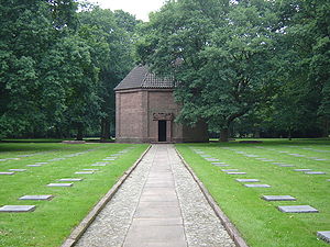
The Menen German war cemetery is a military cemetery in the Belgian town of Menen territory and partly in Wevelgem. There were nearly 48,000 German soldiers buried from the First World War, making it the largest in Flanders. In between are several crosses and oak and chestnut trees.
Maurice Cooper
Irish World War I flying ace
Distance: Approx. 2751 meters
Latitude and longitude: 50.84872222,3.08769444
Captain Maurice Lea Cooper (18 December 1898 – 2 October 1918) was an Irish World War I flying ace credited with six aerial victories.

Geluwe
Distance: Approx. 6183 meters
Latitude and longitude: 50.810721,3.077446
Geluwe (Hilwe in West Flemish) is a town in the West Flemish province of Belgium. It is contained within the municipality of Wervik. The town is known for the "yawning festival" (Dutch: gapersfeesten).
1950 UCI Road World Championships
Cycling championship held in Moorslede, Belgium
Distance: Approx. 4935 meters
Latitude and longitude: 50.88333333,3.06666667
The 1950 UCI Road World Championships was the 23rd edition of the UCI Road World Championships. It took place between 19-20 August 1950 in Moorslede, Belgium. The professionals' championship was held on Sunday, August 20, 1950.

Battle of Menin (1793)
Battle of the War of the First Coalition
Distance: Approx. 6926 meters
Latitude and longitude: 50.7956,3.1217
The Battle of Wervik or of Wervik and Menin was fought on 12 and 13 September 1793 between 30,000 men of the French Army of the North commanded by Jean Nicolas Houchard, and 13,000 Coalition troops: the Veldleger (mobile army) of the Dutch States Army, commanded by the William, Hereditary Prince of Orange and his brother Prince Frederick of Orange-Nassau, and a few squadrons of Austrian cavalry under Pál Kray, seconded by Johann Peter Beaulieu. The great superiority in numbers being on the French side the battle ended in a victory for France, with the Dutch army suffering many losses. Among the casualties was Prince Frederick, who was wounded in the shoulder at Wervik, an injury from which he never fully recovered.

Siege of Menin (1706)
1706 siege
Distance: Approx. 6455 meters
Latitude and longitude: 50.8,3.11666667
The siege of Menin (1706) was a siege by the Allies against the French during the War of the Spanish Succession.
Weather in this IP's area
overcast clouds
5 Celsius
2 Celsius
4 Celsius
6 Celsius
1025 hPa
93 %
1025 hPa
1023 hPa
10000 meters
4.49 m/s
8.42 m/s
191 degree
100 %