217.75.198.6 - IP Lookup: Free IP Address Lookup, Postal Code Lookup, IP Location Lookup, IP ASN, Public IP
Country:
Region:
City:
Location:
Time Zone:
Postal Code:
ISP:
ASN:
language:
User-Agent:
Proxy IP:
Blacklist:
IP information under different IP Channel
ip-api
Country
Region
City
ASN
Time Zone
ISP
Blacklist
Proxy
Latitude
Longitude
Postal
Route
db-ip
Country
Region
City
ASN
Time Zone
ISP
Blacklist
Proxy
Latitude
Longitude
Postal
Route
IPinfo
Country
Region
City
ASN
Time Zone
ISP
Blacklist
Proxy
Latitude
Longitude
Postal
Route
IP2Location
217.75.198.6Country
Region
federacija bosne i hercegovine
City
zenica
Time Zone
Europe/Sarajevo
ISP
Language
User-Agent
Latitude
Longitude
Postal
ipdata
Country
Region
City
ASN
Time Zone
ISP
Blacklist
Proxy
Latitude
Longitude
Postal
Route
Popular places and events near this IP address

Zenica
City in Bosnia and Herzegovina
Distance: Approx. 298 meters
Latitude and longitude: 44.20388889,17.90777778
Zenica ( ZEN-it-sə; Serbo-Croatian Cyrillic: Зеница; Serbo-Croatian pronunciation: [zěnitsa] ) is a city in Bosnia and Herzegovina and an administrative and economic center of the Federation of Bosnia and Herzegovina's Zenica-Doboj Canton. It is located in the Bosna river valley, about 70 km (43 mi) north of Sarajevo. The city is known for its Ironworks Zenica factory but also as a significant university center.

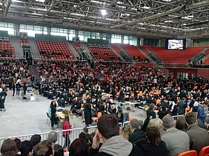
Arena Zenica
Indoor sports venue in Bosnia and Herzegovina
Distance: Approx. 583 meters
Latitude and longitude: 44.20222222,17.91361111
Arena "Husejin Smajlović" (before: Arena Zenica) is a multifunctional indoor sports venue located in Zenica, Bosnia and Herzegovina.

Zenica prison
Prison in Bosnia and Herzegovina
Distance: Approx. 1026 meters
Latitude and longitude: 44.193647,17.913352
The Zenica prison (Kazneno-popravni zavod zatvorenog tipa Zenica, KPZ Zenica, K.P. DOM, Zenička kaznionica) is a closed-type prison located in Zenica, Bosnia and Herzegovina. It was opened in 1886. It was the largest prison in Yugoslavia during its existence, and is currently the largest prison in Bosnia and Herzegovina.

University of Zenica
Distance: Approx. 434 meters
Latitude and longitude: 44.19916667,17.90194444
University of Zenica (Bosnian: Univerzitet u Zenici) is a public university located in Zenica, Bosnia and Herzegovina. The university was founded in 2000, when faculties in Zenica decided to separate from the University of Sarajevo.
2014 Zenica mine disaster
2014 mining accident in Zenica, Bosnia
Distance: Approx. 2505 meters
Latitude and longitude: 44.187644,17.93124
The 2014 Zenica mine disaster was a mining accident that occurred on 4 September 2014 at the coal mine "Raspotočje" in Zenica, Bosnia and Herzegovina.

Bilino Polje
Plain near Zenica, Bosnia and Herzegovina
Distance: Approx. 487 meters
Latitude and longitude: 44.20575,17.90708333
Bilino Polje, is historic areal and polje, located near town of Zenica, in Bosnia and Hezegovina. Today, Bilino Polje represents an urban area of the town, and it is one of its main local communal self-governing units or Bosnian: Mjesna zajednica.
Radio BM
Radio station in Zenica
Distance: Approx. 298 meters
Latitude and longitude: 44.20388889,17.90777778
Radio BM is a Bosnian commercial radio station, broadcasting from Zenica. Radio BM began broadcasting on 17 April 1997, and it was formatted as variety radio station with Bosnian music and national news.

Zenica Synagogue
Historical building in Bosnia and Herzegovina
Distance: Approx. 326 meters
Latitude and longitude: 44.19944444,17.90944444
The Zenica Synagogue (Bosnian: Sinagoga u Zenici) is a former Orthodox Jewish congregation and synagogue that existed in the town of Zenica, Bosnia and Herzegovina between the years of 1903 and 1941. Since 1968, the building has been used as a Jewish history museum and was listed as a national monument in 2013.
Zenica massacre
1993 mass killing during the Croat–Bosniak War
Distance: Approx. 577 meters
Latitude and longitude: 44.19833333,17.91222222
The Zenica massacre happened on 19 April 1993, shortly after noon. Several shells fired from the Croatian Defence Council’s positions located in Putićevo village, about 16 km (9.9 mi) west of Zenica, killed 16 and injured over 50 civilians in a large crowd.
Radio Zenica
Bosnian radio station
Distance: Approx. 298 meters
Latitude and longitude: 44.20388889,17.90777778
Radio Zenica is a Bosnian local public radio station, broadcasting from Zenica, Bosnia and Herzegovina and it broadcasts a variety of programs such as news, music, morning and talk shows. Program is operated by RTV Zenica and it is mainly produced in Bosnian language. Radio Zenica was launched on 20 June 1969 as local/municipal Radio Sarajevo network affiliate from 1969 until 1992 when war in Bosnia and Herzegovina started.
Radio Zenit
Bosnian radio station
Distance: Approx. 298 meters
Latitude and longitude: 44.20388889,17.90777778
Radio Zenit is a Bosnian local commercial radio station, broadcasting from Zenica, Bosnia and Herzegovina. This radio station broadcasts a variety of programs such as pop-rock music and local news. The owner of the radio station is the company B-U Specijal d.o.o.
Bilino Polje abjuration
1203 renunciation of heresy by Bosnian Church clergy at Bilino Polje
Distance: Approx. 487 meters
Latitude and longitude: 44.20575,17.90708333
The Bilino Polje abjuration, also known as “Confessio Christianorum bosniensis”, was an act of alleged heresy abjuration by Bosnian clergy in presence of Ban Kulin and Giovanni da Casamari. It was signed by seven priors of the Bosnian Church, on 8 April 1203 at Bilino Polje field, near today town of Zenica, in Bosnia and Herzegovina.
Weather in this IP's area
overcast clouds
12 Celsius
11 Celsius
12 Celsius
12 Celsius
1016 hPa
76 %
1016 hPa
924 hPa
10000 meters
3.28 m/s
8.35 m/s
198 degree
99 %