217.73.33.116 - IP Lookup: Free IP Address Lookup, Postal Code Lookup, IP Location Lookup, IP ASN, Public IP
Country:
 Germany
Region:
City:
Location:
Time Zone:
Postal Code:
ISP:
ASN:
language:
User-Agent:
Proxy IP:
Blacklist:
IP information under different IP Channel
ip-api
Country
Region
City
ASN
Time Zone
ISP
Blacklist
Proxy
Latitude
Longitude
Postal
Route
db-ip
Country
Region
City
ASN
Time Zone
ISP
Blacklist
Proxy
Latitude
Longitude
Postal
Route
IPinfo
Country
Region
City
ASN
Time Zone
ISP
Blacklist
Proxy
Latitude
Longitude
Postal
Route
IP2Location
217.73.33.116Country
deRegion
hessen
City
bad vilbel
Time Zone
Europe/Berlin
ISP
Language
User-Agent
Latitude
Longitude
Postal
ipdata
Country
Region
City
ASN
Time Zone
ISP
Blacklist
Proxy
Latitude
Longitude
Postal
Route
Popular places and events near this IP address

Battle of Bergen (1759)
1759 battle in the Seven Years' War
Distance: Approx. 2859 meters
Latitude and longitude: 50.155,8.75305556
The Battle of Bergen on 13 April 1759 saw the French army under de Broglie withstand an allied British, Hanoverian, Hessian, Brunswick army under Prince Ferdinand of Brunswick near Frankfurt-am-Main during the Seven Years' War.

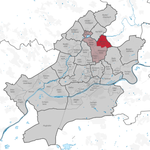
Bad Vilbel
Town in Hesse, Germany
Distance: Approx. 128 meters
Latitude and longitude: 50.17805556,8.73611111
Bad Vilbel (German: [baːt ˈfɪlbl̩] ) is a spa town in Hesse (Hessen), Germany, famous for its many mineral water springs. Bad Vilbel is the largest town in the Wetteraukreis district and part of the Frankfurt Rhein-Main urban area with its city center being located 8 km northeast of downtown Frankfurt am Main at the banks of the river Nidda.

Bergen, Hesse
Village of Frankfurt in Hesse, Germany
Distance: Approx. 2771 meters
Latitude and longitude: 50.155,8.7495
Bergen is a former municipality in Hesse, Germany. Presently, it is part of Bergen-Enkheim, a borough of Frankfurt. It was the location of the Battle of Bergen (Seven Years' War).
Berkersheim
Quarter of Frankfurt am Main in Hesse, Germany
Distance: Approx. 2948 meters
Latitude and longitude: 50.17222222,8.6975
Berkersheim is a quarter of Frankfurt am Main, Germany. It is part of the Ortsbezirk Nord-Ost. Berkersheim had been an independent town until 1910 when it was suburbanised.

Bergen-Enkheim
Borough of Frankfurt am Main in Hesse, Germany
Distance: Approx. 2859 meters
Latitude and longitude: 50.155,8.75305556
Bergen-Enkheim is a borough (Ortsbezirk) of Frankfurt am Main, Germany. Bergen-Enkheim is a popular residential area with families and sports enthusiasts for its small-town character, excellent infrastructure, and the highest number of clubs (Vereine) in Frankfurt, many of them sports clubs. Its athletic facilities include a modern track and field complex, a tennis club, an extensive, recently modernized indoor and outdoor public swimming and sports center, and a nature preserve with small lakes and many kilometers of forested walking, running and biking paths (Enkheimer Ried).

Erlenbach (Nidda)
River in Germany
Distance: Approx. 1155 meters
Latitude and longitude: 50.1786,8.7214
Erlenbach is a river of Hesse, Germany. It flows into the Nidda in Bad Vilbel.

Eschbach (Nidda)
River of Hesse, Germany
Distance: Approx. 2832 meters
Latitude and longitude: 50.18111111,8.69805556
Eschbach is a river of Hesse, Germany. It is a tributary of the Nidda near Bad Vilbel. From the confluence of its source rivers Dornbach and Heuchelbach to its outflow into the Nidda, is 8.1 km long.

Burgfestspiele Bad Vilbel
Distance: Approx. 863 meters
Latitude and longitude: 50.185005,8.744656
Burgfestspiele Bad Vilbel is a theatre festival in Bad Vilbel Germany. The Burgfestspiele Bad Vilbel founded in 1987 performing from June to September in the historic scenery of the water castle Bad Vilbel. Beside own theatre productions, musicals, an own child program and smaller theatre productions in the cellar, the program of the open air theater is completed by guest performances.

Heiligenstock transmitter
Distance: Approx. 3273 meters
Latitude and longitude: 50.1546832,8.711112
Heiligenstock Transmitter, also known as the Heiligenstock Radio Tower, was a wooden German lattice transmitter that was used for mediumwave broadcasting. The tower was built in the year 1934 but was dismantled four years later because of its bad state. The tower was then rebuilt the same year it was dismantled in the city of Frankfurt.

Bad Vilbel station
Railway station in Hesse, Germany
Distance: Approx. 1086 meters
Latitude and longitude: 50.18833333,8.74
Bad Vilbel station is located at the 183.6 kilometre mark of the Main-Weser Railway in the town of Bad Vilbel in the German state of Hesse. The Nidder Valley Railway branches from Bad Vilbel via Nidderau to Glauburg-Stockheim. It is classified by Deutsche Bahn as a category 3 station.

Frankfurt-Berkersheim station
Railway station in Germany
Distance: Approx. 2851 meters
Latitude and longitude: 50.17638889,8.69777778
Frankfurt-Berkersheim station is a railway station in the Berkersheim district of Frankfurt, Germany.

Bad Vilbel Süd station
Railway station in Germany
Distance: Approx. 285 meters
Latitude and longitude: 50.17861111,8.73361111
Bad Vilbel Süd station is a railway station in the southern part of Bad Vilbel, Germany.
Weather in this IP's area
overcast clouds
6 Celsius
6 Celsius
5 Celsius
7 Celsius
1017 hPa
91 %
1017 hPa
997 hPa
10000 meters
0.54 m/s
0.37 m/s
104 degree
100 %