217.73.142.45 - IP Lookup: Free IP Address Lookup, Postal Code Lookup, IP Location Lookup, IP ASN, Public IP
Country:
Region:
City:
Location:
Time Zone:
Postal Code:
IP information under different IP Channel
ip-api
Country
Region
City
ASN
Time Zone
ISP
Blacklist
Proxy
Latitude
Longitude
Postal
Route
Luminati
Country
Region
11
City
tirana
ASN
Time Zone
Europe/Tirane
ISP
Vodafone Albania Sh.A.
Latitude
Longitude
Postal
IPinfo
Country
Region
City
ASN
Time Zone
ISP
Blacklist
Proxy
Latitude
Longitude
Postal
Route
IP2Location
217.73.142.45Country
Region
fier
City
fier
Time Zone
Europe/Tirane
ISP
Language
User-Agent
Latitude
Longitude
Postal
db-ip
Country
Region
City
ASN
Time Zone
ISP
Blacklist
Proxy
Latitude
Longitude
Postal
Route
ipdata
Country
Region
City
ASN
Time Zone
ISP
Blacklist
Proxy
Latitude
Longitude
Postal
Route
Popular places and events near this IP address

Fier District
Defunct (2000) Albanian administrative area
Distance: Approx. 3282 meters
Latitude and longitude: 40.7,19.53333333
Fier District (Albanian: Rrethi i Fierit) was one of the 36 districts of Albania, which were dissolved in July 2000 and replaced by 12 counties. It had a population of 200,154 in 2001, and an area of 850 km2 (330 sq mi). Located in the south-west of the country, its capital was the city of Fier.

Fier
Seventh largest city of Albania
Distance: Approx. 155 meters
Latitude and longitude: 40.725,19.55722222
Fier (pronounced [fiˈɛɾ]; Albanian definite form: Fieri, Latin: Fierum) is the seventh most populous city of the Republic of Albania and seat of Fier County and Fier Municipality. It is situated on the bank of Gjanica River in the Myzeqe Plain between the Seman in the north, the Vjosë in the south and the foothills of the Mallakastra Mountains in the southeast. Fier experiences a seasonal Mediterranean climate affected by its proximity to the Adriatic Sea in the west.

Fier County
County in southern Albania
Distance: Approx. 3704 meters
Latitude and longitude: 40.75,19.58333333
Fier County (Albanian pronunciation: [fieɽ]; Albanian: Qarku Fier), officially the County of Fier (Albanian: Qarku i Fierit), is a county in the Southern Region of the Republic of Albania. It is the eighth largest by area and the third most populous of the twelve counties, with about 240,000 people within an area of 1,890 km2 (730 sq mi). The county borders on the Adriatic Sea to the west, the counties of Tirana to the north, Elbasan to the northeast, Berat to the east, Gjirokastër to the southeast and Vlorë to the south.
Loni Papuçiu Stadium
Albanian football stadium
Distance: Approx. 473 meters
Latitude and longitude: 40.72083333,19.55222222
Loni Papuçiu Stadium (Albanian: Stadiumi Loni Papuçiu) is a multi-use stadium in Fier, Albania which is used as the home ground of local football club Apolonia. It was built in 1958 and has been the Apolonia's home ground ever since. The stadium has a seated capacity of 6,800.
Fier Power Station
Distance: Approx. 2572 meters
Latitude and longitude: 40.70111111,19.55111111
The Fier Power Station was Albania's largest thermal power plant having 6 identical groups of 31 MW each thus totalling a capacity of 186 MW. The plant was decommissioned in 2007.
Portëz
Municipal unit in Fier, Albania
Distance: Approx. 3516 meters
Latitude and longitude: 40.7,19.58333333
Portëz is a village and a former municipality in the Fier County, southwestern Albania. At the 2015 local government reform it became a subdivision of the municipality Fier. The population at the 2011 census was 8,259.
Mbrostar
Municipal unit in Fier, Albania
Distance: Approx. 3704 meters
Latitude and longitude: 40.75,19.58333333
Mbrostar is a village and a former municipality in the Fier County, southwestern Albania. At the 2015 local government reform it became a subdivision of the municipality Fier. The population at the 2011 census was 7,460.
Qendër, Fier
Municipal unit in Fier, Albania
Distance: Approx. 2189 meters
Latitude and longitude: 40.73333333,19.53333333
Qendër, also known as Çlirim or Ferma Çlirim (former state owned farm named Çlirim, Liberation, during the Communist era), is a former municipality in the Fier County, southwestern Albania. At the 2015 local government reform it became a subdivision of the municipality Fier. The population at the 2011 census was 4,207.
Driza oil field
Albanian oil field
Distance: Approx. 2274 meters
Latitude and longitude: 40.704,19.55
Driza oil field is an Albanian oil field that was discovered in 1939. It is one of the biggest on-shore oil field of Albania. It is situated near the village Drizë, on the southern edge of the city of Fier (a major city).
Muçaj
Village in Fier, Albania
Distance: Approx. 5133 meters
Latitude and longitude: 40.76666667,19.53333333
Muçaj is a village in Fier County, Albania. It was part of the former municipality Dërmenas. At the 2015 local government reform it became part of the municipality Fier.

Fier Mosque
Mosque in Fier, Albania
Distance: Approx. 265 meters
Latitude and longitude: 40.7261,19.5573
The Mosque of Fier (Albanian: Xhamia e Fierit) is a historic Albanian mosque in the town of Fier, Albania. It is not to be confused with the Ottoman-era mosque in another part of the city. The Mosque of Fier is one of the largest mosques in Albania and is a visitors' attraction of Fier town.
Fier railway station
Railway station in Fier, Albania
Distance: Approx. 703 meters
Latitude and longitude: 40.7299,19.5535
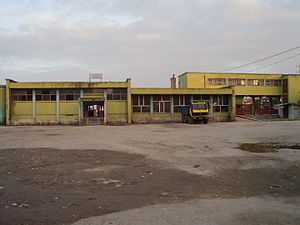
Fier railway station (Albanian: Stacioni hekurudhor i Fier) is a railway station that serves the city of Fier in Fier County, Albania. The station opened in 1968 after an extension from Rrogozhine was completed. It was a terminus until the line was extended southwards to Ballsh in 1975, though passenger services south of Fier did not commence until 1985.
Weather in this IP's area
overcast clouds
12 Celsius
11 Celsius
12 Celsius
12 Celsius
1014 hPa
89 %
1014 hPa
1007 hPa
10000 meters
1.61 m/s
1.8 m/s
88 degree
100 %
