Country:
 Germany
Region:
City:
Latitude and Longitude:
Time Zone:
Postal Code:
IP information under different IP Channel
ip-api
Country
Region
City
ASN
Time Zone
ISP
Blacklist
Proxy
Latitude
Longitude
Postal
Route
IPinfo
Country
Region
City
ASN
Time Zone
ISP
Blacklist
Proxy
Latitude
Longitude
Postal
Route
MaxMind
Country
Region
City
ASN
Time Zone
ISP
Blacklist
Proxy
Latitude
Longitude
Postal
Route
Luminati
Country
DEASN
Time Zone
Europe/Berlin
ISP
euNetworks GmbH
Latitude
Longitude
Postal
db-ip
Country
Region
City
ASN
Time Zone
ISP
Blacklist
Proxy
Latitude
Longitude
Postal
Route
ipdata
Country
Region
City
ASN
Time Zone
ISP
Blacklist
Proxy
Latitude
Longitude
Postal
Route
Popular places and events near this IP address

Erfurt
Capital of Thuringia, Germany
Distance: Approx. 754 meters
Latitude and longitude: 50.97805556,11.02888889
Erfurt (German pronunciation: [ˈɛʁfʊʁt] ) is the capital and largest city of the Central German state of Thuringia. It lies in the wide valley of the River Gera, in the southern part of the Thuringian Basin, north of the Thuringian Forest, and in the middle of a line of the six largest Thuringian cities (Thüringer Städtekette), stretching from Eisenach in the west, via Gotha, Erfurt, Weimar and Jena, to Gera in the east, close to the geographic centre of Germany. Erfurt is 100 km (62 mi) south-west of Leipzig, 250 km (155 mi) north-east of Frankfurt, 300 km (186 mi) south-west of Berlin and 400 km (249 mi) north of Munich.

Krämerbrücke
Bridge in Thuringia, Germany
Distance: Approx. 692 meters
Latitude and longitude: 50.97861111,11.03083333
The Krämerbrücke (pronounced [ˈkʁɛːmɐˌbʁʏkə]; Merchants' bridge) is a medieval arch bridge in the city of Erfurt, in Thuringia, central Germany, which is lined with half-timbered shops and houses on both sides of a cobblestone street. It is one of the few remaining bridges in the world that have inhabited buildings. It has been continuously inhabited for over 500 years, longer than any other bridge in Europe.

Principality of Erfurt
Former principality
Distance: Approx. 291 meters
Latitude and longitude: 50.98333333,11.03333333
The Principality of Erfurt (German: Fürstentum Erfurt; French: Principauté d'Erfurt) was a small state in modern Thuringia, Germany, that existed from 1807 to 1814, comprising the modern city of Erfurt and the surrounding land. It was subordinate directly to Napoleon, the Emperor of the French, rather than being a part of the Confederation of the Rhine. After nearly 3 months of siege, the city fell to Prussian, Austrian and Russian forces.

Old Synagogue (Erfurt)
11th century former synagogue in Germany
Distance: Approx. 690 meters
Latitude and longitude: 50.97861111,11.02930556
The Old Synagogue (German: Alte Synagoge; Yiddish: אלטע שול, ערפורט; Hebrew: בית הכנסת הישן (ארפורט)) is a former Jewish congregation and synagogue, located in Erfurt, Thuringia, Germany. Dating from the late 11th century, the synagogue is one of the best preserved Medieval synagogues in Europe. Most parts of the building date from around 1250–1320.

Evangelical Church in Central Germany
United church body covering several German states
Distance: Approx. 593 meters
Latitude and longitude: 50.9796,11.02805
The Evangelical Church in Central Germany (German: Evangelische Kirche in Mitteldeutschland; EKM) is a United church body covering most of the German states of Saxony-Anhalt and Thuringia and some adjacent areas in Brandenburg and Saxony.

Flutgraben
Canal in Germany
Distance: Approx. 698 meters
Latitude and longitude: 50.98833333,11.02166667
The Flutgraben is a canal in Erfurt, Thuringia, Germany. It is a flood control channel, created between 1890 and 1898 in order to prevent flooding of the river Gera in the city centre of Erfurt.

St. Augustine's Monastery (Erfurt)
Distance: Approx. 372 meters
Latitude and longitude: 50.98145833,11.03000556
St. Augustine's Monastery (German: Augustinerkloster) in Erfurt, central Germany, is a former church and monastery complex dating from the 13th century. The site is almost one hectare (2.5 acres) in size.

All Saints' Church, Erfurt
Church in Thuringia, Germany
Distance: Approx. 814 meters
Latitude and longitude: 50.97777778,11.02666667
All Saints' Church (German: Allerheiligenkirche) in the city of Erfurt in Thuringia, Germany, is a small Roman Catholic church building dating from the 12th to 14th century. The Gothic hall church is located at the fork of Allerheiligenstraße and Marktstraße in the historical centre of Erfurt. It has an irregular floor plan and, at 53 metres (173 ft 11 in), the highest church tower in the old part of the city.

St Andrew's Church, Erfurt
Church in Thuringia, Germany
Distance: Approx. 705 meters
Latitude and longitude: 50.98037222,11.02271389
St Andrew's Church (German: Andreaskirche) is a Gothic church building at Andreasstraße (Andrew Street) in the historical centre of the city of Erfurt in Thuringia, Germany. The surrounding quarter Andreasviertel and the northern district Andreasvorstadt are named after it. St Andrew's Church is now a Lutheran parish church.

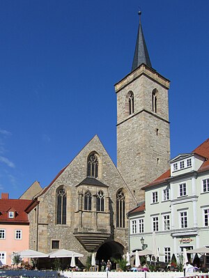
St Michael's Church, Erfurt
Church in Thuringia, Germany
Distance: Approx. 606 meters
Latitude and longitude: 50.97944444,11.02833333
St Michael's Church (German: Michaeliskirche) in the historical centre of the city of Erfurt in Thuringia, Germany, is a Gothic church building. It belongs to the Evangelische Stadtmission Erfurt and is the university church of the University of Erfurt.
St Giles' Church, Erfurt
Church in Thuringia, Germany
Distance: Approx. 686 meters
Latitude and longitude: 50.9787377,11.0316616
St Giles' Church (German: Ägidienkirche, also St. Ägidii) in the historical centre of the city of Erfurt in Thuringia, Germany, forms the eastern entrance from Wenigemarkt (Minor Market) to the Krämerbrücke (Merchants' Bridge) with its archway. The single-nave Gothic church building is one of the former two bridgehead churches.

Schottenkirche, Erfurt
Church building in Thuringia, Germany
Distance: Approx. 600 meters
Latitude and longitude: 50.97972222,11.03277778
The Schottenkirche (pronounced [ˈʃɔtn̩ˌkɪʁçə], 'Scots' Church'; also St. Nicolai und Jacobi 'St Nicholas' and James') in the historical part of the city of Erfurt in Thuringia, Germany, is a Roman Catholic church building dating back to the 12th century. The Romanesque basilica belonged to a former Celtic monastery of St James.
Weather in this IP's area
light rain
12 Celsius
12 Celsius
11 Celsius
14 Celsius
1014 hPa
94 %
1014 hPa
991 hPa
10000 meters
2.06 m/s
200 degree
07:46:03
18:15:12