217.68.201.164 - IP Lookup: Free IP Address Lookup, Postal Code Lookup, IP Location Lookup, IP ASN, Public IP
Country:
Region:
City:
Location:
Time Zone:
Postal Code:
IP information under different IP Channel
ip-api
Country
Region
City
ASN
Time Zone
ISP
Blacklist
Proxy
Latitude
Longitude
Postal
Route
Luminati
Country
ASN
Time Zone
Europe/London
ISP
Telesat International Ltd
Latitude
Longitude
Postal
IPinfo
Country
Region
City
ASN
Time Zone
ISP
Blacklist
Proxy
Latitude
Longitude
Postal
Route
IP2Location
217.68.201.164Country
Region
niederosterreich
City
stronsdorf
Time Zone
Europe/Vienna
ISP
Language
User-Agent
Latitude
Longitude
Postal
db-ip
Country
Region
City
ASN
Time Zone
ISP
Blacklist
Proxy
Latitude
Longitude
Postal
Route
ipdata
Country
Region
City
ASN
Time Zone
ISP
Blacklist
Proxy
Latitude
Longitude
Postal
Route
Popular places and events near this IP address

Mailberg
Municipality in Lower Austria, Austria
Distance: Approx. 7581 meters
Latitude and longitude: 48.66666667,16.18333333
Mailberg is a town in the district of Hollabrunn in Lower Austria, Austria. First mentioned in records in 1055, Castle Mailberg (in German: Schloss Mailberg) is owned and run by the Austrian Grand Priory of the Sovereign Military Order of Malta since 1146. It is known for its wine production and now serves as a castle hotel and as Vinothek for the local Winemakers Community "Mailberg Valley".

Nappersdorf-Kammersdorf
Municipality in Lower Austria, Austria
Distance: Approx. 4117 meters
Latitude and longitude: 48.63333333,16.23333333
Nappersdorf-Kammersdorf is a town in the district of Hollabrunn in Lower Austria, Austria.

Fallbach, Austria
Municipality in Lower Austria, Austria
Distance: Approx. 9808 meters
Latitude and longitude: 48.65,16.41666667
Fallbach is a town in the district of Mistelbach in the Austrian state of Lower Austria.
Gaubitsch
Municipality in Lower Austria, Austria
Distance: Approx. 7357 meters
Latitude and longitude: 48.65,16.38333333
Gaubitsch is a town in the district of Mistelbach in the Austrian state of Lower Austria.
Gnadendorf
Municipality in Lower Austria, Austria
Distance: Approx. 9353 meters
Latitude and longitude: 48.61666667,16.4
Gnadendorf is a town in the district of Mistelbach in the Austrian state of Lower Austria.

Großharras
Municipality in Lower Austria, Austria
Distance: Approx. 3072 meters
Latitude and longitude: 48.66666667,16.25
Großharras is a town in the district of Mistelbach in the Austrian state of Lower Austria.

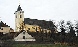
Stronsdorf
Municipality in Lower Austria, Austria
Distance: Approx. 1228 meters
Latitude and longitude: 48.65,16.3
Stronsdorf is a town in the district of Mistelbach in the Austrian state of Lower Austria.

Unterstinkenbrunn
Municipality in Lower Austria, Austria
Distance: Approx. 5244 meters
Latitude and longitude: 48.66666667,16.35
Unterstinkenbrunn is a town in the district of Mistelbach in the Austrian state of Lower Austria.

Battle of Mailberg
Distance: Approx. 7581 meters
Latitude and longitude: 48.66666667,16.18333333
The Battle of Mailberg took place on 12 May 1082. The opponents were Vratislaus II of Bohemia (Czech: Vratislav II.) and Leopold II, Margrave of Austria (German: Luitpold II).
Weather in this IP's area
broken clouds
2 Celsius
-2 Celsius
1 Celsius
2 Celsius
1040 hPa
69 %
1040 hPa
1011 hPa
10000 meters
3.75 m/s
5.81 m/s
13 degree
73 %

