217.66.226.211 - IP Lookup: Free IP Address Lookup, Postal Code Lookup, IP Location Lookup, IP ASN, Public IP
Country:
Region:
City:
Location:
Time Zone:
Postal Code:
IP information under different IP Channel
ip-api
Country
Region
City
ASN
Time Zone
ISP
Blacklist
Proxy
Latitude
Longitude
Postal
Route
Luminati
Country
Region
rbh
City
ramallah
ASN
Time Zone
Asia/Hebron
ISP
Palestine Telecommunications Company (PALTEL)
Latitude
Longitude
Postal
IPinfo
Country
Region
City
ASN
Time Zone
ISP
Blacklist
Proxy
Latitude
Longitude
Postal
Route
IP2Location
217.66.226.211Country
Region
gaza
City
gaza
Time Zone
Asia/Gaza
ISP
Language
User-Agent
Latitude
Longitude
Postal
db-ip
Country
Region
City
ASN
Time Zone
ISP
Blacklist
Proxy
Latitude
Longitude
Postal
Route
ipdata
Country
Region
City
ASN
Time Zone
ISP
Blacklist
Proxy
Latitude
Longitude
Postal
Route
Popular places and events near this IP address

Great Mosque of Gaza
Mosque in Gaza, Palestine
Distance: Approx. 506 meters
Latitude and longitude: 31.50420278,34.46446667
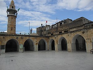
The Great Mosque of Gaza, also known as the Great Omari Mosque, was the largest and oldest mosque in all of Gaza, Palestine, located in Gaza City. Believed to stand on the site of an ancient Philistine temple, the site was used by the Byzantines to erect a church in the 5th century. After the Rashidun conquest in the 7th century, it was transformed into a mosque.
Katib al-Wilaya Mosque
Mosque in Gaza City, Palestine
Distance: Approx. 589 meters
Latitude and longitude: 31.5039,34.4623
Katib al-Wilaya Mosque or Welayat Mosque (Arabic: جامع الولايات) was a small historic mosque located along Omar Mukhtar Street in Gaza City in the Zaytun Quarter of the Old City. The mosque was built by the Burji Mamluks in 1432, however, the structure could date further back to 1344. Additions to the western part of the mosque were commissioned in 1584 by Ahmed Bey, the Ottoman clerk of the Damascus Vilayet (Province of Damascus).

Qasr al-Basha
Museum in Gaza City, Palestine
Distance: Approx. 494 meters
Latitude and longitude: 31.50441667,34.46596667
Qasr al-Basha (Arabic: قصر الباشا), also Pasha's Palace Museum, Radwan Castle, and Napoleon's Fort, is a historic building in the Old City of Gaza, now housing a museum. It served as a seat of power in the Mamluk and Ottoman periods and as a police station during the British Mandate.

Church of Saint Porphyrius
Church in Gaza City, Palestine
Distance: Approx. 556 meters
Latitude and longitude: 31.5033,34.4621
The Church of Saint Porphyrius (Greek: Εκκλησία του Αγίου Πορφυρίου, romanized: Ekklisía tou Agíou Porfyríou, IPA: [e.kliˈsi.a tu aˈʝi.u por.fiˈri.u]; Arabic: كَنِيسَة الْقِدِّيس بُرْفِيرْيُوس, romanized: Kanīsat al-Qiddīs Burfīryūs) is a Greek Orthodox church in Gaza City, State of Palestine. It belongs to the Greek Orthodox Patriarchate of Jerusalem and is the oldest active church in the city. Located in the Zaytun Quarter of the Old City of Gaza, it is named after the 5th-century bishop of Gaza, Saint Porphyrius, whose tomb is situated in the northeastern corner of the church.
Ibn Marwan Mosque
Mosque in Gaza City, Palestine
Distance: Approx. 521 meters
Latitude and longitude: 31.504164,34.469014
The Ibn Marwan Mosque (Arabic: جامع ابن مروان, transl: Jami' Ibn Marwan) is a Mamluk-era mosque in Gaza, Palestine in the midst of a cemetery in the Tuffah neighborhood, relatively isolated from the rest of the city. Inside is the tomb of a holy man named Sheikh Ali ibn Marwan who belonged to the Hasani family. The Hasani family came from Morocco and settled in Gaza where Ibn Marwan died in 1314 CE. The cemetery is also named after Ibn Marwan.

Ibn Uthman Mosque
Mosque in Gaza City, Gaza Strip, Palestine
Distance: Approx. 273 meters
Latitude and longitude: 31.499889,34.469375
The Ibn Uthman Mosque (Arabic: مسجد ابن عثمان Jami Ibn 'Uthman) is a ruined mosque in Gaza City, in the Gaza Strip, Palestine. It is regarded as second only to the Great Mosque of Gaza in terms of beauty and status as a Friday mosque. Noted for its architectural patterns, the mosque was established in three different stages during the Burji Mamluk period of rule in Gaza.
Palestine Square
City square in Gaza City, Palestine
Distance: Approx. 821 meters
Latitude and longitude: 31.50611111,34.46166667
Palestine Square (Arabic: ميدان فلسطين, romanized: Mīdān Falastīn), also known as Al-Saha or As-Saha (Arabic: الساحة, "the (community) space" or "the square"), is a city square in east-central Gaza City, State of Palestine, in between Jamal Abdel Nasser Street and Omar Mukhtar Street. It is the location of a bus station, a taxi station, a fruit market, a hospital, and dozens of small shops and vendors. Gaza's municipal headquarters is also located in the square.
Mahkamah Mosque
Mosque in Gaza City, Palestine
Distance: Approx. 374 meters
Latitude and longitude: 31.50193889,34.46971944
The Mahkamah Mosque (also known as Mosque of Birdibak or Madrasa of Amir Bardabak; Arabic transliteration: Jāmi' al-Mahkamah al-Birdibakiyyah) was a congregational mosque and madrasa, built in 1455, destroyed by Israeli bombing during the 2014 Gaza War. The mosque was located along Baghdad Street near the main western entrance of the Shuja'iyya district in Gaza City, Palestine.

Al-Ahli Arab Hospital explosion
2023 deadly explosion in the Gaza Strip
Distance: Approx. 713 meters
Latitude and longitude: 31.50488889,34.46163889
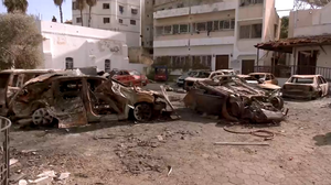
On 17 October 2023, an explosion took place in a courtyard of al-Ahli Arab Hospital in Gaza City during the Israel–Hamas war, resulting in a large number of displaced Palestinians seeking shelter there being killed or injured. International media initially reported that over 500 Palestinians were killed according to the Gaza Health Ministry, but this was a mistranslation of a report that had mentioned over 500 total victims, including injured. The Gaza Health Ministry later reported a more precise figure of 471 killed and 342 wounded.
Al-Ahli Arab Hospital
Hospital in Gaza City, Palestine
Distance: Approx. 723 meters
Latitude and longitude: 31.5049,34.4615
Al-Ahli Arab Hospital (Arabic: المستشفى الأهلي العربي, lit. 'The Arab People's Hospital') is a hospital in the Gaza Strip. Its headquarters are located in the Zeitoun neighborhood in the south of Gaza City, and it is managed by the Episcopal Church in Jerusalem. Founded in 1882, it is one of the oldest hospitals in the city and the only Christian hospital in Gaza.

Church of Saint Porphyrius airstrike
2023 bombing of a church in Gaza City, Palestine
Distance: Approx. 556 meters
Latitude and longitude: 31.5033,34.4621
On 19 October 2023, part of the Church of Saint Porphyrius, a Greek Orthodox church in Gaza City, in the Israeli-occupied Palestinian territories, was damaged during an Israeli aistrike, killing at least 18 Palestinian civilians during the 2023 Israel–Hamas war. Over 450 Christian and Muslim Palestinian residents of the Gaza Strip had been sheltering there. According to the Israeli military the explosion resulted from one of its airstrikes, which had targeted a nearby Hamas command post.

Old City of Gaza
Historical city center of Gaza, Palestine
Distance: Approx. 478 meters
Latitude and longitude: 31.50333333,34.46333333
The Old City of Gaza is the historical center of Gaza City, in the Gaza Strip. For much of recorded history it has been the southernmost coastal city in the region of Palestine, occupying a strategic position on ancient trade route of the Via Maris, between Egypt and the Levant. Throughout its history, Gaza has been ruled by various empires, including the Philistines, Egyptians, Assyrians, Babylonians, Romans, and Ottomans.
Weather in this IP's area
scattered clouds
16 Celsius
16 Celsius
16 Celsius
16 Celsius
1016 hPa
56 %
1016 hPa
1011 hPa
10000 meters
6.13 m/s
8.34 m/s
237 degree
29 %