Country:
 Italy
ItalyRegion:
City:
Latitude and Longitude:
Time Zone:
Postal Code:
IP information under different IP Channel
ip-api
Country
Region
City
ASN
Time Zone
ISP
Blacklist
Proxy
Latitude
Longitude
Postal
Route
IPinfo
Country
Region
City
ASN
Time Zone
ISP
Blacklist
Proxy
Latitude
Longitude
Postal
Route
MaxMind
Country
Region
City
ASN
Time Zone
ISP
Blacklist
Proxy
Latitude
Longitude
Postal
Route
Luminati
Country
ITRegion
62
City
frosinone
ASN
Time Zone
Europe/Rome
ISP
SEEWEB s.r.l.
Latitude
Longitude
Postal
db-ip
Country
Region
City
ASN
Time Zone
ISP
Blacklist
Proxy
Latitude
Longitude
Postal
Route
ipdata
Country
Region
City
ASN
Time Zone
ISP
Blacklist
Proxy
Latitude
Longitude
Postal
Route
Popular places and events near this IP address
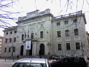
Province of Frosinone
Province of Italy
Distance: Approx. 708 meters
Latitude and longitude: 41.63333333,13.35
The province of Frosinone (Italian: provincia di Frosinone) is a province in the Lazio region of Italy. Its capital is the city of Frosinone. It has an area of 3,247 square kilometres (1,254 sq mi) and a total population of 493,605 (2016).

Ferentino
Comune in Lazio, Italy
Distance: Approx. 9444 meters
Latitude and longitude: 41.68333333,13.25
Ferentino is a town and comune in Italy, in the province of Frosinone, Lazio, 65 kilometres (40 mi) southeast of Rome. It is situated on a hill 400 metres (1,312 feet) above sea level, in the Monti Ernici area.

Stadio Matusa
Distance: Approx. 537 meters
Latitude and longitude: 41.63777778,13.34305556
Stadio Comunale Matusa was a multi-use stadium in Frosinone, Italy. It was used mostly for football matches and was the home ground of Frosinone Calcio — replaced by Stadio Benito Stirpe. The stadium holds 10,000.

Pofi
Comune in Lazio, Italy
Distance: Approx. 9687 meters
Latitude and longitude: 41.56666667,13.41666667
Pofi is a comune (municipality) of about 4,200 inhabitants in the province of Frosinone in the Italian region Lazio, located about 80 kilometres (50 mi) southeast of Rome and about 9 kilometres (6 mi) southeast of Frosinone. Pofi borders the following municipalities: Arnara, Castro dei Volsci, Ceccano, Ceprano, Ripi. It is located on an extinct volcano, near the Sacco river valley.

Ripi
Comune in Lazio, Italy
Distance: Approx. 7858 meters
Latitude and longitude: 41.61666667,13.43333333
Ripi is a comune (municipality) in the Province of Frosinone in the Italian region Lazio, located about 80 kilometres (50 mi) southeast of Rome and about 7 kilometres (4 mi) east of Frosinone. Ripi borders the following municipalities: Arnara, Boville Ernica, Ceprano, Pofi, Strangolagalli, Torrice, Veroli.
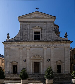
Roman Catholic Diocese of Frosinone-Veroli-Ferentino
Latin Catholic ecclesiastical jurisdiction in Italy
Distance: Approx. 708 meters
Latitude and longitude: 41.63333333,13.35
The Diocese of Frosinone-Veroli-Ferentino (Latin: Dioecesis Frusinatensis-Verulana-Ferentina) is a Latin Church ecclesiastical territory or diocese of the Catholic Church in Italy. It has existed since 1986. In that year, the Diocese of Ferentino was united into the Diocese of Veroli-Frosinone, which was the name of the historic Diocese of Veroli from 1956.
Sant'Erasmo, Veroli
Distance: Approx. 9249 meters
Latitude and longitude: 41.692978,13.418602
Sant'Erasmo is a Romanesque architecture, Roman Catholic church and convent located on Via Garibaldi in the town of Veroli, province of Frosinone, region of Lazio, Italy.
San Paolo Apostolo, Veroli
Distance: Approx. 8886 meters
Latitude and longitude: 41.689143,13.417579
San Paolo Apostolo is a Romanesque architecture, Roman Catholic church and convent located on Via Cavour in the town of Veroli, province of Frosinone, region of Lazio, Italy.
Accademia di Belle Arti di Frosinone
Fine arts school in Frosinone, Italy
Distance: Approx. 984 meters
Latitude and longitude: 41.64005,13.3488
The Accademia di Belle Arti di Frosinone is an academy of Fine arts located in Frosinone, Italy. It was founded in 1973.

Stadio Benito Stirpe
Football stadium in Frosinone, Italy
Distance: Approx. 1631 meters
Latitude and longitude: 41.63416667,13.32194444
The Stadio Benito Stirpe (also known as Stadio Casaleno), is an all-seater football stadium in the Italian city of Frosinone, Lazio. Designed in the mid-1970s and built in the second half of the 1980s, the stadium remained unfinished for about thirty years. The stadium was completed between 2015 and 2017 on the initiative of local football team Frosinone Calcio, who won a lease for the stadium from the local council for 90 years, in order to replace the old municipal stadium.
Weather in this IP's area
broken clouds
31 Celsius
33 Celsius
29 Celsius
33 Celsius
1012 hPa
49 %
1012 hPa
991 hPa
10000 meters
3.45 m/s
3.92 m/s
190 degree
79 %
06:40:08
19:28:42