Country:
 Canada
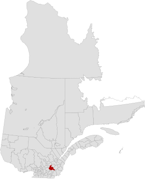
Region:
City:
Latitude and Longitude:
Time Zone:
Postal Code:
IP information under different IP Channel
ip-api
Country
Region
City
ASN
Time Zone
ISP
Blacklist
Proxy
Latitude
Longitude
Postal
Route
IPinfo
Country
Region
City
ASN
Time Zone
ISP
Blacklist
Proxy
Latitude
Longitude
Postal
Route
MaxMind
Country
Region
City
ASN
Time Zone
ISP
Blacklist
Proxy
Latitude
Longitude
Postal
Route
Luminati
Country
CARegion
qc
City
sherbrooke
ASN
Time Zone
America/Toronto
ISP
OXIO-ASN-01
Latitude
Longitude
Postal
db-ip
Country
Region
City
ASN
Time Zone
ISP
Blacklist
Proxy
Latitude
Longitude
Postal
Route
ipdata
Country
Region
City
ASN
Time Zone
ISP
Blacklist
Proxy
Latitude
Longitude
Postal
Route
Popular places and events near this IP address
Arthabaska Regional County Municipality
Regional county municipality in Quebec, Canada
Distance: Approx. 7627 meters
Latitude and longitude: 45.91666667,-72.08333333
Arthabaska Regional County Municipality is a regional county municipality located in the Centre-du-Québec region of Quebec. Its seat is Victoriaville.

Kingsey Falls
City in Quebec, Canada
Distance: Approx. 96 meters
Latitude and longitude: 45.85,-72.06666667
Kingsey Falls, Quebec is a town in Centre-du-Québec, Quebec, Canada, with a population of 1,946 at the 2016 census. It is 30 km east of Drummondville and west of Route 116. One of the largest employers in the community is Cascades, which is headquartered there.

Danville, Quebec
City in Quebec, Canada
Distance: Approx. 8278 meters
Latitude and longitude: 45.78333333,-72.01666667
Danville is a city in the administrative region of Estrie, in the Canadian province of Quebec. As of the 2016 Canadian Census, the population was 3,836.

Sainte-Élizabeth-de-Warwick, Quebec
Municipality in Quebec, Canada
Distance: Approx. 7627 meters
Latitude and longitude: 45.91666667,-72.08333333
Sainte-Élizabeth-de-Warwick is a municipality located in the Centre-du-Québec region of Quebec, Canada. Before February 2, 2008, the name was spelled Sainte-Élisabeth-de-Warwick.
Drummond–Bois-Francs
Provincial electoral district in Quebec, Canada
Distance: Approx. 7837 meters
Latitude and longitude: 45.919,-72.053
Drummond–Bois-Francs is a provincial electoral district in the Centre-du-Québec region of Quebec, Canada, that elects members to the National Assembly of Quebec. It notably includes parts of the city of Drummondville as well as Saint-Cyrille-de-Wendover, Warwick, Kingsey Falls and Saint-Lucien It was created for the 2012 election from parts of the former Drummond and Richmond electoral districts.
Landry River (Nicolet Southwest River tributary)
River in Estrie, Quebec, Canada
Distance: Approx. 5986 meters
Latitude and longitude: 45.80361,-72.02528
The Landry River (in French: rivière Landry) is a tributary on the south shore of the Nicolet Southwest River. It crosses the municipalities of Cleveland (MRC Le Val-Saint-François Regional County Municipality) and Danville (MRC Les Sources Regional County Municipality), in the administrative region of Estrie, in Quebec, in Canada.
Weather in this IP's area
overcast clouds
16 Celsius
16 Celsius
15 Celsius
17 Celsius
1018 hPa
87 %
1018 hPa
1004 hPa
10000 meters
1.32 m/s
1.26 m/s
147 degree
100 %
06:30:50
18:53:47