Country:
Region:
City:
Latitude and Longitude:
Time Zone:
Postal Code:
IP information under different IP Channel
ip-api
Country
Region
City
ASN
Time Zone
ISP
Blacklist
Proxy
Latitude
Longitude
Postal
Route
Luminati
Country
Region
qc
City
sherbrooke
ASN
Time Zone
America/Toronto
ISP
OXIO-ASN-01
Latitude
Longitude
Postal
IPinfo
Country
Region
City
ASN
Time Zone
ISP
Blacklist
Proxy
Latitude
Longitude
Postal
Route
db-ip
Country
Region
City
ASN
Time Zone
ISP
Blacklist
Proxy
Latitude
Longitude
Postal
Route
ipdata
Country
Region
City
ASN
Time Zone
ISP
Blacklist
Proxy
Latitude
Longitude
Postal
Route
Popular places and events near this IP address

Cap-de-la-Madeleine
Trois-Rivières in Quebec, Canada
Distance: Approx. 3622 meters
Latitude and longitude: 46.36666667,-72.5
Cap-de-la-Madeleine is a former city in Quebec, Canada at the confluence of the Saint-Maurice River and the St. Lawrence River. It was amalgamated into the City of Trois-Rivières in 2002.

Saint-Maurice River
River in Quebec, Canada
Distance: Approx. 4574 meters
Latitude and longitude: 46.34861111,-72.52777778
The Saint-Maurice River, or the Saint-Maurice River, is one of the main tributaries of the St. Lawrence River, after the Ottawa and the Saguenay Rivers and drains an area of 42,735 km2. It touches the Lake Saint John watershed to the north; the Nottaway River watershed, a major tributary of James Bay, to the northwest; and the southwestern tributaries of the Ottawa River.

Battle of Trois-Rivières
Battle of the American Revolutionary War
Distance: Approx. 4574 meters
Latitude and longitude: 46.35,-72.55
The Battle of Trois-Rivières was fought on June 8, 1776, during the American Revolutionary War. A British army under Quebec Governor Guy Carleton defeated an attempt by units from the Continental Army under the command of Brigadier General William Thompson to stop a British advance up the Saint Lawrence River valley. The battle occurred as a part of the American colonists' invasion of Quebec, which had begun in September 1775 with the goal of removing the province from British rule.
Three Rivers and St. Maurice
Federal electoral district in Quebec, Canada
Distance: Approx. 2832 meters
Latitude and longitude: 46.4,-72.5
Three Rivers and St. Maurice (French: Trois-Rivières-et-Saint-Maurice; also known as Three Rivers—St. Maurice) was a federal electoral district in Quebec, Canada, that was represented in the House of Commons of Canada from 1892 to 1935.

Notre-Dame-du-Cap Basilica
Church in Quebec, Canada
Distance: Approx. 3659 meters
Latitude and longitude: 46.36805556,-72.4975
The Basilica of Notre-Dame-du-Cap is a minor basilica in Trois-Rivières, Quebec, Canada. It is Canada's national shrine to the Blessed Virgin Mary, and one of the country's six national shrines. Each year, the site is visited by thousands of Catholic pilgrims.
Sainte-Marthe-du-Cap
Distance: Approx. 3513 meters
Latitude and longitude: 46.37675,-72.49175
Sainte-Marthe-du-Cap is a former city in Quebec, Canada on the St. Lawrence River. It was amalgamated into the City of Trois-Rivières in 2002.
Three Rivers Academy
High school in Trois-Rivières, Quebec, Canada
Distance: Approx. 3479 meters
Latitude and longitude: 46.359872,-72.548003
The Three Rivers Academy is an English-language high school in Trois-Rivières, Quebec, Canada. It was created from the amalgamation of St. Patrick's High School and Three Rivers High School.

Our Lady of the Cape
Distance: Approx. 3659 meters
Latitude and longitude: 46.36805556,-72.4975
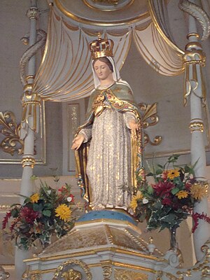
Our Lady of the Cape (Notre-Dame-du-Cap in French) is a title given to Mary the Mother of God in Cap-de-la-Madeleine, Quebec Canada. The title refers specifically to a statue of the Blessed Mother which is currently located in the Old Shrine.
Cégep de Trois-Rivières
Public college in Trois-Rivière, Quebec
Distance: Approx. 4388 meters
Latitude and longitude: 46.358056,-72.568056
Cégep de Trois-Rivières is a French-language College of general and vocational education (CEGEP) in Trois-Rivières, Quebec, Canada. It is located at 3500 rue De Courval. It was established in 1968.
CFCQ-FM
Former radio station in Quebec, Canada
Distance: Approx. 3317 meters
Latitude and longitude: 46.361,-72.521
CFCQ-FM was an educational radio station which operated on 93.9 MHz/FM in Trois-Rivières, Quebec, Canada. The station broadcast with an effective radiated power of 28,800 watts. Owned by Téléduc Inc., the actual sign-on date of CFCQ-FM is currently unknown.
Saint-Quentin Island
Distance: Approx. 4145 meters
Latitude and longitude: 46.3525,-72.5275
Saint-Quentin Island lies at the confluence of the Saint-Maurice River and Saint Lawrence River in the city of Trois-Rivières, Quebec, Canada. The island, along with Saint-Christophe and De La Poterie islands, are each named after one of the three channels formed by the Saint-Maurice River at its mouth with the St. Lawrence, where it flows between two islands.
Île Saint-Christophe (Canada)
Distance: Approx. 3178 meters
Latitude and longitude: 46.361,-72.536
Île Saint-Christophe is a small island adjacent to Saint-Quentin Island in the Saint-Maurice River at its confluence with the Saint Lawrence River in the city of Trois-Rivières, Quebec, Canada. The island is home to HMCS Radisson, a Canadian Forces Naval Reserve Division.
Weather in this IP's area
light rain
12 Celsius
10 Celsius
10 Celsius
12 Celsius
1003 hPa
50 %
1003 hPa
999 hPa
10000 meters
7.72 m/s
14.4 m/s
270 degree
75 %
06:42:21
16:25:34