217.199.224.137 - IP Lookup: Free IP Address Lookup, Postal Code Lookup, IP Location Lookup, IP ASN, Public IP
Country:
Region:
City:
Location:
Time Zone:
Postal Code:
IP information under different IP Channel
ip-api
Country
Region
City
ASN
Time Zone
ISP
Blacklist
Proxy
Latitude
Longitude
Postal
Route
Luminati
Country
ASN
Time Zone
Europe/Moscow
ISP
Kompeatelecom Ltd.
Latitude
Longitude
Postal
IPinfo
Country
Region
City
ASN
Time Zone
ISP
Blacklist
Proxy
Latitude
Longitude
Postal
Route
IP2Location
217.199.224.137Country
Region
rostovskaya oblast'
City
donetsk
Time Zone
Europe/Moscow
ISP
Language
User-Agent
Latitude
Longitude
Postal
db-ip
Country
Region
City
ASN
Time Zone
ISP
Blacklist
Proxy
Latitude
Longitude
Postal
Route
ipdata
Country
Region
City
ASN
Time Zone
ISP
Blacklist
Proxy
Latitude
Longitude
Postal
Route
Popular places and events near this IP address

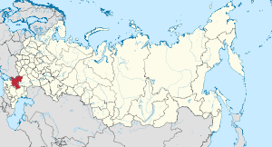
Donetsk, Rostov Oblast
Town in Rostov Oblast, Russia
Distance: Approx. 1064 meters
Latitude and longitude: 48.33333333,39.93333333
Donetsk (Russian: Донецк) is a town in Rostov Oblast, Russia, located on the Seversky Donets River on the border with Ukraine. By road it is located 388 kilometres (241 mi) west of Volgograd. Population: 50,098 (2010 Census); 48,040 (2002 Census); 48,673 (1989 Soviet census); 38,000 (1970).

Shelling of Donetsk, Rostov Oblast
Distance: Approx. 1064 meters
Latitude and longitude: 48.33333333,39.93333333
On 13 July 2014, mortar shells fired from Ukrainian territory landed in the courtyard of a private home in the border town of Donetsk. The shelling killed one civilian and injured two others.
Izvaryne
Urban locality in Luhansk Oblast, Ukraine
Distance: Approx. 6552 meters
Latitude and longitude: 48.2875,39.89305556
Izvaryne (Ukrainian: Ізварине; Russian: Изварино, romanized: Izvarino) is a rural settlement located on the E40 highway in Sorokyne urban hromada, Dovzhansk Raion (district) of Luhansk Oblast in Ukraine. It is also an important road and railway crossing point on the Ukrainian side of the Russia–Ukraine border. There are facilities at the crossing for motorcars, lorries, and trains.
Izvaryne-Donetsk
Border crossing between Russia and Ukraine
Distance: Approx. 6552 meters
Latitude and longitude: 48.2875,39.89305556
Izvaryne-Donetsk is a land border crossing between Ukraine and Russia, on autoroute E40 (Ukraine M 04) in the Donbas region. On the Ukrainian side, it is in the town of Izvaryne in Krasnodon city municipality, within Luhansk Oblast. On the Russian side it is in the city of Donetsk within Rostov Oblast.
Izvaryne railway station
Railway station in Ukraine
Distance: Approx. 7155 meters
Latitude and longitude: 48.28125,39.89205556
Izvaryne (Ukrainian: Ізварине) is a railway station that is located in a town of Izvaryne, Krasnodon city, Luhansk Oblast in Ukraine. It is part of the Luhansk administration (Donetsk Railways). The station is an important transportation gateway to Ukraine.

Donetsk Museum of History and Ethnography
Museum in Donetsk, Rostov, Russia
Distance: Approx. 331 meters
Latitude and longitude: 48.336,39.9447
The Donetsk Museum of History and Ethnography was opened in August 2005. It is devoted to the 50th anniversary of Donetsk. In 1955, It received its modern name in relation to the location on the Seversky Donets River.
Bilenke, Luhansk Oblast
Village in Luhansk Oblast, Ukraine
Distance: Approx. 4198 meters
Latitude and longitude: 48.35333333,39.89916667
Bilenke (Ukrainian: Біленьке) is a village in Sorokyne urban hromada, Dovzhansk Raion, Luhansk Oblast (province) of Ukraine.
Prykordonne, Luhansk Oblast
Urban locality in Luhansk Oblast, Ukraine
Distance: Approx. 4428 meters
Latitude and longitude: 48.29583333,39.96555556
Prykordonne (Ukrainian: Прикордонне), formerly known as Krasnodarskyi (Краснодарський) is a rural settlement in Sorokyne urban hromada, Dovzhansk Raion (district) of Luhansk Oblast in Ukraine. Population: 325 (2022 estimate) On 19 September 2024, the Verkhovna Rada voted to rename Krasnodarskyi to Prykordonne.
Sievernyi
Urban locality in Luhansk Oblast, Ukraine
Distance: Approx. 3155 meters
Latitude and longitude: 48.35666667,39.9225
Sievernyi (Ukrainian: Сєверний) is a rural settlement in Sorokyne urban hromada, Dovzhansk Raion (district) of Luhansk Oblast in Ukraine. As of the 2022 estimation, the population of Sievernyi is 1,814.
Sievero-Hundorivskyi
Urban locality in Luhansk Oblast, Ukraine
Distance: Approx. 6218 meters
Latitude and longitude: 48.36972222,39.88333333
Sievero-Hundorivskyi (Ukrainian: Сєверо-Гундорівський) is a rural settlement in Sorokyne urban hromada, Dovzhansk Raion (district) of Luhansk Oblast in Ukraine.
Weather in this IP's area
overcast clouds
1 Celsius
-4 Celsius
1 Celsius
1 Celsius
1031 hPa
87 %
1031 hPa
1015 hPa
10000 meters
6.14 m/s
9.43 m/s
72 degree
100 %