Country:
Region:
City:
Latitude and Longitude:
Time Zone:
Postal Code:
IP information under different IP Channel
ip-api
Country
Region
City
ASN
Time Zone
ISP
Blacklist
Proxy
Latitude
Longitude
Postal
Route
Luminati
Country
Region
an
City
varnita
ASN
Time Zone
Europe/Chisinau
ISP
INTERDNESTRKOM, Sovmestnoe Zakrytoe Aktsionernoe Obshchestvo
Latitude
Longitude
Postal
IPinfo
Country
Region
City
ASN
Time Zone
ISP
Blacklist
Proxy
Latitude
Longitude
Postal
Route
db-ip
Country
Region
City
ASN
Time Zone
ISP
Blacklist
Proxy
Latitude
Longitude
Postal
Route
ipdata
Country
Region
City
ASN
Time Zone
ISP
Blacklist
Proxy
Latitude
Longitude
Postal
Route
Popular places and events near this IP address
Bender, Moldova
Municipality in Transnistria, Moldova
Distance: Approx. 3731 meters
Latitude and longitude: 46.83333333,29.48333333
Bender ([benˈder], Moldovan Cyrillic: Бендер) or Bendery (Russian: Бендеры, [bʲɪnˈdɛrɨ]; Ukrainian: Бендери), also known as Tighina (Moldovan Cyrillic: Тигина), is a city within the internationally recognized borders of Moldova under de facto control of the unrecognized Pridnestrovian Moldavian Republic (Transnistria) (PMR) since 1992. It is located on the western bank of the river Dniester in the historical region of Bessarabia. Together with its suburb Proteagailovca, the city forms a municipality, which is separate from Transnistria (as an administrative unit of Moldova) according to Moldovan law.
Malaya Sportivnaya Arena
Distance: Approx. 7812 meters
Latitude and longitude: 46.8404,29.5579
Malaya Sportivnaya Arena (literally Small Sports Arena) is a multi-use stadium in Tiraspol, Moldova. It is currently used mostly for football matches, and hosts FC Sheriff Tiraspol's reserve team games, as well as some FC Dinamo Bender and FC Tiraspol matches. It is located in the Sheriff Sports Complex, alongside the larger Sheriff Stadium, where the Sheriff Tiraspol senior team plays.

Bîc
Right tributary of the Dniester
Distance: Approx. 5423 meters
Latitude and longitude: 46.91166667,29.46638889
Bîc (also spelled Bâc, pronunciation: [bɨk]) is a river in Moldova, a right tributary of the Dniester.

Skirmish at Bender
Part of the Great Northern War (1713)
Distance: Approx. 3731 meters
Latitude and longitude: 46.83333333,29.48333333
The Skirmish at Bender (Swedish: Kalabaliken i Bender; Finnish: Benderin kalabaliikki) was devised to remove Charles XII of Sweden from the Ottoman Empire after his military defeats in Russia. It took place on 1 February 1713 on Ottoman territory, in what is now the town of Bender, Moldova (separatist region/country of Transnistria).

Parcani, Transnistria
Commune in Transnistria, Moldova
Distance: Approx. 4697 meters
Latitude and longitude: 46.83666667,29.50888889
Parcani (Moldovan Cyrillic: Паркань; Bulgarian: Паркани, Parkani; Ukrainian: Паркани, Parkany; Russian: Парка́ны, Parkany) is a large commune and village in the Slobozia District of Transnistria, a de facto independent entity within the internationally recognized borders of Moldova. The village has a population of around 10,500, of whom 95% are ethnic Bulgarians (Bessarabian Bulgarians). The first Bulgarian colonists arrived in the village in the early 19th century.
Proteagailovca
Village in Bender municipality, Moldova
Distance: Approx. 5234 meters
Latitude and longitude: 46.81666667,29.45
Proteagailovca (Moldovan Cyrillic and Russian: Протягайловка, romanized: Protyagaylovka; Ukrainian: Протягайлівка, romanized: Protyagaylivka) is a village in the municipality of Bender (Tighina), Moldova. It had a population of 3,142 at the 2004 Census. The locality, although situated on the right (western) bank of the river Dniester, is under the control of the breakaway Transnistrian authorities.
Calfa
Commune in Anenii Noi District, Moldova
Distance: Approx. 7184 meters
Latitude and longitude: 46.9,29.38333333
Calfa is a commune in the Anenii Noi District of the Republic of Moldova. It is composed of two villages, Calfa and Calfa Nouă.
Gura Bîcului
Commune and village in Anenii Noi District, Moldova
Distance: Approx. 7831 meters
Latitude and longitude: 46.93333333,29.46666667
Gura Bîcului is a commune and village in the Anenii Noi District of the Republic of Moldova. The Gura Bîcului bridge on the Dniester river was blown up on 5 May 1992 during the Transnistria War. It was later rebuilt by the Organization for Security and Co-operation in Europe, using European Union funds, as part of the so-called Berlin Plus package.
Dinamo Stadium (Bender)
Distance: Approx. 5223 meters
Latitude and longitude: 46.81741667,29.47644444
Stadionul Dinamo (Russian: Стадион «Динамо») is a football stadium in Bender, Moldova. It is the home ground of FC Tighina. In addition to Tighina, FC Florești have also used the stadium as a home ground.
Bîcioc
Commune in Transnistria, Moldova
Distance: Approx. 6205 meters
Latitude and longitude: 46.91666667,29.48333333
Bîcioc (Moldovan Cyrillic and Russian: Бычок, romanized: Bychok, Ukrainian: Бичок, romanized: Bychok) is a commune in the Grigoriopol District of Transnistria, Moldova. It is composed of two villages, Bîcioc and Novovladimirovca (Нововладимировка). It is currently under the administration of the breakaway government of the Transnistrian Moldovan Republic.

Transfiguration Cathedral, Bender
Church in Transnistria, Moldova
Distance: Approx. 4661 meters
Latitude and longitude: 46.8239,29.4823
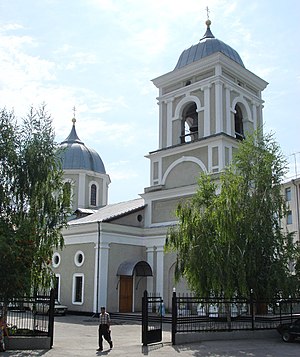
The Transfiguration Cathedral (Romanian: Catedrala Schimbarea la Față din Tighina) (Russian: Преображенский кафедральный собор) is the name given to a Russian Orthodox church in the Diocese of Tiraspol and Dubossary, Bender, a town controlled by Transnistria, de facto independent territory of Moldova. Its history dates back to 1814 when working on the expansion of local strength. It was built between 1815 and 1820 to constitute a symbol of liberation from Ottoman Turkish rule place.

Tighina Fortress
Distance: Approx. 3442 meters
Latitude and longitude: 46.8381,29.4874
The Bendery Fortress (Romanian: Cetatea Tighina; renamed by the Turks as Bender) is a 15th-century fortress on the right bank of the Dniester River in Bender, Moldova, built from earth and wood during the reign of Prince Stephen the Great. In 1538 it was conquered by the Turkish sultan Suleiman the Magnificent, who ordered it to be rebuilt in stone and enlarged.
Weather in this IP's area
broken clouds
9 Celsius
8 Celsius
9 Celsius
9 Celsius
1012 hPa
47 %
1012 hPa
999 hPa
10000 meters
2.48 m/s
3.16 m/s
359 degree
78 %
07:09:49
16:25:14
