217.173.135.222 - IP Lookup: Free IP Address Lookup, Postal Code Lookup, IP Location Lookup, IP ASN, Public IP
Country:
Region:
City:
Location:
Time Zone:
Postal Code:
ISP:
ASN:
language:
User-Agent:
Proxy IP:
Blacklist:
IP information under different IP Channel
ip-api
Country
Region
City
ASN
Time Zone
ISP
Blacklist
Proxy
Latitude
Longitude
Postal
Route
db-ip
Country
Region
City
ASN
Time Zone
ISP
Blacklist
Proxy
Latitude
Longitude
Postal
Route
IPinfo
Country
Region
City
ASN
Time Zone
ISP
Blacklist
Proxy
Latitude
Longitude
Postal
Route
IP2Location
217.173.135.222Country
Region
sachsen
City
markkleeberg
Time Zone
Europe/Berlin
ISP
Language
User-Agent
Latitude
Longitude
Postal
ipdata
Country
Region
City
ASN
Time Zone
ISP
Blacklist
Proxy
Latitude
Longitude
Postal
Route
Popular places and events near this IP address

Markkleeberg
Town in Saxony, Germany
Distance: Approx. 933 meters
Latitude and longitude: 51.27777778,12.38333333
Markkleeberg is an affluent suburb of Leipzig, located in the Leipzig district of the Free State of Saxony, Germany. The river Pleiße runs through the city, which borders Leipzig to the north and to the west. Markkleeberg is known to be the entry point to a region of recultivated open-cast mining lakes south of Leipzig dubbed the Leipziger Neuseenland.

Markkleeberger See
Distance: Approx. 1419 meters
Latitude and longitude: 51.2668,12.40963889
Markkleeberger See is a lake in Saxony, Germany, next to Markkleeberg, a suburb on the south side of Leipzig. At an elevation of 112.5 m, its surface area is 2.52 km2. It is a former open-pit coal mine, flooded in 1999 with groundwater and developed in 2006 as a tourist area.

Kanupark Markkleeberg
Distance: Approx. 2962 meters
Latitude and longitude: 51.258,12.427
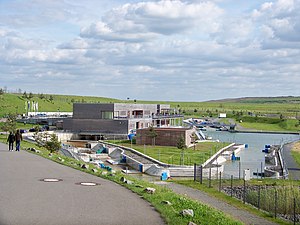
Kanupark Markkleeberg, built in 2006, is the second of two artificial whitewater canoe/kayak slalom courses in Germany, and the only one powered by pumps. The other German course is the Eiskanal in Augsburg, used in the 1972 Summer Olympic Games in Munich. Kanupark Markkleeberg is located on the southeast shore of Markkleeberger See, a lake south of Markkleeberg, a suburb on the south side of Leipzig.

Leinegraben (Leipzig)
River in Germany
Distance: Approx. 1383 meters
Latitude and longitude: 51.2878,12.388
The Leinegraben is a small river in Saxony, Germany. It flows into the Pleiße near Leipzig. It is a second-order body of water.

Leipzig-Connewitz station
Railway station in Saxony, Germany
Distance: Approx. 2739 meters
Latitude and longitude: 51.300251,12.385743
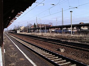
Leipzig-Connewitz is a railway station in the city of Leipzig, Germany. The station is located on the Leipzig–Hof railway and Leipzig Hbf–Leipzig-Connewitz railway. Since December 2013 the station is served by the S-Bahn Mitteldeutschland, a subsidiary of Deutsche Bahn.

Markkleeberg Nord station
Railway station in Markkleeberg, Germany
Distance: Approx. 2133 meters
Latitude and longitude: 51.288136,12.372136
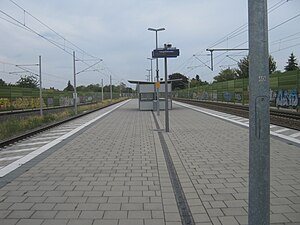
Markkleeberg Nord is a railway station in Markkleeberg, Saxony, Germany. The station is located on the Leipzig–Hof railway. The train services are operated by Deutsche Bahn.

Markkleeberg station
Railway station in Markkleeberg, Germany
Distance: Approx. 1702 meters
Latitude and longitude: 51.279117,12.37249
Markkleeberg is a railway station in Markkleeberg, Saxony, Germany. The station is located on the Leipzig–Hof railway. The train services are operated by Deutsche Bahn.

Markkleeberg-Großstädteln station
Railway station in Markkleeberg, Germany
Distance: Approx. 2127 meters
Latitude and longitude: 51.262387,12.376184
Markkleeberg-Großstädteln is a railway station in Markkleeberg, Germany. The station is located on the Leipzig–Hof railway. The train services are operated by Deutsche Bahn.
Markkleeberg-Gaschwitz station
Railway halt in Markkleeberg, Germany
Distance: Approx. 3192 meters
Latitude and longitude: 51.250118,12.379027
Markkleeberg-Gaschwitz is a railway station in Markkleeberg, Germany. The station is located on the Leipzig–Hof railway and the Leipzig-Plagwitz–Markkleeberg-Gaschwitz railway. The train services are operated by Deutsche Bahn.

Rundling (Leipzig)
Housing estate in Leipzig, Germany
Distance: Approx. 2194 meters
Latitude and longitude: 51.296214,12.393511
The Rundling, also called "Nibelungensiedlung", is a circular housing estate in the southern part of Leipzig in the Lößnig neighborhood. At a time of great housing shortage, the housing complex was built in 1929/30 by the Leipzig architect and city planning officer Hubert Ritter. Ritter built 24 houses in a row construction on a flat hill on what was then the outskirts of the city, arranged in the form of three concentric rings.

Agra (site)
Building in Leipzig, Saxony, Germany
Distance: Approx. 1047 meters
Latitude and longitude: 51.28333333,12.38611111
The Agra site south of Leipzig in Germany includes an exhibition center as well as a green space with a total surface area of 190 hectares (470 acres). The combination of a natural area and an event complex originated from the concomitance of a horticultural exhibition and an agricultural fair in the early years of the German Democratic Republic. The GDR agricultural fair named Agra gave its name to the site.
Leipzig Wildlife Park
Zoo in Leipzig, Germany
Distance: Approx. 3172 meters
Latitude and longitude: 51.29777,12.36611
The Leipzig Wildlife Park (in German: Wildpark Leipzig) is a zoo on the southern outskirts of Leipzig in the neighbourhood of Connewitz, Germany. It is located in the Leipzig Riverside Forest and is 42 ha (103.8 acres) in size. In the Leipzig Wildlife Park, around 25 animal species with around 250 animals that live or have lived in Central Europe or that have become native here are shown with free admission.
Weather in this IP's area
clear sky
1 Celsius
1 Celsius
1 Celsius
1 Celsius
1036 hPa
82 %
1036 hPa
1020 hPa
10000 meters
1.33 m/s
1.39 m/s
137 degree

