Country:
 Russian Federation
Region:
City:
Latitude and Longitude:
Time Zone:
Postal Code:
IP information under different IP Channel
ip-api
Country
Region
City
ASN
Time Zone
ISP
Blacklist
Proxy
Latitude
Longitude
Postal
Route
IPinfo
Country
Region
City
ASN
Time Zone
ISP
Blacklist
Proxy
Latitude
Longitude
Postal
Route
MaxMind
Country
Region
City
ASN
Time Zone
ISP
Blacklist
Proxy
Latitude
Longitude
Postal
Route
Luminati
Country
RUASN
Time Zone
Europe/Moscow
ISP
Joint Stock Company Gazprom Space Systems
Latitude
Longitude
Postal
db-ip
Country
Region
City
ASN
Time Zone
ISP
Blacklist
Proxy
Latitude
Longitude
Postal
Route
ipdata
Country
Region
City
ASN
Time Zone
ISP
Blacklist
Proxy
Latitude
Longitude
Postal
Route
Popular places and events near this IP address

Salekhard
Town in Yamalo-Nenets Autonomous Okrug, Russia
Distance: Approx. 1871 meters
Latitude and longitude: 66.53333333,66.6
Salekhard (Russian: Салеха́рд [səlʲɪˈxart]; Khanty: Пуӆңават, Pułñawat; Nenets: Саляʼ харад, Saljaꜧ harad, formerly Obdorsk) is a town and the administrative centre of Yamalo-Nenets Autonomous Okrug, Russia. The town lies on the Arctic Circle, with the town centre being about 1 kilometer (0.62 mi) south and suburbs stretching to the north of the circle. The population is 47,910 (2021 Census).
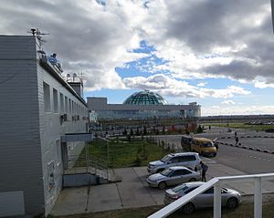
Salekhard Airport
Airport in Russia
Distance: Approx. 4361 meters
Latitude and longitude: 66.58916667,66.59555556
Salekhard Airport (IATA: SLY, ICAO: USDD) is an airport in Yamalo-Nenets Autonomous Okrug, Russia located 7 kilometres (4.3 mi) north of Salekhard. It is a civilian airfield, handling medium-sized aircraft. It is also a designated emergency airfield for commercial airliner cross-polar routes.

Poluy
River in Russia
Distance: Approx. 2510 meters
Latitude and longitude: 66.5583,66.55
The Poluy (Russian: Полуй) is a river in Yamalo-Nenets Autonomous Okrug, Russia, a right tributary of the Ob. It is 369 kilometres (229 mi) long, with a drainage basin of 21,000 square kilometres (8,100 sq mi). It flows into the Ob near the city Salekhard.
Weather in this IP's area
overcast clouds
13 Celsius
13 Celsius
13 Celsius
13 Celsius
1025 hPa
90 %
1025 hPa
1023 hPa
10000 meters
1.96 m/s
1.96 m/s
246 degree
97 %
05:59:47
18:56:30