Country:
Region:
City:
Latitude and Longitude:
Time Zone:
Postal Code:
IP information under different IP Channel
ip-api
Country
Region
City
ASN
Time Zone
ISP
Blacklist
Proxy
Latitude
Longitude
Postal
Route
Luminati
Country
Region
eng
City
lincoln
ASN
Time Zone
Europe/London
ISP
Six Degrees Technology Group Limited
Latitude
Longitude
Postal
IPinfo
Country
Region
City
ASN
Time Zone
ISP
Blacklist
Proxy
Latitude
Longitude
Postal
Route
db-ip
Country
Region
City
ASN
Time Zone
ISP
Blacklist
Proxy
Latitude
Longitude
Postal
Route
ipdata
Country
Region
City
ASN
Time Zone
ISP
Blacklist
Proxy
Latitude
Longitude
Postal
Route
Popular places and events near this IP address

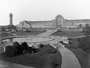
The Crystal Palace
Former building originally in Hyde Park, London, 1854 relocated to Sydenham, South London
Distance: Approx. 332 meters
Latitude and longitude: 51.4226,-0.0756
The Crystal Palace was a cast iron and plate glass structure, originally built in Hyde Park, London, to house the Great Exhibition of 1851. The exhibition took place from 1 May to 15 October 1851, and more than 14,000 exhibitors from around the world gathered in its 990,000-square-foot (92,000 m2) exhibition space to display examples of technology developed in the Industrial Revolution. Designed by Joseph Paxton, the Great Exhibition building was 1,851 feet (564 m) long, with an interior height of 128 feet (39 m), and was three times the size of St Paul's Cathedral.

Crystal Palace, London
Residential area in London, England
Distance: Approx. 535 meters
Latitude and longitude: 51.4203,-0.0705
Crystal Palace is an area in South London, named after the Crystal Palace Exhibition building which stood in the area from 1854, until it was destroyed by a fire in 1936. About 7 miles (11 km) southeast of Charing Cross, it includes one of the highest points in London, at 367 feet (112 m), offering views over the capital. The area has no defined boundaries and straddles five London boroughs and three postal districts, although there is a Crystal Palace electoral ward and Crystal Palace Park in the London Borough of Bromley.

Crystal Palace railway station
National Rail station in London, England
Distance: Approx. 443 meters
Latitude and longitude: 51.4182,-0.0726
Crystal Palace railway station is a Network Rail and London Overground station in the London Borough of Bromley in south London. It is located in the Anerley area between the town centres of Crystal Palace and Penge, 8 miles 56 chains (14.0 km) from London Victoria. It is one of two stations built to serve the site of the 1851 exhibition building, the Crystal Palace, when it was moved from Hyde Park to Sydenham Hill after 1851.

Crystal Palace transmitting station
Telecommunications site in Bromley, England
Distance: Approx. 508 meters
Latitude and longitude: 51.4242,-0.075
The Crystal Palace transmitting station, officially known as Arqiva Crystal Palace, is a broadcasting and telecommunications site in the Crystal Palace area of the London Borough of Bromley, England (grid reference TQ339712). It is located on the site of the former television station and transmitter operated by John Logie Baird from 1933. The station is the eighth-tallest structure in London, and is best known as the main television transmitter for the Greater London area and parts of the surrounding Home Counties.

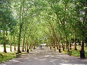
Crystal Palace Park
Victorian pleasure ground in Crystal Palace, Bromley, London
Distance: Approx. 575 meters
Latitude and longitude: 51.42083333,-0.07
Crystal Palace Park is a large park in south-east London, Grade II* listed on the Register of Historic Parks and Gardens. It was laid out in the 1850s as a pleasure ground, centred around the re-location of The Crystal Palace -- the largest glass building of the time -- from central London to this area on the border of Kent and Surrey; the suburb that grew around the park is known by the same name. The Palace had been relocated from Hyde Park after the 1851 Great Exhibition and rebuilt with some modifications and enlargements to form the centrepiece of the park, before being destroyed by fire in 1936.

Norwood Ridge
Ridge in south London
Distance: Approx. 177 meters
Latitude and longitude: 51.421,-0.0761
The Norwood Ridge is a 10-square-mile (26 km2) rectangular upland which occupies the geographical centre of south London, centred 5 miles (8 km) south of London Bridge. Beneath its topsoil it is a ridge of London Clay that is capped on all sides (including as isolated knolls in the north) with remaining natural gravel deposits mixed with some sandy soil, which in the South Thames basin is a material known as the Claygate Beds.

Crystal Palace (High Level) railway station
Former railway station in South London
Distance: Approx. 146 meters
Latitude and longitude: 51.4214,-0.0785
Crystal Palace (High Level) was a railway station in South London. It was one of two stations built to serve the new site of the Great Exhibition building, the Crystal Palace, when it was moved from Hyde Park to Sydenham Hill after 1851. It was the terminus of the Crystal Palace and South London Junction Railway (CPSLJR), which was later absorbed by the London, Chatham and Dover Railway (LCDR).

Upper Norwood Library
Distance: Approx. 225 meters
Latitude and longitude: 51.4198,-0.0814
Upper Norwood Library is a community managed library in Upper Norwood, South London. It stands on Westow Hill, in Crystal Palace town centre, within the London Borough of Lambeth, but on the edge of the boundary with the London Borough of Croydon. It is funded largely by Lambeth Council, and in part by Croydon Council, with the building itself managed by a community-run independent charity, the Upper Norwood Library Trust.

Festival of Empire
Distance: Approx. 442 meters
Latitude and longitude: 51.421,-0.072
The 1911 Festival of Empire was the biggest single event held at The Crystal Palace in London since its opening. It opened on 12 May and was one of the events to celebrate the coronation of King George V. The original intention had been that Edward VII would open it in 1910, however, this was postponed after his death shortly before the planned opening day. The Festival contained a display of landscapes and exhibits from the British Empire, mainly the dominion countries, to encourage emigration to those nations; and it contained a large scale pageant dramatising British history.

Crystal Palace School
Former art school in London, England
Distance: Approx. 360 meters
Latitude and longitude: 51.422,-0.074
Crystal Palace School of Art, Science, and Literature, also known as Crystal Palace Company's School of Art, was opened in 1854 by the Crystal Palace Company as a new enterprise, to occupy part of the centrepiece building of the Great Exhibition, following its re-erection in suburban south-east London. The civil engineer and later first director of the Royal College of Music, George Grove, was appointed secretary. (His sister Eleanor Grove also worked for women's education.) It was a part of the great movements for educational and social reform in nineteenth century Britain.
Dulwich Upper Wood
Local nature reserve in London, England
Distance: Approx. 434 meters
Latitude and longitude: 51.424,-0.078
Dulwich Upper Wood is a 2.4 hectare local nature reserve and Site of Borough Importance for Nature Conservation, Grade 1, in Crystal Palace in the London Borough of Southwark. It is owned by Southwark Council and managed by the Trust for Urban Ecology.

Christ Church, Gipsy Hill
Church
Distance: Approx. 415 meters
Latitude and longitude: 51.4217,-0.0836
Christ Church in Gipsy Hill is an Anglican Church in the London Borough of Lambeth. The remaining part of the original Victorian church building, the tower, which is now a private dwelling is a Grade II Listed Building and occupies a prominent position, the tower being a notable landmark in the area.
Weather in this IP's area
clear sky
10 Celsius
8 Celsius
8 Celsius
10 Celsius
1031 hPa
91 %
1031 hPa
1018 hPa
10000 meters
3.09 m/s
240 degree
07:09:59
16:18:39
