Country:
Region:
City:
Latitude and Longitude:
Time Zone:
Postal Code:
IP information under different IP Channel
ip-api
Country
Region
City
ASN
Time Zone
ISP
Blacklist
Proxy
Latitude
Longitude
Postal
Route
Luminati
Country
Region
34
City
istanbul
ASN
Time Zone
Europe/Istanbul
ISP
SECURITYSERVICES
Latitude
Longitude
Postal
IPinfo
Country
Region
City
ASN
Time Zone
ISP
Blacklist
Proxy
Latitude
Longitude
Postal
Route
db-ip
Country
Region
City
ASN
Time Zone
ISP
Blacklist
Proxy
Latitude
Longitude
Postal
Route
ipdata
Country
Region
City
ASN
Time Zone
ISP
Blacklist
Proxy
Latitude
Longitude
Postal
Route
Popular places and events near this IP address

Ümraniye
District and municipality in Istanbul, Turkey
Distance: Approx. 610 meters
Latitude and longitude: 41.03111111,29.10805556
Ümraniye (pronounced [ymˈɾaːnije]) is a municipality and district of Istanbul Province, Turkey. Its area is 46 km2, and its population is 723,760 (2023). It was separated from Üsküdar in 1987.

Haldun Alagaş Sports Hall
Distance: Approx. 942 meters
Latitude and longitude: 41.0252,29.10466
Haldun Alagaş Sports Hall (Turkish: Haldun Alagaş Spor Kompleksi) is an indoor arena located in Istanbul, Turkey. Opened in December 2000, the arena mostly hosts basketball and volleyball games. It has a seating capacity for 2,468 spectators.
Weapons found in the Ergenekon investigation
Distance: Approx. 2086 meters
Latitude and longitude: 41.02046944,29.11950278
A number of Weapons found in the Ergenekon investigation form a key part of the Ergenekon trials, prosecuting the Ergenekon organization. The Ergenekon investigation officially began after an anonymous tip led to the finding of 27 grenades in Ümraniye, a district of Istanbul. The serial numbers of these grenades matched those of grenades found in other locations and some used in terrorist attacks.
Npistanbul Brain Hospital
Hospital in İstanbul, Turkey
Distance: Approx. 1174 meters
Latitude and longitude: 41.0289,29.1141
NPİSTANBUL Brain Hospital (NPİSTANBUL or NPI) is the first neuropsychiatric hospital in Turkey. It was established on March 20, 2007 with attendance of Parliament Speaker Mr Bulent Arınç. NPİSTANBUL emphasizes cooperation of psychology, neurology and psychiatry, patients are examined by all three branches of science, and the results are evaluated in common case meetings and consultations.

Çamlıca Mosque
Mosque in Turkey
Distance: Approx. 2574 meters
Latitude and longitude: 41.0347,29.0708
Currently the largest mosque in Turkey, the Grand Çamlıca Mosque (Turkish pronunciation: [tʃamlɯdʒa]) (Turkish: Büyük Çamlıca Camii) is a landmark complex for Islamic worship which was completed and opened on 7 March 2019. The mosque stands astride Çamlıca Hill in the Üsküdar district of Istanbul and is visible from much of the centre of the city. The complex incorporates an art gallery, library, and conference hall.

Çamlıca TRT Television Tower
Distance: Approx. 2711 meters
Latitude and longitude: 41.03194444,29.06916667
Çamlıca TRT Television Tower (Turkish: TRT Çamlıca Verici İstasyonu) was a communications tower in the Üsküdar district of Istanbul, Turkey, which was owned and operated by the state-owned Turkish Radio and Television Corporation (TRT). It was demolished in late 2020 after 48 years in service.

Yamanevler (Istanbul Metro)
Station of the Istanbul Metro
Distance: Approx. 1025 meters
Latitude and longitude: 41.0246,29.1054
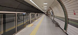
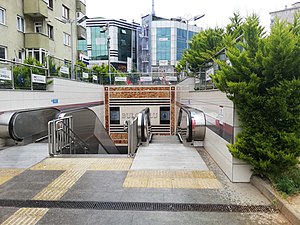
Yamanevler is an underground station of the M5 line of the Istanbul Metro in Üsküdar. It is located beneath Alemdağ Avenue in the Atatkent neighborhood of Ümraniye. Connection to IETT city buses is available from at street level.
Çarşı (Istanbul Metro)
Istanbul Metro station
Distance: Approx. 910 meters
Latitude and longitude: 41.0259,29.0968
Çarşı is a Turkish underground station on the M5 line of the Istanbul Metro in Ümraniye. It is located beneath Alemdağ Avenue and Tunaboyu Street in the Yaman Evler neighborhood of Ümraniye. Connection to IETT city buses is available from at street level.

Ümraniye (Istanbul Metro)
Station of the Istanbul Metro
Distance: Approx. 1704 meters
Latitude and longitude: 41.0246,29.0847
Ümraniye is an underground station on the M5 line of the Istanbul Metro in Ümraniye. It is located beneath Alemdağ Avenue and Bosna Boulevard in the Tantavi neighborhood of Ümraniye. Connection to IETT city buses is available from at street level.

Bulgurlu (Istanbul Metro)
Station of the Istanbul Metro
Distance: Approx. 1704 meters
Latitude and longitude: 41.0246,29.0847
Bulgurlu is an underground station on the M5 line of the Istanbul Metro in east Üsküdar. It is located beneath Alemdağ and Gürpınar Avenues in the Bulgurlu neighborhood of Üsküdar. Connection to IETT city buses is available from at street level, one block south.

Bulgurlu, Üsküdar
Neighborhood in Istanbul, Turkey
Distance: Approx. 2767 meters
Latitude and longitude: 41.0167237,29.076846
Bulgurlu is neighbourhood in the municipality and district of Üsküdar, Istanbul Province, Turkey. Its population is 30,569 (2022). It is on the Asian side of the Bosphorus.

Çakmak (Istanbul Metro)
Metro station in Istanbul, Turkey
Distance: Approx. 2093 meters
Latitude and longitude: 41.02098,29.12022
Çakmak is an underground station on the M5 line of the Istanbul Metro in Ümraniye. The station is located on Alemdağ Street in the Saray quarter of Ümraniye. Connection to IETT city buses is available at street level.
Weather in this IP's area
clear sky
16 Celsius
16 Celsius
16 Celsius
18 Celsius
1028 hPa
57 %
1028 hPa
1012 hPa
10000 meters
6.62 m/s
8.15 m/s
47 degree
07:43:04
17:51:43