Country:
 Great Britain
Region:
City:
Latitude and Longitude:
Time Zone:
Postal Code:
IP information under different IP Channel
ip-api
Country
Region
City
ASN
Time Zone
ISP
Blacklist
Proxy
Latitude
Longitude
Postal
Route
IPinfo
Country
Region
City
ASN
Time Zone
ISP
Blacklist
Proxy
Latitude
Longitude
Postal
Route
MaxMind
Country
Region
City
ASN
Time Zone
ISP
Blacklist
Proxy
Latitude
Longitude
Postal
Route
Luminati
Country
GBRegion
eng
City
kingstonuponthames
ASN
Time Zone
Europe/London
ISP
Infinity Developments Limited
Latitude
Longitude
Postal
db-ip
Country
Region
City
ASN
Time Zone
ISP
Blacklist
Proxy
Latitude
Longitude
Postal
Route
ipdata
Country
Region
City
ASN
Time Zone
ISP
Blacklist
Proxy
Latitude
Longitude
Postal
Route
Popular places and events near this IP address
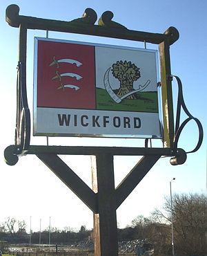
Wickford
Town and civil parish in Essex, England
Distance: Approx. 186 meters
Latitude and longitude: 51.6114,0.5207
Wickford is a town and civil parish in the south of the English county of Essex, with a population of 33,486. Located approximately 30 miles (50 km) east of London, it is within the Borough of Basildon along with the original town of Basildon, Billericay, Laindon and Pitsea. Wickford has a main high street which includes a wide range of shops.

Wickford railway station
Railway station in Essex, England
Distance: Approx. 536 meters
Latitude and longitude: 51.615,0.519
Wickford railway station is a junction stop on the Shenfield to Southend Line and also the western terminus of the Crouch Valley Line in the east of England, serving the town of Wickford in the Basildon district of Essex. It is 29 miles 2 chains (46.71 km) down the line from London Liverpool Street and is situated between Billericay to the west and, to the east, Rayleigh on the Southend Line and Battlesbridge on the Crouch Valley Line. The Engineer's Line Reference for the line is SSV, the station's three-letter station code is WIC. Most Southend services connect to the Great Eastern Main Line at Shenfield for northbound connections.

Battlesbridge railway station
Railway station in Essex, England
Distance: Approx. 3337 meters
Latitude and longitude: 51.625,0.566
Battlesbridge railway station is a stop on the Crouch Valley Line in the East of England, serving the village of Battlesbridge, Essex. It is 31 miles 40 chains (50.7 km) down the line from London Liverpool Street and is situated between Wickford to the west and South Woodham Ferrers. Train services are operated by Greater Anglia.
The Bromfords School
Academy in Wickford, Essex, England
Distance: Approx. 1233 meters
Latitude and longitude: 51.60495,0.50837
The Bromfords School is a coeducational secondary school and sixth form with academy status, located in Wickford, Essex, England. Most pupils live in Wickford, while a large minority of pupils live in nearby Basildon and other neighbouring towns. The sixth form is smaller than average.

Shotgate
Human settlement in England
Distance: Approx. 2011 meters
Latitude and longitude: 51.608,0.552
Shotgate is a civil parish and village in Essex, England. On 1 April 2007, Shotgate became the first area of Wickford to have a Parish Council.
Beauchamps High School
Foundation school in Wickford, Essex, England
Distance: Approx. 1315 meters
Latitude and longitude: 51.61295,0.54207
Beauchamps High School is a mixed intake secondary school and sixth form for students aged between 11 and 18 (school years 7 to 13) in Wickford, Essex, England. The sixth form offers post 16 education for students aged 16–18 and accepts both former Beauchamps students and students educated at other establishments. The school includes a fairly diverse student population.

Rawreth
Human settlement in England
Distance: Approx. 3401 meters
Latitude and longitude: 51.610833,0.5725
Rawreth is a village and civil parish in the District of Rochford, Essex, England. It is situated between Wickford and Rayleigh. The place-name 'Rawreth' is first attested in the Pipe Rolls for 1177, where it appears as Raggerea.

Ramsden Bellhouse
Village in Essex, England
Distance: Approx. 3134 meters
Latitude and longitude: 51.623,0.4823
Ramsden Bellhouse is a village and civil parish in Essex in the east of England. It is in the Borough of Basildon and in the parliamentary constituency of Billericay. The River Crouch flows through Ramsden Bellhouse, flowing under Church Road.

Runwell Hospital
Hospital in Essex, England
Distance: Approx. 2982 meters
Latitude and longitude: 51.6352,0.5418
Runwell Hospital was a hospital in the Chelmsford district of Essex. It was managed by the South Essex Partnership University NHS Foundation Trust.

A132 road (England)
Road in England
Distance: Approx. 995 meters
Latitude and longitude: 51.61907,0.52949
The A132 road is a road in England connecting Pitsea and South Woodham Ferrers.

Runwell
Human settlement in England
Distance: Approx. 1851 meters
Latitude and longitude: 51.624,0.54
Runwell is a village near Wickford and a civil parish on the A132 road, in the Chelmsford District, in the English county of Essex. The village is surrounded by neighbouring parishes such as Battlesbridge and Rettendon.

Shotgate Thickets
Nature reserve in Essex, England
Distance: Approx. 2195 meters
Latitude and longitude: 51.618,0.553
Shotgate Thickets is a 3.2-hectare (7.9-acre) nature reserve east of Wickford in Essex. It is managed by the Essex Wildlife Trust. This site on the north bank of the River Crouch has oak woodland, two ponds, rough grassland and thorn thickets.
Weather in this IP's area
clear sky
13 Celsius
12 Celsius
11 Celsius
14 Celsius
1013 hPa
85 %
1013 hPa
1011 hPa
10000 meters
4.63 m/s
200 degree
07:27:30
17:58:10