217.140.39.31 - IP Lookup: Free IP Address Lookup, Postal Code Lookup, IP Location Lookup, IP ASN, Public IP
Country:
Region:
City:
Location:
Time Zone:
Postal Code:
IP information under different IP Channel
ip-api
Country
Region
City
ASN
Time Zone
ISP
Blacklist
Proxy
Latitude
Longitude
Postal
Route
Luminati
Country
ASN
Time Zone
Europe/London
ISP
British Telecommunications PLC
Latitude
Longitude
Postal
IPinfo
Country
Region
City
ASN
Time Zone
ISP
Blacklist
Proxy
Latitude
Longitude
Postal
Route
IP2Location
217.140.39.31Country
Region
england
City
bristol
Time Zone
Europe/London
ISP
Language
User-Agent
Latitude
Longitude
Postal
db-ip
Country
Region
City
ASN
Time Zone
ISP
Blacklist
Proxy
Latitude
Longitude
Postal
Route
ipdata
Country
Region
City
ASN
Time Zone
ISP
Blacklist
Proxy
Latitude
Longitude
Postal
Route
Popular places and events near this IP address

Bristol Crown Court
Judicial building in Bristol, England
Distance: Approx. 126 meters
Latitude and longitude: 51.4548,-2.5949
The Bristol Crown Court is a Crown Court venue which deals with criminal cases at Small Street in Bristol, England. The building, which was completed in 1868, was previously used as a main post office before it was converted for judicial use in the early 1990s.

Bristol Beacon
Concert hall in Bristol, England
Distance: Approx. 124 meters
Latitude and longitude: 51.4546,-2.5981
Bristol Beacon, previously Colston Hall, is a concert hall and Grade II listed building on Colston Street, Bristol, England. It is owned by Bristol City Council. Since 2011, it has been managed by Bristol Music Trust.

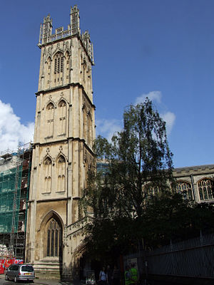
Church of St John the Baptist, Bristol
Church in Bristol, England
Distance: Approx. 116 meters
Latitude and longitude: 51.45583333,-2.59527778
The Church of St John the Baptist in Bristol, also known as St John on the Wall, is a historic church in the care of heritage charity the Churches Conservation Trust. The upper church and its medieval vaulted crypt is located at the lower end of Broad Street and is built into the old city's medieval walls.

St Stephen's Church, Bristol
Church in Bristol, United Kingdom
Distance: Approx. 110 meters
Latitude and longitude: 51.454256,-2.596146
St Stephen's Church in St Stephen's Avenue, is the parish church for the city of Bristol, England. It has been designated by Historic England as a grade I listed building.

St Mary on the Quay
Church in Bristol, United Kingdom
Distance: Approx. 88 meters
Latitude and longitude: 51.4545,-2.5972
St Mary on the Quay is a Roman Catholic Parish church in Bristol, England. It is situated on Colston Avenue, next to Beacon Tower in the centre of the city. It is the oldest Roman Catholic church in Bristol; the first one built after the Reformation.

Christmas Steps, Bristol
Street in Bristol, England
Distance: Approx. 101 meters
Latitude and longitude: 51.4561,-2.5968
Christmas Steps is a historic street in the city centre of Bristol, England.

St Bartholomew's Hospital, Bristol
Distance: Approx. 68 meters
Latitude and longitude: 51.45581,-2.596512
St Bartholomew's Hospital is the site of a medieval monastery hospital at the bottom of Christmas Steps, in Lewin's Mead, Bristol, England. It has been designated as a grade II* listed building. The building incorporates an arcade of arches from a 12th-century town house.

Foster's Almshouses, Bristol
Distance: Approx. 101 meters
Latitude and longitude: 51.456,-2.5973
Foster's Almshouse (grid reference ST586732) is a historic building on Colston Street, Bristol, England. The almshouse was founded by a bequest from the 15th-century merchant John Foster in 1492; his will can be read online. The west wing of the current building was built in 1861, the north wing in 1872, and the south and east wings in 1880-83 by Foster and Wood.

Chapel of the Three Kings of Cologne
Building in Bristol, England
Distance: Approx. 110 meters
Latitude and longitude: 51.456121,-2.597164
The Chapel of the Three Kings of Cologne is a church in Colston Street, near the top of Christmas Steps, Bristol, England. It has been designated as a Grade II* listed building. The Three Kings of Cologne refers to the Biblical Magi.

Beacon Tower
Office building in Bristol, UK
Distance: Approx. 100 meters
Latitude and longitude: 51.455,-2.598
Beacon Tower, formerly Colston Tower, is a high-rise building located on Colston Avenue, in the centre of Bristol, England. The building was designed in 1961, but not completed until 1973. It rises 63 metres (207 ft) and has 15 floors of offices.

Broad Street, Bristol
Street in Bristol, England
Distance: Approx. 124 meters
Latitude and longitude: 51.456313,-2.596605
Broad Street, along with High Street, Wine Street and Corn Street, is one of the four original streets that have made up the city of Bristol since Saxon times, when it was the burgh of Brycgstow. Prior to the building of The Exchange merchants would set up their stalls on Broad Street. An old city gate stands at the bottom of the street, where it joins Quay Street.
Antlers Gallery
Distance: Approx. 112 meters
Latitude and longitude: 51.4562,-2.5968
Antlers Gallery is a commercial gallery based in Bristol England. Created in 2010 by gallery Director Jack Gibbon, Antlers Gallery produces temporary exhibitions across varying locations, with their only permanent base being online. Dubbed the 'nomadic' gallery, they use a similar business model to pop – up galleries but tie these together under the gallery brand.
Weather in this IP's area
mist
6 Celsius
4 Celsius
4 Celsius
7 Celsius
1031 hPa
97 %
1031 hPa
1029 hPa
2300 meters
2.06 m/s
210 degree
100 %