Country:
 Great Britain
Region:
City:
Latitude and Longitude:
Time Zone:
Postal Code:
IP information under different IP Channel
ip-api
Country
Region
City
ASN
Time Zone
ISP
Blacklist
Proxy
Latitude
Longitude
Postal
Route
Luminati
Country
GBRegion
eng
City
liverpool
ASN
Time Zone
Europe/London
ISP
Linix Ltd
Latitude
Longitude
Postal
IPinfo
Country
Region
City
ASN
Time Zone
ISP
Blacklist
Proxy
Latitude
Longitude
Postal
Route
db-ip
Country
Region
City
ASN
Time Zone
ISP
Blacklist
Proxy
Latitude
Longitude
Postal
Route
ipdata
Country
Region
City
ASN
Time Zone
ISP
Blacklist
Proxy
Latitude
Longitude
Postal
Route
Popular places and events near this IP address

Alderley Edge
Village and civil parish in England
Distance: Approx. 331 meters
Latitude and longitude: 53.303,-2.236
Alderley Edge is a village and civil parish in Cheshire, England. In 2011, it had a population of 4,780. Alderley Edge is 6 miles (10 km) northwest of Macclesfield and 12 miles (19 km) south of Manchester, at the base of a steep and thickly wooded sandstone escarpment, Alderley Edge, which is the area's chief topographical feature and overlooks the Cheshire Plain.

Alderley Edge railway station
Railway station in Cheshire, England
Distance: Approx. 435 meters
Latitude and longitude: 53.304,-2.237
Alderley Edge railway station serves the large village of Alderley Edge in Cheshire, England. The station is 13¾ miles (22 km) south of Manchester Piccadilly on the Crewe to Manchester Line.

Geology of Alderley Edge
Hill in Cheshire, United Kingdom
Distance: Approx. 1360 meters
Latitude and longitude: 53.298,-2.212
One of the classic locations for the study of Triassic sandstones in the UK is at Alderley Edge in Cheshire. Numerous scientists from the early 19th century up to the present day have studied the area and it is a popular field site for universities around the UK. The sandstones also provide important insights into the nature of continental natural gas and petroleum reservoirs.
St Philip's Church, Alderley Edge
Church in Cheshire, England
Distance: Approx. 556 meters
Latitude and longitude: 53.3044,-2.2387
St Philip's Church is in the village of Alderley Edge, Cheshire, England. The church is recorded in the National Heritage List for England as a designated Grade II* listed building. It is an active Anglican parish church in the diocese of Chester, the archdeaconry of Macclesfield and the deanery of Knutsford.
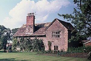
Chorley Old Hall
Historic site
Distance: Approx. 966 meters
Latitude and longitude: 53.2999,-2.2452
Chorley Old Hall is a moated manor house on the B5359 road to the southwest of Alderley Edge, Cheshire, England. The house is recorded in the National Heritage List for England as a designated Grade I listed building, and the moated site is a scheduled monument. It is the oldest inhabited country house in Cheshire and consists of two ranges, one medieval (built around 1330) and the other Elizabethan (built in the mid-16th century).
The Ryleys School
Preparatory day school in Alderley Edge, Cheshire, England
Distance: Approx. 748 meters
Latitude and longitude: 53.302513,-2.242437
The Ryleys School in Alderley Edge, Cheshire is a preparatory school for boys and girls aged between 1 and 11.

Alderley Edge School for Girls
Girls' independent selective school in Alderley Edge, Cheshire, England
Distance: Approx. 583 meters
Latitude and longitude: 53.3051,-2.2385
Alderley Edge School for Girls is an independent day school for girls in Alderley Edge, Cheshire, England. The school caters for pupils aged three to eighteen, providing both secondary and primary school education, as well as a nursery and sixth form. It is a member of the Girls' Schools Association (GSA) and is a registered Apple Distinguished School (ADS) and Apple Regional Training Centre.

Moss Lane, Alderley Edge
Cricket ground in England
Distance: Approx. 126 meters
Latitude and longitude: 53.3022,-2.2293
Moss Lane is a cricket ground in Moss Lane, Alderley Edge, Cheshire. The ground is surrounded on all four sides by residential housing. The ground is used by Alderley Edge Cricket Club.

Fulshaw Hall
Historic site in Cheshire, England
Distance: Approx. 1724 meters
Latitude and longitude: 53.31743,-2.23588
Fulshaw Hall is a country house, south of the civil parish of Wilmslow, in Cheshire, England. It is recorded in the National Heritage List for England as a designated Grade II listed building. Samuel Finney III, the miniature-painter to Queen Charlotte, lived at Fulshaw from 1769 until his death in 1798.

Alderley Edge Methodist Church
Church in Cheshire, England
Distance: Approx. 228 meters
Latitude and longitude: 53.3008,-2.2337
Alderley Edge Methodist Church is in Chapel Road, Alderley Edge, Cheshire, England. It is an active Methodist church. The church and its associated hall are recorded in the National Heritage List for England as a designated Grade II listed building.
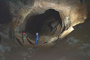
Alderley Edge Mines
Abandoned mines in Cheshire, England
Distance: Approx. 1452 meters
Latitude and longitude: 53.296,-2.212
The Alderley Edge Mines are located on the escarpment in Alderley Edge, Cheshire. Archaeological evidence indicates that copper mining took place here during Roman times and the Bronze Age, and written records show that mining continued here from the 1690s up to the 1920s. The site was the location of the Alderley Edge Landscape Project and the Pot Shaft Hoard.

Alderley Edge Urban District
Distance: Approx. 331 meters
Latitude and longitude: 53.303,-2.236
Alderley Edge is a former Urban District in Cheshire, based in the village of Alderley Edge. It was created in 1894 and abolished in 1974 when it was incorporated into the Borough of Macclesfield, which was itself abolished in 2009. The archives were deposited with Cheshire Archives and Local Studies: some information here [1].
Weather in this IP's area
overcast clouds
4 Celsius
4 Celsius
3 Celsius
6 Celsius
1038 hPa
92 %
1038 hPa
1027 hPa
8000 meters
1.03 m/s
60 degree
100 %
07:30:46
16:15:56